

System and process for integrative computational soil mapping
a system and process technology, applied in the field of integrative computational soil mapping, can solve the problems of unsatisfactory products, restricted soil sampling and soil property measurement by laboratory analysis, etc., and achieve the effects of saving monetary resources and time, reducing the number of soil property measurements, and improving the expected crop-related outcomes
- Summary
- Abstract
- Description
- Claims
- Application Information
AI Technical Summary
Benefits of technology
Problems solved by technology
Method used
Image

Examples
Embodiment Construction
[0028]While this invention is susceptible of embodiment in many different forms, there is shown in the drawings, and will herein be described hereinafter in detail, some specific embodiments of the invention. It should be understood, however, that the present disclosure is to be considered an exemplification of the principles of the invention and is not intended to limit the invention to the specific embodiments so described.
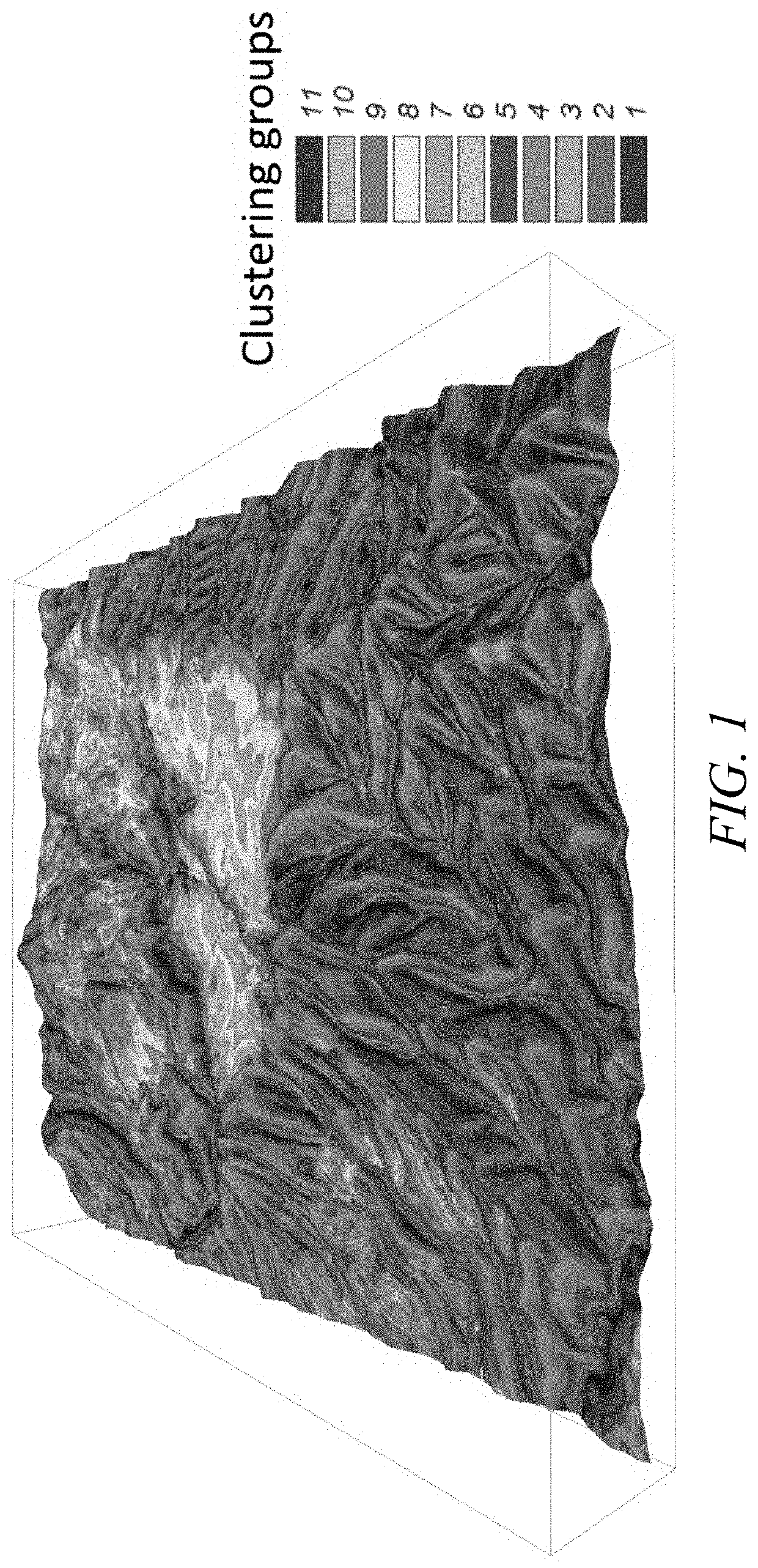
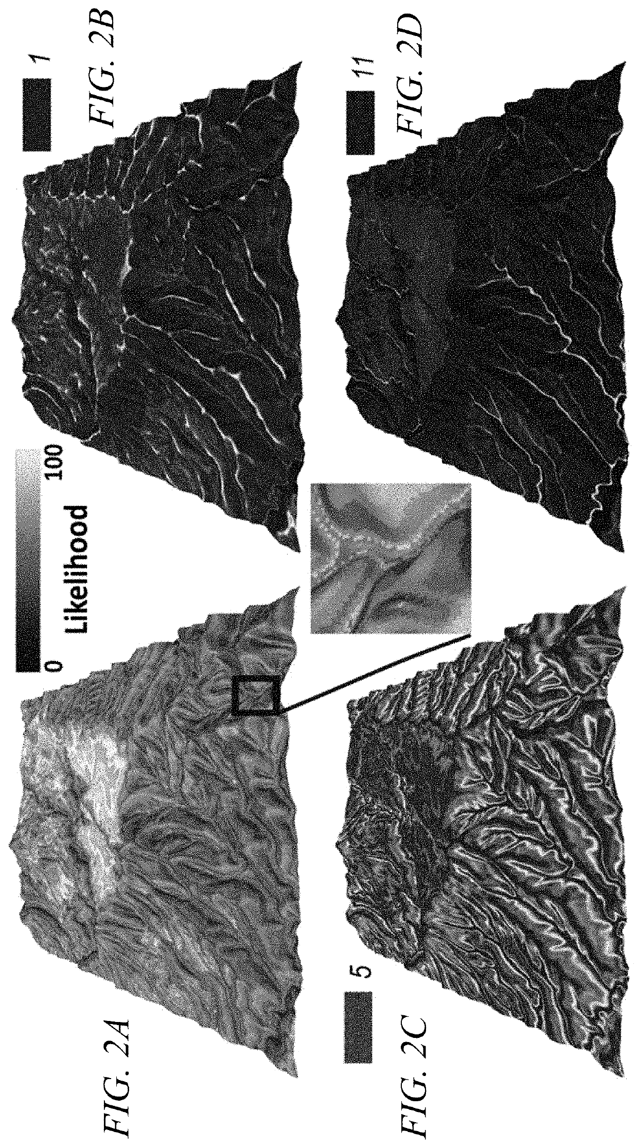
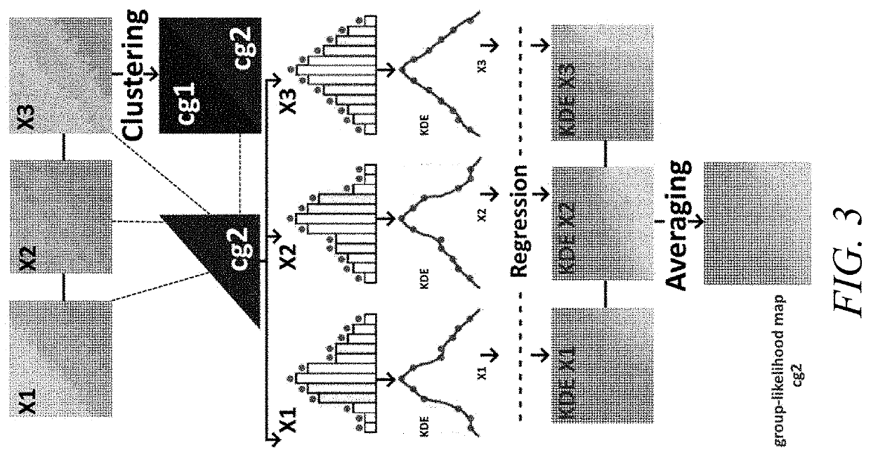
[0029]A system and process for integrative computational soil mapping are provided herein and provide a statistically robust and computationally efficient system and process to produce digital soil maps for precision land management. More particularly, the integrative computational soil mapping system and process produce digital maps of soil properties using a minimal number of soil sample measurements and without compromising the statistical precision of the resulting digital soil maps. The system and process generate precise, fine-resolution, continuous predic...
PUM
 Abstract
Description
Claims
Application Information