Precise parallel swathing guidance via satellite navigation and tilt measurement

a technology of satellite navigation and parallel swathing, applied in the field of precise parallel swathing guidance via satellite navigation and tilt measurement, can solve the problems of approximation worsening, guidance error, and inability to determine the position of the obj

Inactive Publication Date: 2002-12-31
TRIMBLE NAVIGATION LTD
View PDF8 Cites 124 Cited by
  • Summary
  • Abstract
  • Description
  • Claims
  • Application Information

AI Technical Summary

Problems solved by technology

However, if the tractor is on an inclined terrain with a variable tilt, which is often the case, the SATPS alone cannot determine the terrain tilt so the POI also cannot be determined.
This results in a guidance error because the POI is approximated by the point of reception (POR), and this approximation worsens as the terrain inclination increases.
In addition, in the pri

Method used


Image

  • Precise parallel swathing guidance via satellite navigation and tilt measurement
  • Precise parallel swathing guidance via satellite navigation and tilt measurement
  • Precise parallel swathing guidance via satellite navigation and tilt measurement

Examples


Embodiment Construction

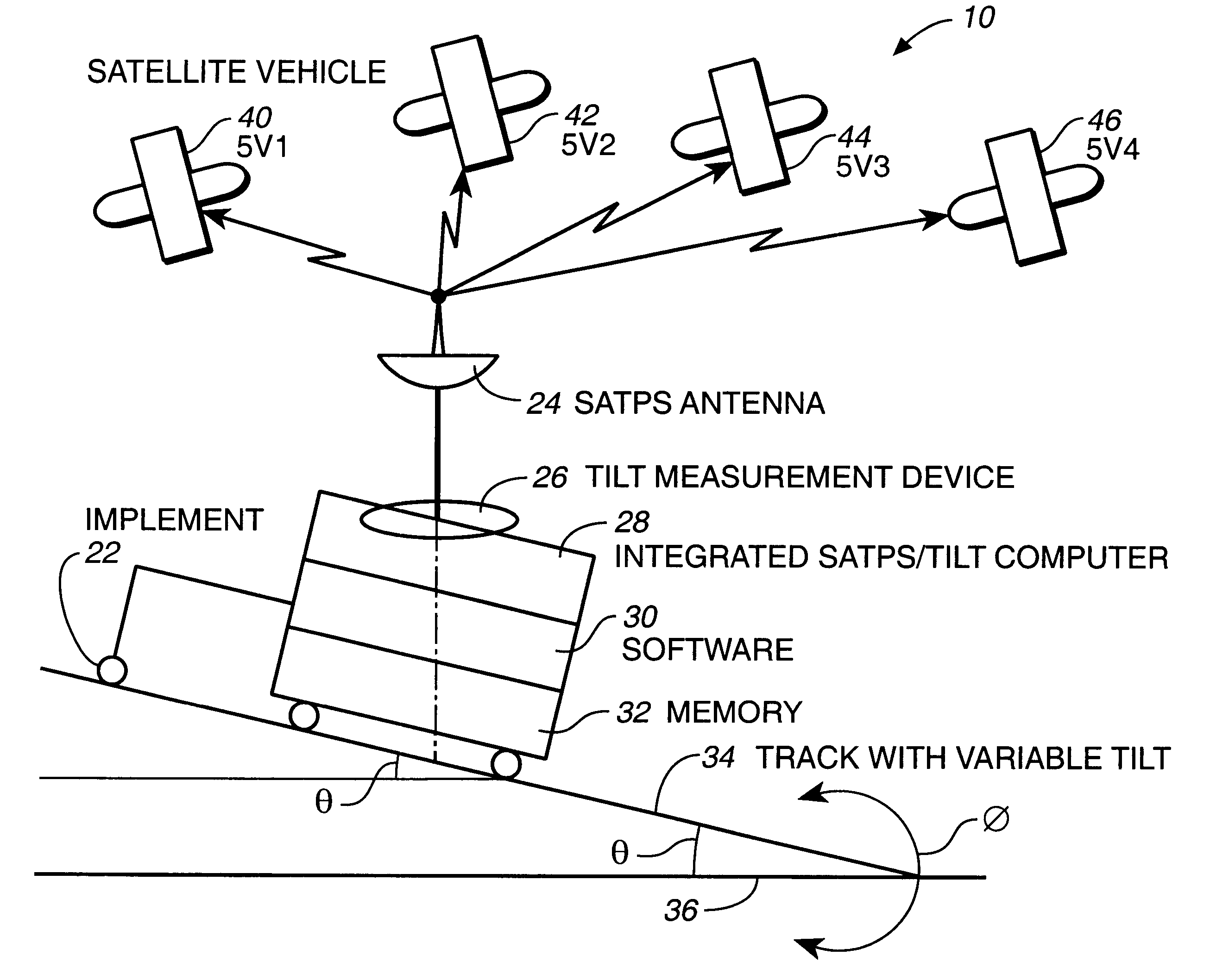
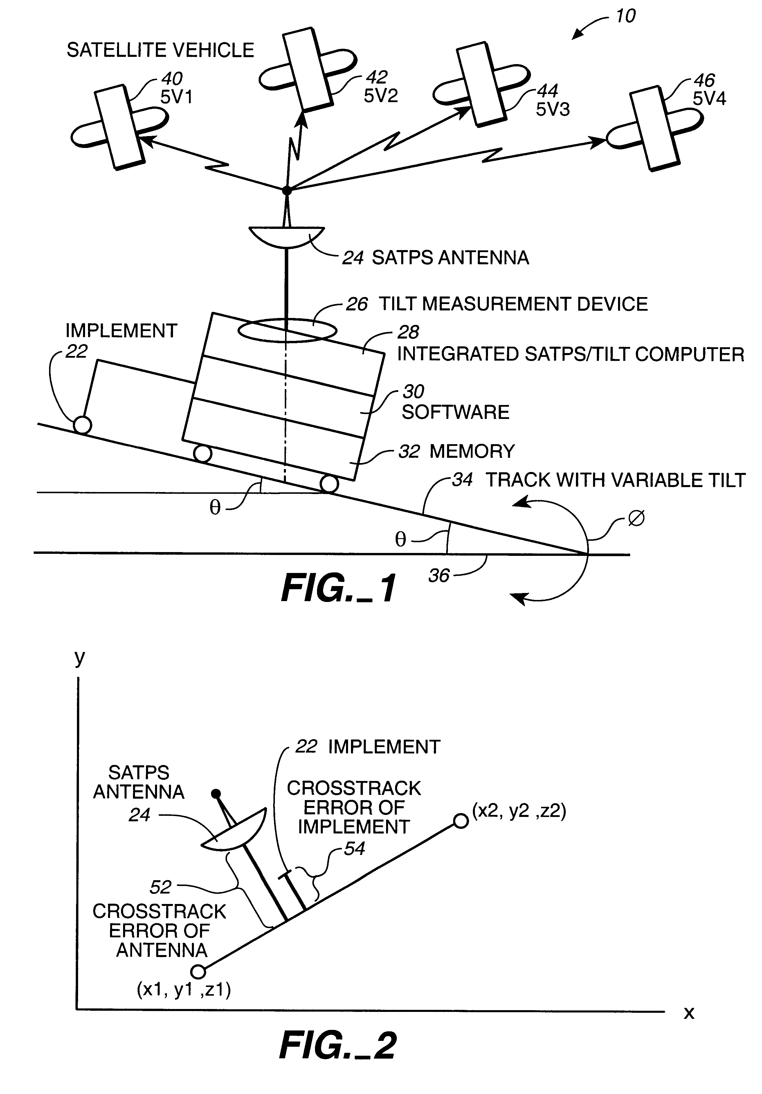
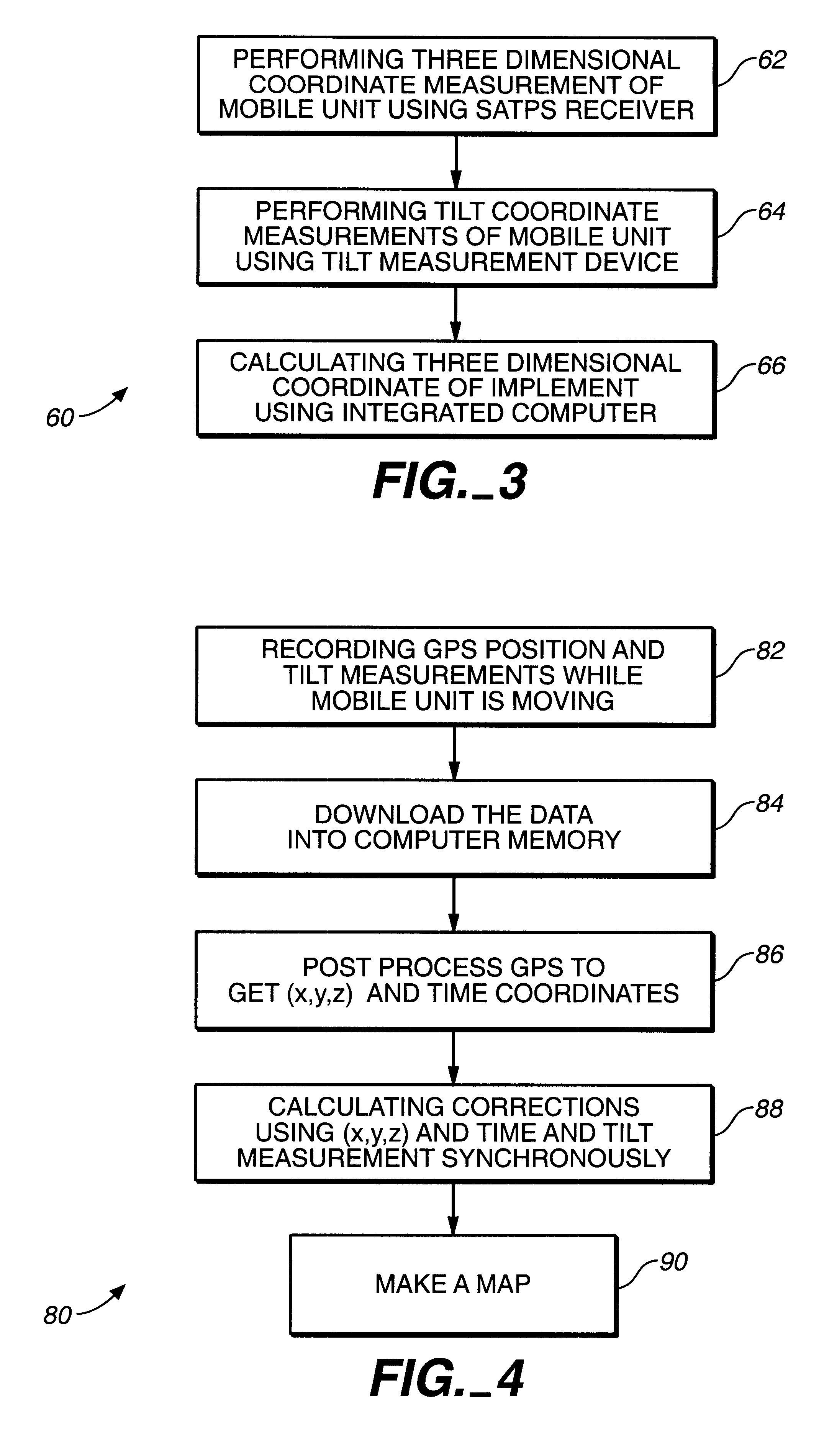
The first aspect of the present invention is best understood by focusing on FIG. 1 that shows a positioning system (10) of the present invention that is capable of precise measurement of actual coordinates of a mobile unit that moves along a track with variable tilt.

In one embodiment, the positioning system (10) comprises a satellite positioning system (SATPS) receiver. The SATPS receiver including a SATPS antenna (24) is mounted in a housing means of the mobile unit (20). The positioning system (10) additionally includes a tilt angle measurement device (26) integrated with the SATPS receiver. The SATPS receiver is configured to perform three dimensional coordinates measurements of the mobile unit. The tilt measurement device (26) is configured to perform tilt coordinates measurements of the mobile unit (20) that moves along a track (34) with variable tilt. The three dimensional coordinates and the tilt coordinates of the mobile unit are utilized by an integrated SATPS / tilt navigati...


PUM


Abstract

The satellite navigational system integrated with the tilt measurement system capable of precise measurement of the actual coordinates of the mobile unit that moves along a track with variable tilt is disclosed. Using the integrated satellite/tilt measurement system, a plurality of 3 dimensional lines separated by optimal swathing offset vector can be formed and followed in order to provide field guidance during a precision farming operation across variably inclined terrain.

Description

FIELD OF THE INVENTION FIELD OF THE INVENTIONThe current invention is in the field of the satellite navigational system.DESCRIPTION OF THE BACKGROUND ARTIn the available art relating to the satellite positional systems (SATPS), the curvature of terrain is not taken into account.Indeed, the SATPS provides the 3-D location of signal reception (for instance, the 3-D location of the antenna). However, the position of interest is often not the same as where the satellite receiver (SR) is located since the SR is placed in the location for good signal reception. For example, for a tractor towing an implement, the best location for the SR may be on top of the tractor cab, but the position of interest (POI) for providing guidance to the tractor operator may be the position on the ground below the operator. If the tractor is on a flat terrain, determining this POI is a simple adjustment to account for the antenna height. However, if the tractor is on an inclined terrain with a variable tilt, ...

Claims


Application Information

Patent Timeline
IPC IPC(8): G01S5/14G01S19/04G01S19/10G01S19/14G01S19/44G01S19/53
CPCG01S19/47G01S19/40G01S19/43G01S19/41G01S19/14G01S19/39G01S19/49G05D1/0278G05D2201/0201Y02A40/10G05D1/0202
Inventor NICHOLS, MARK EDWARD
Owner TRIMBLE NAVIGATION LTD
Why Eureka
Try Eureka