Method of accurately determining positions of deployed seismic geophones

a geophone and accurate technology, applied in seismic signal receivers, seismicology, instruments, etc., can solve the problems of difficult to obtain accurate positions for geophones, and achieve the effect of accurately deploying geophones, without difficulty, expense and tim

Inactive Publication Date: 2005-09-13
WESTERNGECO LLC
View PDF12 Cites 44 Cited by
  • Summary
  • Abstract
  • Description
  • Claims
  • Application Information

AI Technical Summary

Benefits of technology

[0009]The method of the present invention is used in conjunction with at least one portable navigational satellite receiver that is operable at or very near the position of the seismic technician that deploys geophones in the terrain. The portable navigational satellite receiver is used to accurately determine the physical position of the deployed geophone at or very near the time of deployment of the geophone. A controller is used to record positional measurements of the deployed geophone in an electronic data storage device, or memory. The recorded positional measurements of each geophone is electronically paired with a unique identification code for that geophone, and this data pair is stored in the memory or physical data storage.
[0011]The present invention also provides a method for accurately deploying geophones in a predetermined pattern or geophone array without the difficulty, expense and time required for measuring and laying out the position of each geophone relative to a survey benchmark or to adjacent geophones. The preferred embodiment of the present invention utilizes at least one portable navigational satellite receiver and either a stationary navigational satellite receiver operated at a known location or a broadcast navigational satellite correction system for providing corrections for the measurements made using the portable navigational satellite receiver.

Problems solved by technology

Human error, undulations in the terrain, and natural and man-made obstacles in the terrain make it difficult to obtain accurate positions for the geophones.

Method used


Image

  • Method of accurately determining positions of deployed seismic geophones
  • Method of accurately determining positions of deployed seismic geophones
  • Method of accurately determining positions of deployed seismic geophones

Examples


Embodiment Construction

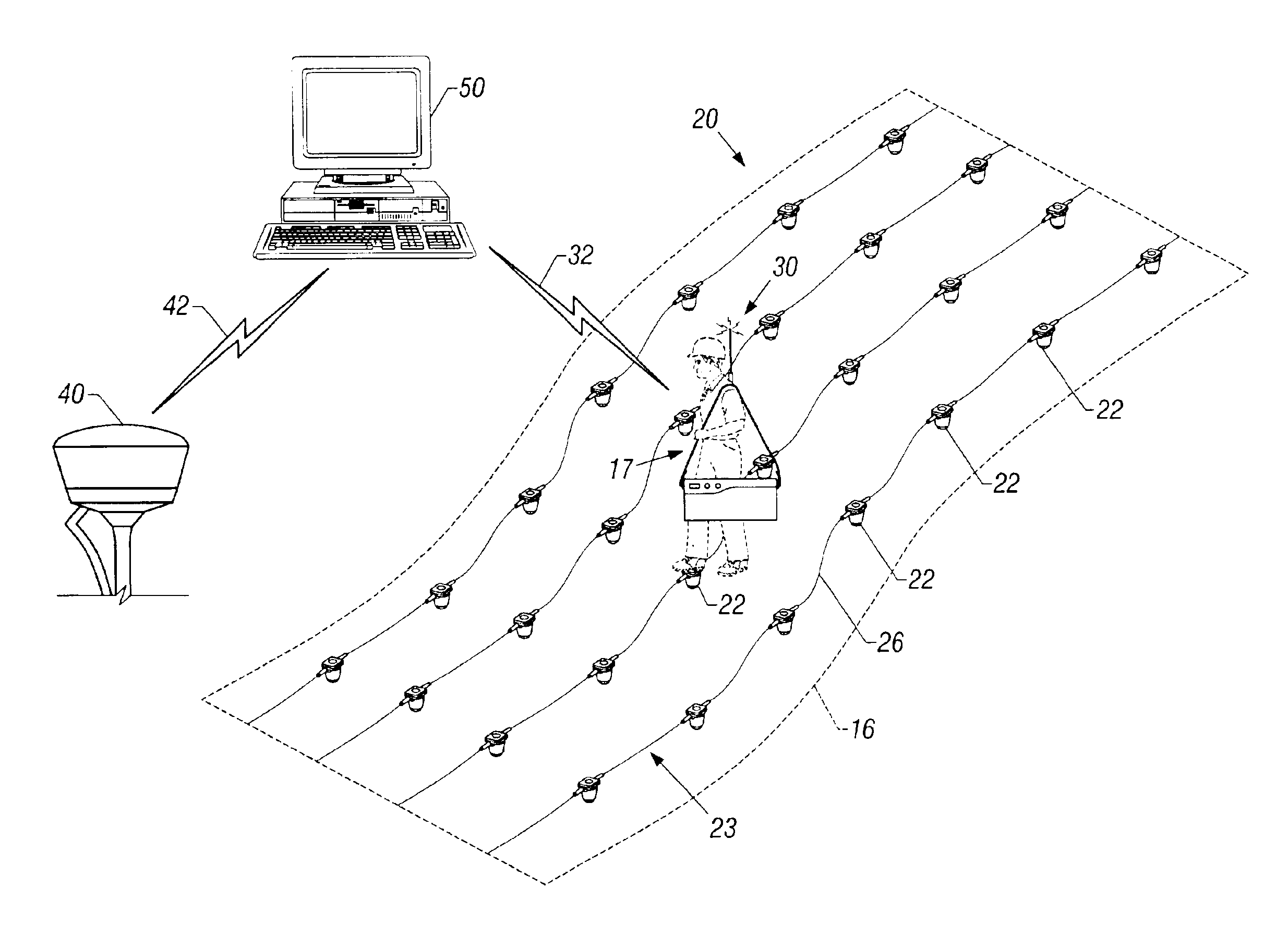
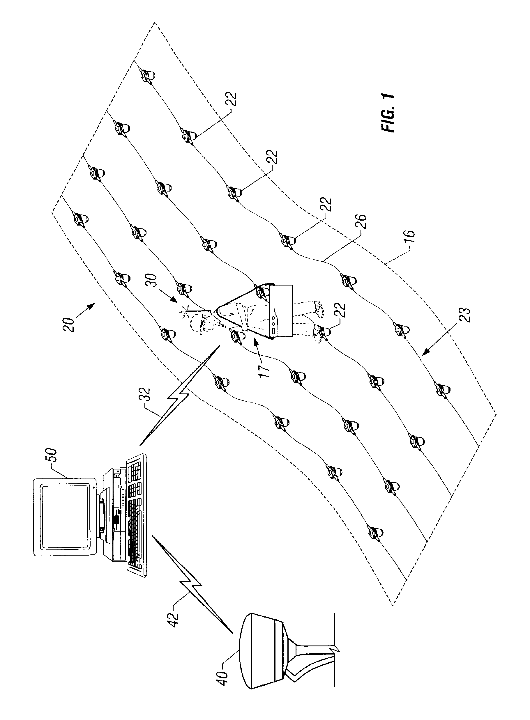
[0025]FIG. 1 depicts a typical seismic spread 20 of terrain having multiple geophones 22 disposed therein to facilitate a seismic investigation of subsurface geological formations lying beneath the terrain. The geophones 22 are generally coupled one to others by cables 26, thereby forming seismic strings 23 having a series of geophones 22 cabled together in electronic communication. The seismic strings 23 in FIG. 1 are deployed in a generally parallel configuration to achieve the desired seismic coverage with generally uniform distribution and spacing of the geophones 22. The seismic strings 23 are deployed to cover the area of the seismic investigation, or the seismic spread 20.

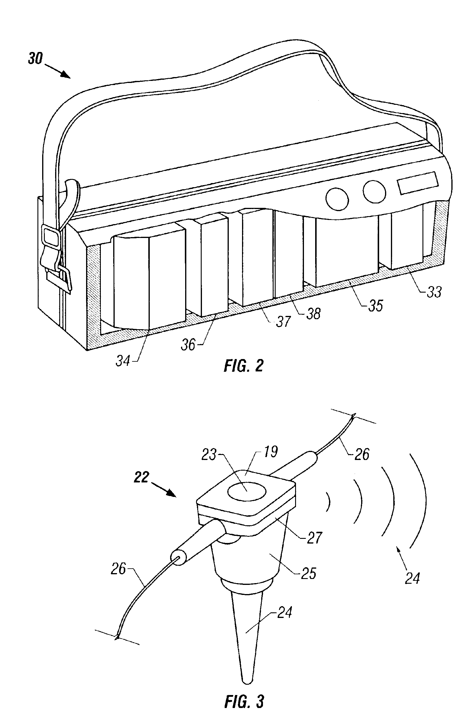
[0026]FIG. 2 shows an embodiment of the portable instruments case 30 of the present invention. The instruments contained in the instruments case 30, or otherwise transported to the general location of each geophone deployment, comprise a geophone data receiver 33, a controller 34, navigational satellite rece...


PUM


Abstract

A method is provided for accurately determining the physical location of a deployed seismic geophone used in seismic investigations by using a portable navigational satellite receiver to obtain a set of navigational satellite measurements providing the position of the deployed geophone at the time of deployment of the geophone into the earth. A method is provided for automatically and accurately identifying and determining the physical location of a deployed geophone used in seismic investigations by using one or more portable navigational satellite receivers and an automatic geophone identification and tracking system at the time of geophone deployment.

Description

BACKGROUND OF THE INVENTION[0001]1. Field of the Invention[0002]The present invention relates to a method of obtaining land-based seismic data. More particularly, the present invention relates to a method and apparatus for accurately determining the positions of geophones deployed in a geophysical spread.[0003]2. Description of the Prior Art[0004]In conventional land-based seismic studies, individual (analog) seismic sensors called geophones are implanted into the earth generally along a targeted seismic survey line. Each geophone generally has a case that may be buried or coupled to an earth spike for being driven into the earth by applying an inserting force to the top of the geophone case. Each geophone is generally deployed in a vertical orientation. Geophones having an earth spike are deployed into the earth with the earth spike downwardly disposed. Soil compaction (for buried geophones) or an inserting force (for geophones having an earth spike) are applied by a seismic techni...

Claims


Application Information

Patent Timeline
Patent Type & Authority Patents(United States)
IPC IPC(8): G01V1/16
CPCG01V1/16
Inventor LEMENAGER, ERWANNWONG, RICHARD VOON CHOONGCOOPER, CARL DANIEL
Owner WESTERNGECO LLC
Why Eureka
Try Eureka