
Navigation system for vehicle

Inactive Publication Date: 2009-08-25
DENSO CORP
View PDF8 Cites 8 Cited by
  • Summary
  • Abstract
  • Description
  • Claims
  • Application Information

AI Technical Summary

Benefits of technology

The present invention provides a navigation system that displays icons of roadside facilities on a map based on the accessibility of the user of the navigation system. The system selectively displays only the necessary icons for the user based on their current position and the type of road they are traveling on. The system can also display icons of the roadside facilities based on the user's input or the type of facility. The system can also automatically turn off certain icons when the user stays at a facility for a certain period of time. The user can also set a predetermined period for when the icons are turned on or off. Overall, the system simplifies the user's experience by displaying only the necessary information and improving the user's ability to access the roadside facilities.

Problems solved by technology

The problems described above may be caused by displaying all the icons of the specified facility type(s) on the road map, and those icons may merely obstruct other facility icons, location names or the like on the road map.

Method used


Image

  • Navigation system for vehicle
  • Navigation system for vehicle
  • Navigation system for vehicle

Examples


Embodiment Construction

[0041]Embodiments of the present invention are described with reference to the drawings. A navigation system 100 of the present invention is intended for use in a subject vehicle such as an automobile or the like.

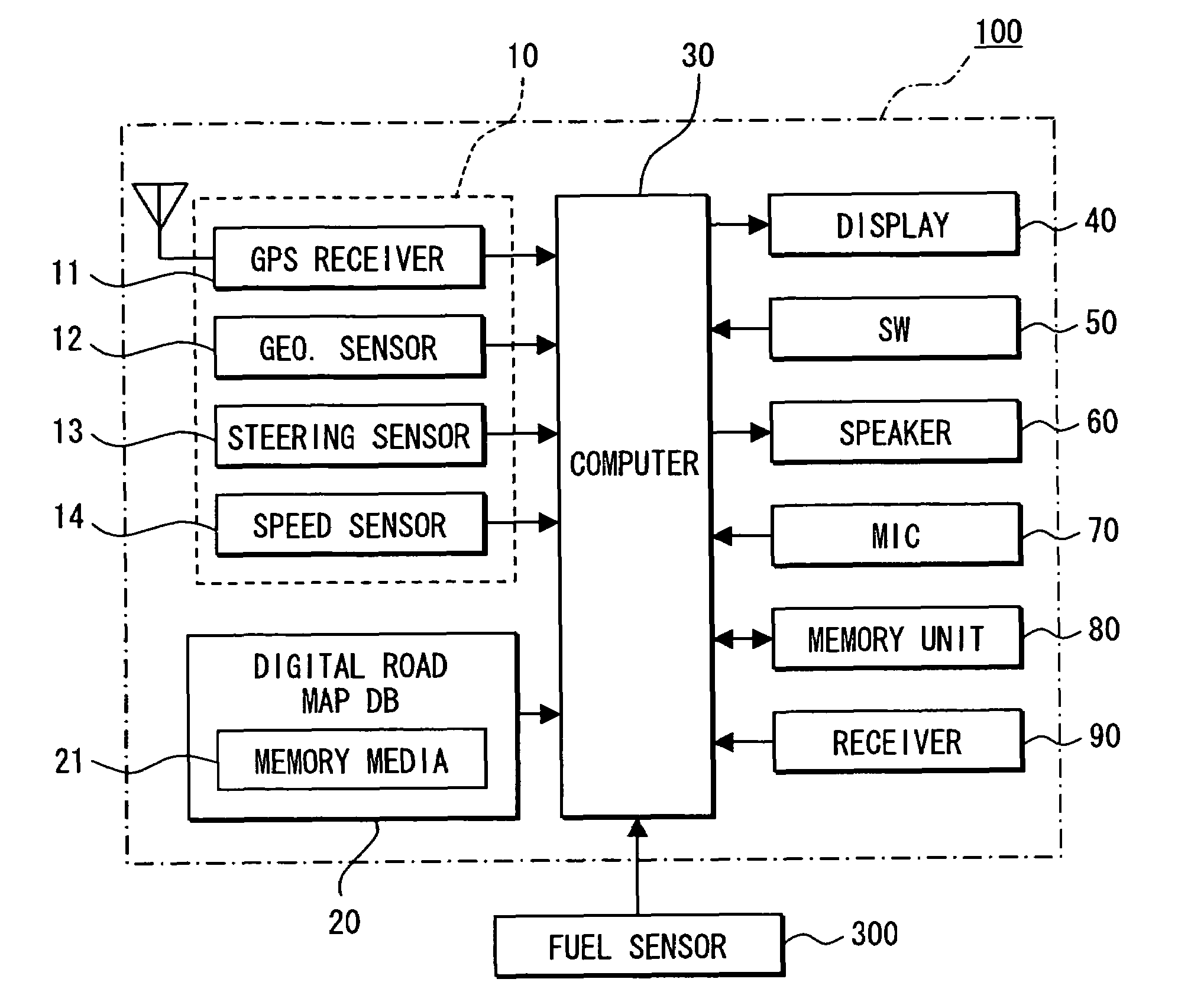
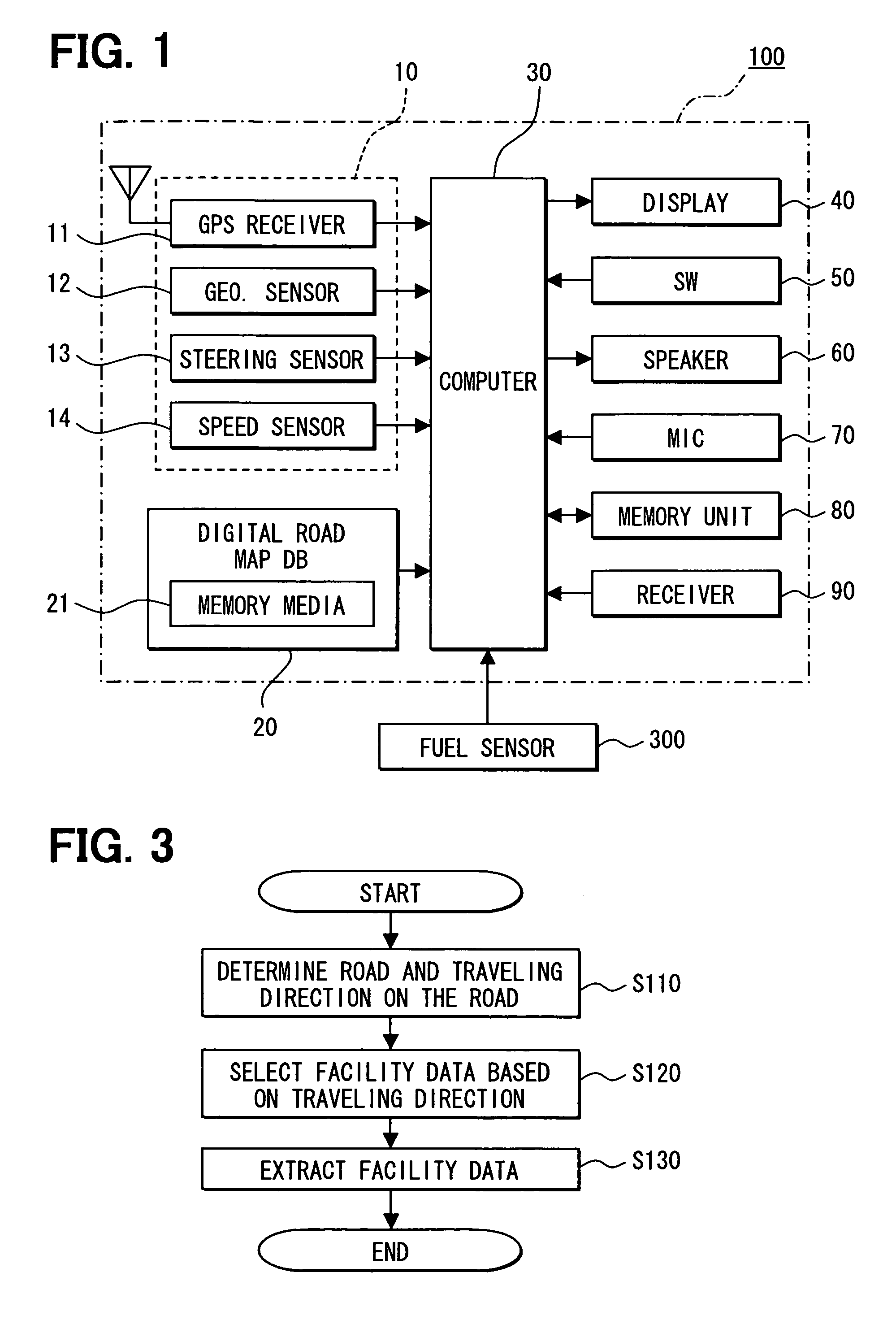
[0042]FIG. 1 shows a block diagram of the navigation system 100 in an embodiment of the present invention. The navigation system 100 includes a position detector 10, a digital road map database 12, a computer 30, a display unit 40, operation switches 50, a speaker 60, a microphone 70, a memory unit 80, and a traffic information receiver 90.

[0043]The computer 30 has a CPU, a ROM, a RAM, an I / O of well-known type included therein and a bus line for connecting these component. The ROM stores a program that is executed in the computer 30, and the CPU or the like performs a predetermined calculation process according to the program stored in the ROM. In addition, the computer 30 is connected to a fuel sensor 300 that detects a fuel level of the subject vehicle.

[0044]The position...


PUM


Abstract

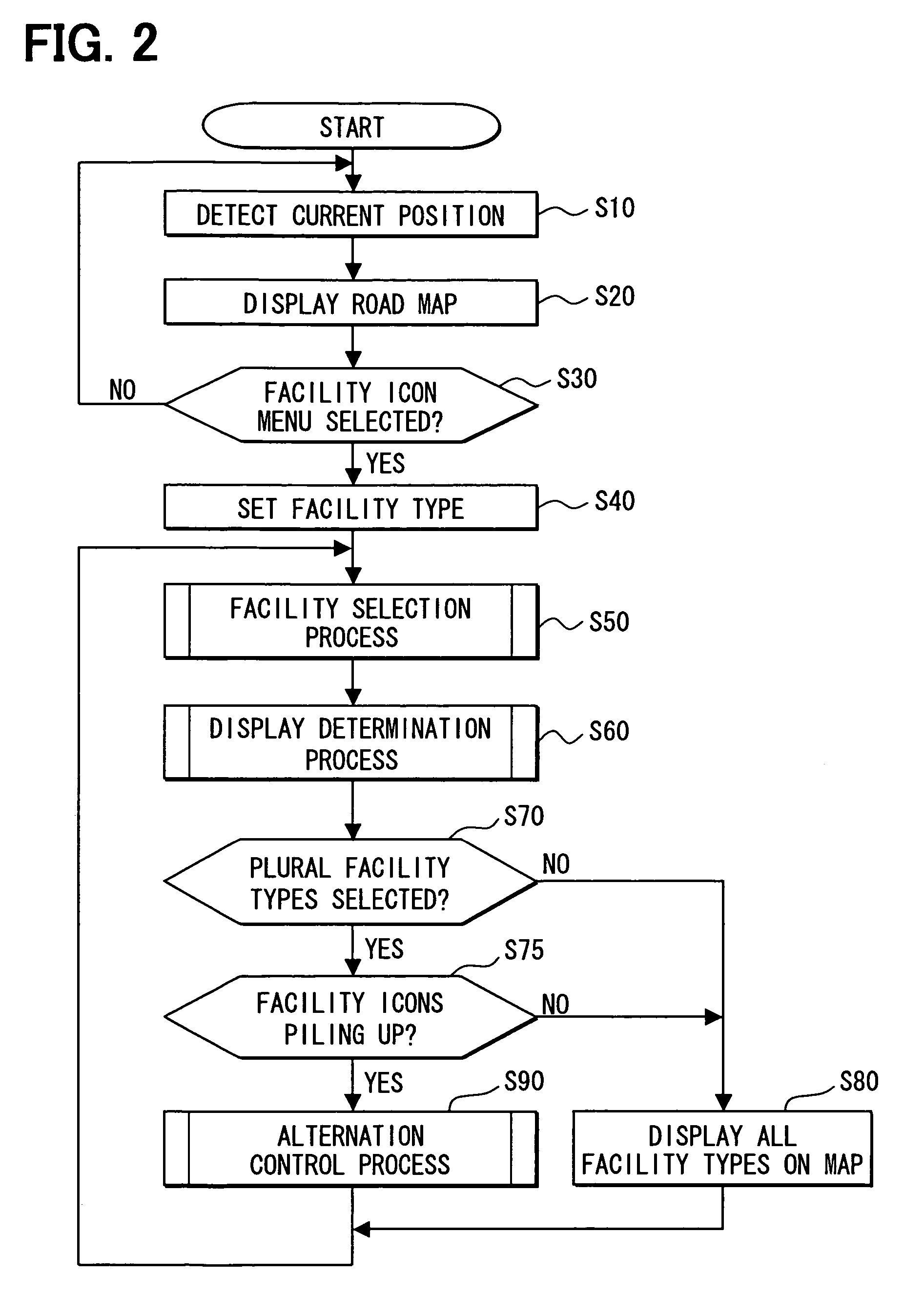
A navigation system in a subject vehicle includes a display unit for displaying a map, a position detection function for detecting a current position and a traveling direction of the subject vehicle, a storage function for storing map data and facility data for displaying a facility icon on the map, a road recognition function for recognizing a road and a lane of the road where the subject vehicle is traveling, a facility selection function for searching a facility in the facility data and a facility icon control means for controlling the facility icon according to a facility type in the facility data. The facility icon on the map is selectively displayed on the map according to the traveling direction of the subject vehicle based on information calculated by above functions.

Description

CROSS REFERENCE TO RELATED APPLICATION[0001]This application is based on and claims the benefit of priority of Japanese Patent Application No. 2005-84687 filed on Mar. 23, 2005, the disclosure of which is incorporated herein by reference.FIELD OF THE INVENTION[0002]The present invention generally relates to a navigation system.BACKGROUND OF THE INVENTION[0003]Conventionally, a navigation system is used to display icons of roadside facilities such as a drug store, a gas station, a restaurant or the like on a road map. Display of the icons of the road-side facilities is configurable based on user input from a display configuration menu. Upon receiving the user input for turning on, for example, the icons of the drug store, the navigation system displays drug store icons around a current position of a subject vehicle on the map. In this manner, a user of the navigation system can locate the drug stores around the current position of the subject vehicle on the road map. However, the use...

Claims


Application Information

Patent Timeline
Patent Type & Authority Patents(United States)
IPC IPC(8): G01C21/26
CPCG01C21/3682G08G1/096716G08G1/09675G08G1/096861G08G1/096783G08G1/096827G08G1/096775
Inventor NOMURA, TOSHIO
Owner DENSO CORP
Learn More