
Navigation system with function of one-touch map matching correction and method thereof

a mapping system and one-touch technology, applied in the field of navigation systems, can solve problems such as tens of meters of error, neighboring road matching to neighboring roads other than actual roads, and path search and guidance for roads other than roads

Active Publication Date: 2010-01-12
HYUNDAI AUTONET
View PDF28 Cites 76 Cited by
  • Summary
  • Abstract
  • Description
  • Claims
  • Application Information

AI Technical Summary

Benefits of technology

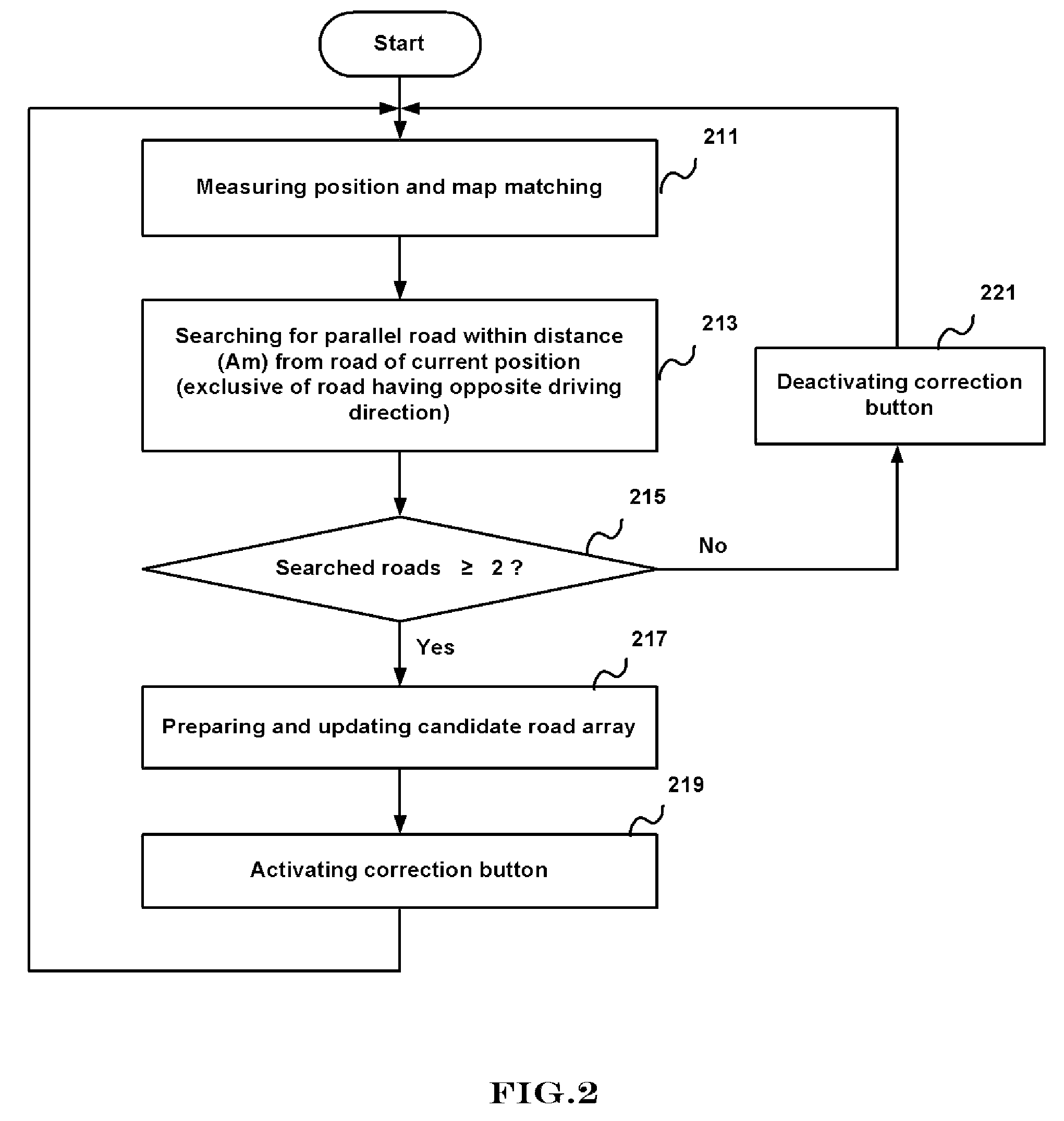
"The present invention is a navigation system with a function of map matching correction. The system includes a GPS module for measuring position and driving direction, a map database for storing map data, a storage unit for storing a candidate designation index, road information corresponding to the index, a guidance stop flag, a flag activating a map-matching correction button, and voice data for road sequence guidance. The system can correct map matching when there are multiple parallel roads within a certain distance of a current position. The system can also display map data, activate or deactivate the map-matching correction button, and guide the user to their destination using the displayed map data. The technical effects of the invention include improved accuracy and efficiency of map matching correction and improved user experience."

Problems solved by technology

In general, when the self position of the GPS module is calculated using the position signals received from the GPS satellites, it gets to be in error by tens of meters.
However, in case where the correction using the MM method is performed in an area where a plurality of roads are arrayed to be in parallel with the road on which the user is under driving, erroneous map matching to neighboring roads other than an actual road can occur.
In case where the calculated position is matched to the road in the conventional MM method as described above, erroneous path search and guidance for the roads other than the road where the user is being advanced by car or on foot occur.
Therefore, there is a drawback in that the user can be confused by unwanted path search and guidance.

Method used


Image

  • Navigation system with function of one-touch map matching correction and method thereof
  • Navigation system with function of one-touch map matching correction and method thereof
  • Navigation system with function of one-touch map matching correction and method thereof

Examples


first embodiment

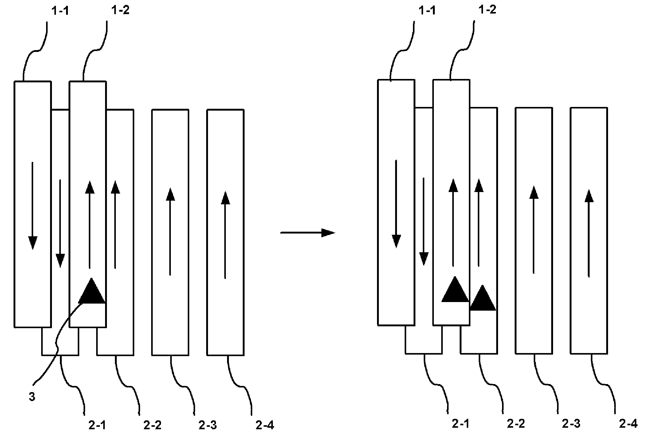
[0027]In the present invention, the activated map-matching correction button is repeatedly pressed, thereby sequentially changing the plurality of roads at one side and at a right angle with a driving direction in consideration of a shape of a road line while performing the map matching corrections. In other words, the map matching correction refers to a self position correction.

second embodiment

[0028]In the present invention, if a map-matching correction button is activated and then, pressed, a plurality of roads arrayed to be in parallel are magnified and displayed on a display device, and map matching correction is performed for a road selected by a user from the displayed roads.

[0029]Hereinafter, a navigation system with a function of one-touch map matching correction and a method thereof according to the present invention will be described with reference to the attached drawings.

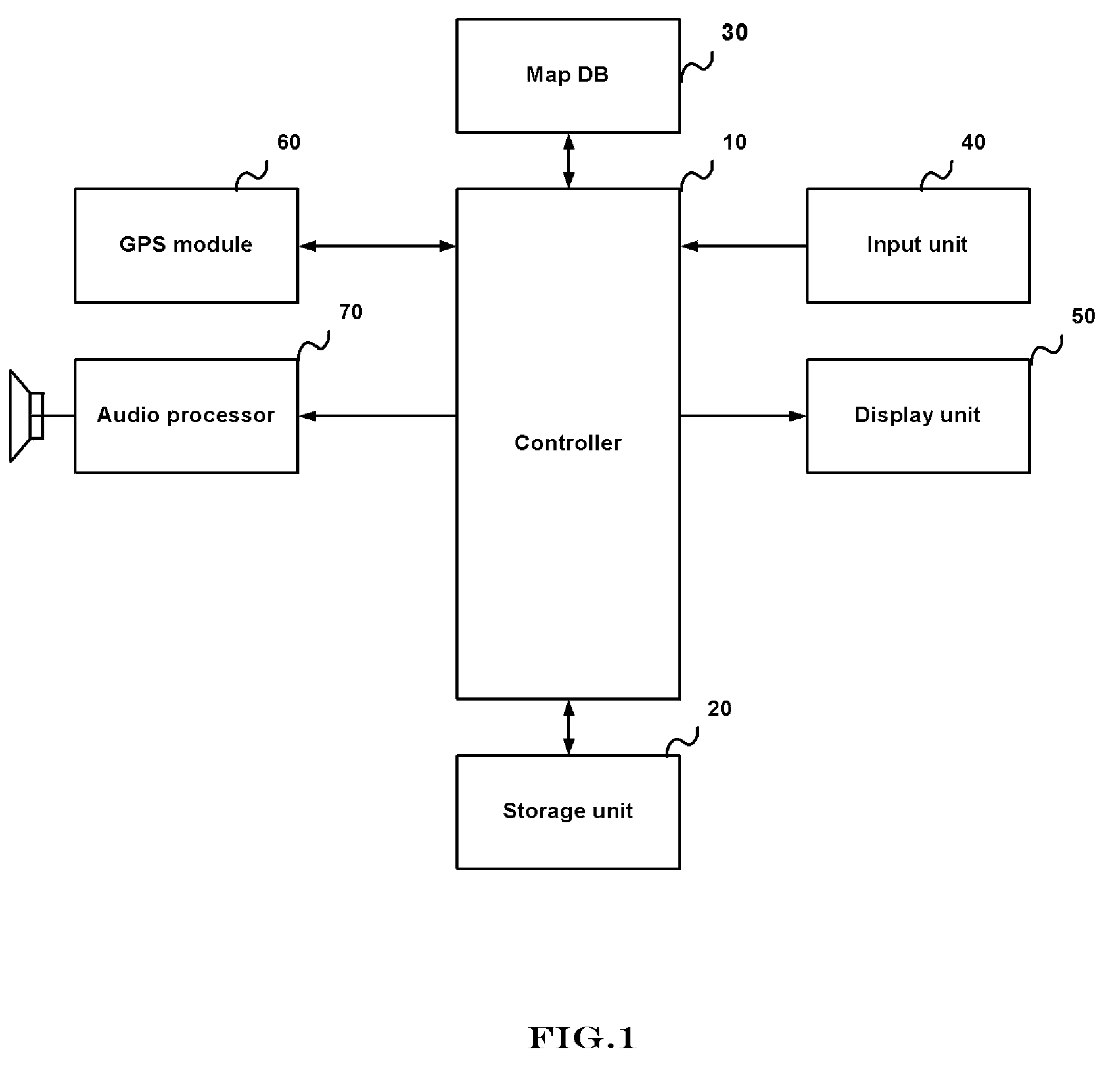
[0030]FIG. 1 is a block diagram illustrating the navigation system with the function of one-touch map matching correction according to the present invention.

[0031]The navigation system includes a controller 10, a storage unit 20, a map database (DB) 30, an input unit 40, a display unit 50, a GPS module 60, and an audio processor 70.

[0032]The controller 10 controls a general operation of the navigation system according to the present invention.

[0033]The storage unit 20 includes a region for stor...


PUM


Abstract

A navigation system with a function of one-touch map matching correction, and a method thereof. The navigation system includes a GPS module for receiving each position signal, and measuring self position and driving direction; a map database for storing map data; a storage unit for storing a candidate designation index, road information, a guidance stop flag, a flag activating a map-matching correction button, and voice data for road sequence guidance; a display unit for displaying the map data, activating or deactivating the map-matching correction button, and generating a coordinate value of a position; and a controller for indexing the parallel roads, generating a candidate road array, activating the map-matching correction button, and sequentially selecting candidate roads while performing the map matching correction.

Description

BACKGROUND OF THE INVENTION[0001]1. Field of the Invention[0002]The present invention relates to a navigation system, and more particularly, to a navigation system with a function of one-touch map matching correction, for performing one-touch map matching correction when there exist a plurality of parallel roads within a predetermined distance from a road of a current position, and a method thereof.[0003]2. Description of the Related Art[0004]In general, in a navigation system, a path from a current position to a destination inputted by a user on the basis of a global positioning system (GPS) is selected by a path selection method predefined by the user, and road guidance based on the selected path is performed.[0005]In detail, the navigation system includes a map database for storing map data, which is obtained by mapping information on a national terrain, a road on the terrain, a building and a terrain around the road, and names and addresses of the road and the buildings, accordi...

Claims


Application Information

Patent Timeline
Patent Type & Authority Patents(United States)
IPC IPC(8): G01C21/00G01S19/14
CPCG01C21/30G01C21/3664G01C21/3667G01S19/14G08G1/0969
Inventor KWON, PIL SU
Owner HYUNDAI AUTONET
Learn More