Apparatus and method of generating curved baseline for map labeling

a technology of a map and a baseline, applied in the field of apparatus and methods for displaying maps, can solve the problems of compromising the map drawing performance of a handheld or vehicle navigation gps device, and the number of polyline points can be very larg

Active Publication Date: 2010-04-06
MITAC INT CORP
View PDF145 Cites 11 Cited by
  • Summary
  • Abstract
  • Description
  • Claims
  • Application Information

AI Technical Summary

Benefits of technology

[0010]The present invention provided an efficient method and apparatus for calculating a curved baseline for display text on an end user's portable map displaying device, and in particular, on a portable global positioning system (GPS) device, that may for instance, be handheld by a user and / or mounted in a vehicle.

Problems solved by technology

However, the number of points of polylines can be very large and the computation burden of generating curved labels may compromise the map drawing performance of a handheld or vehicle navigation GPS device.

Method used


Image

  • Apparatus and method of generating curved baseline for map labeling
  • Apparatus and method of generating curved baseline for map labeling
  • Apparatus and method of generating curved baseline for map labeling

Examples


Embodiment Construction

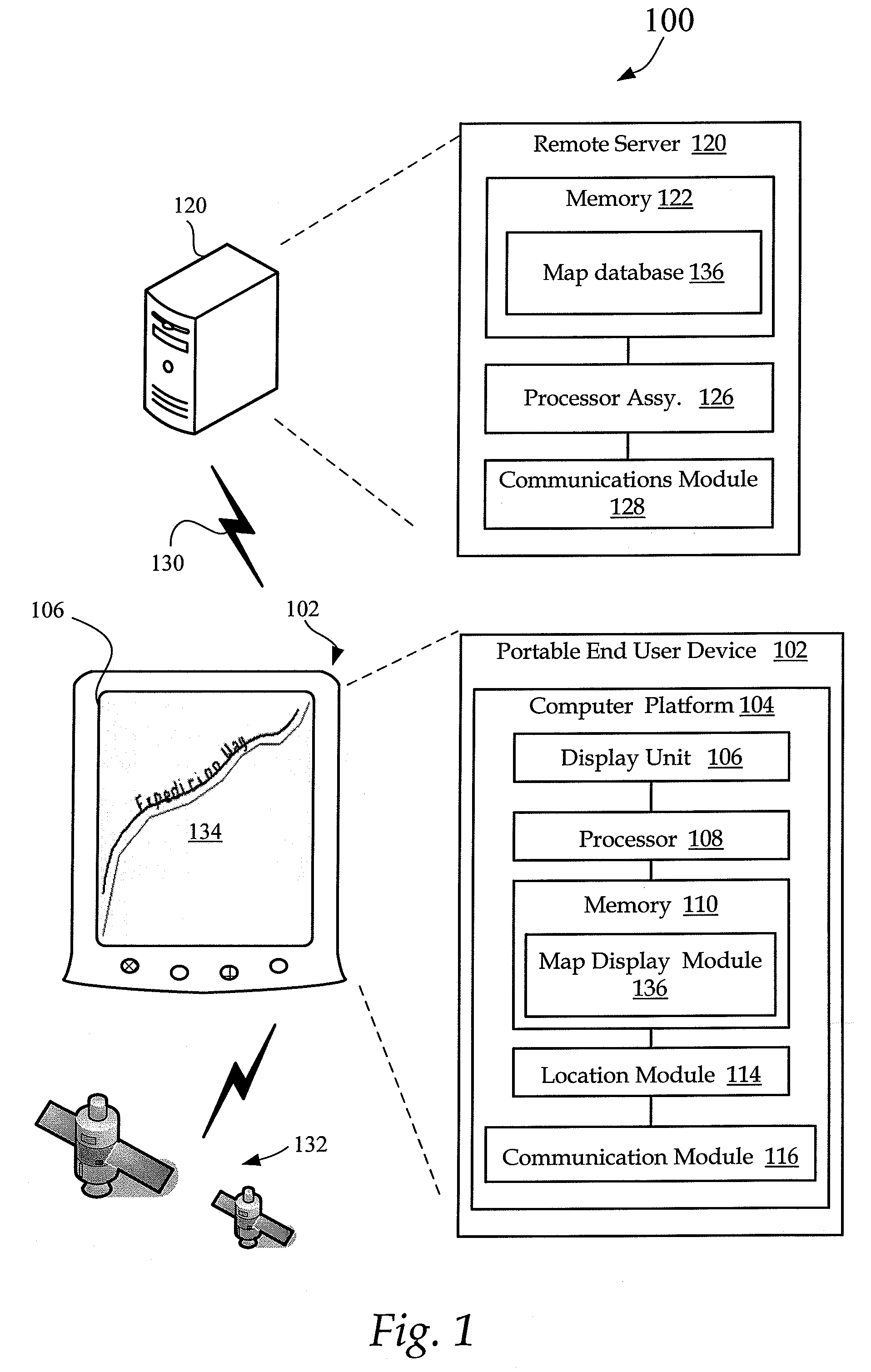
[0034]FIG. 1 is an illustration of a navigation system 100 for determining the position of a portable user device 102. The system 100 may also provide the capability of guiding a user in navigating the user to a predetermined location.

[0035]In one exemplary embodiment, the system 100 determines the position of a portable user device 102 using location parameters derived from, a radio-navigation system, such as the Global Positioning System (GPS), developed and operated by the U.S. Defense Department. In some embodiments, the GPS navigation system 100 receives data from several satellites 132 orbiting the earth at a distance of approximately 20,000 kilometers. The GPS position location parameters permit a user device 102, in communication with the satellites, to determine their respective three dimensional positions and velocities using very precise location parameters and timing signals received from the satellites 132.

[0036]The user device 102 includes an integrated / external displa...


PUM


Abstract

Apparatus and methods of generating a curved baseline for a map labeling include receiving a polyline P={p1,p2, . . . ,pn} of n points, generating a supporting polyline Q={q1,q2, . . . , qm} (m≧n) of m points at an expected distance d between polyline P and a curved base line L. A predetermined number of B-Spline points is generated based upon supporting polyline Q. The B-Spline points are then connected to form a curved baseline L for displaying a label.

Description

FIELD OF THE INVENTION[0001]The present invention relates generally to apparatus and methods for displaying maps, and more specifically, to apparatus and methods that generate curved labeling on portable GPS (Global Positioning System) devices.BACKGROUND OF THE INVENTION[0002]Global positioning systems allow automatic route calculation from a current position to a destination location. Such systems guide a driver of a vehicle along a calculated trip route from the particular instantaneous vehicle location to the destination location by outputting trip instructions in conjunction with a visual display of route segments as the vehicle progresses.[0003]One exemplary geographical position location system receives and analyzes location parameters derived from the Global Positioning System (GPS), a radio-navigation system, developed and operated by the U.S. Defense Department, which includes a series of 24 constellation satellites orbiting the earth at a distance of approximately 20,000 k...

Claims


Application Information

Patent Timeline
Patent Type & Authority Patents(United States)
IPC IPC(8): G06T15/40
CPCG01C21/3673G09B29/007G06T17/05G06T11/203
Inventor NI, HONGJIE
Owner MITAC INT CORP
Why Eureka
Try Eureka