
System for monitoring RNP for safe terrain clearance

a technology of safe terrain and monitoring system, which is applied in the direction of process and machine control, instruments, navigation instruments, etc., can solve the problems of pilots starting to ignore the egpws alert, alarm conditions may not be avoided at all, and pilots may be unable to respond to the aler

Active Publication Date: 2010-04-06
HONEYWELL INT INC
View PDF11 Cites 5 Cited by
  • Summary
  • Abstract
  • Description
  • Claims
  • Application Information

AI Technical Summary

Problems solved by technology

This may cause the EGPWS to trigger terrain avoidance alerts (caution or warning) because terrain or other obstacles impinges on the EGPWS alert envelope.
These nuisance alerts may reduce pilot responsiveness to the EGPWS alerts; that is, the pilot may start to ignore the EGPWS alert.
Additionally, the approach path designer must tailor the approach to avoid ground proximity alarms which leads to non-optimum approach paths, and sometimes the alarm conditions may not be avoidable at all.

Method used


Image

  • System for monitoring RNP for safe terrain clearance
  • System for monitoring RNP for safe terrain clearance
  • System for monitoring RNP for safe terrain clearance

Examples


Embodiment Construction

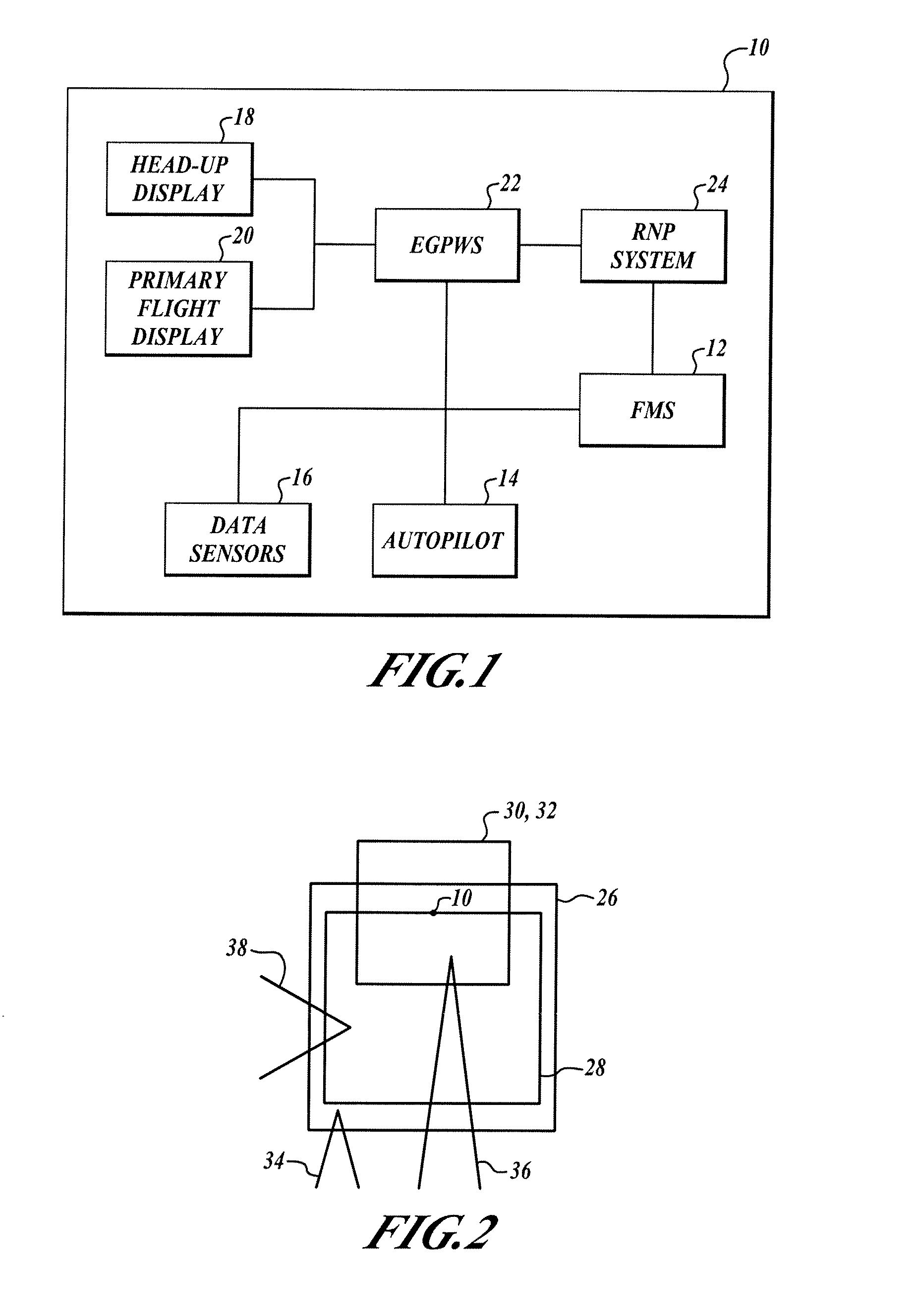
[0015]FIG. 1 shows a schematic diagram of an aircraft 10 for performing an embodiment of the present invention. The aircraft 10 includes a Flight Management System (FMS) 12, an autopilot 14, data sensors, head-up and primary flight displays 18, 20, an Enhanced Ground Proximity Warning System (EGPWS) 22, and a Required Navigation Performance (RNP) procedure system 24 (referred to herein as the RNP system 24). The RNP system 24 is in communication with the aircraft EGPWS 22 and the FMS 12. Thusly, the RNP system 24 may access the EGPWS 22 and the FMS 12 to obtain the information and data necessary to perform methods according to the present invention.

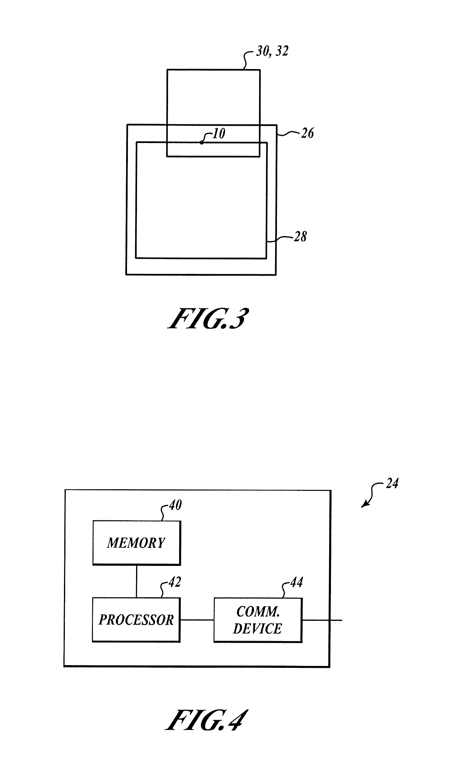
[0016]FIG. 2 shows a front or rear view of an aircraft 10. The aircraft 10 is flying in RNP space. An EGPWS caution envelope 26 is unchanged, and an EGPWS warning envelope 28 size has been altered to conform to the size of the RNP flight envelope 32, thereby forming a modified EGPWS warning envelope 30. Thus, if the EGPWS 22 determines th...


PUM


Abstract

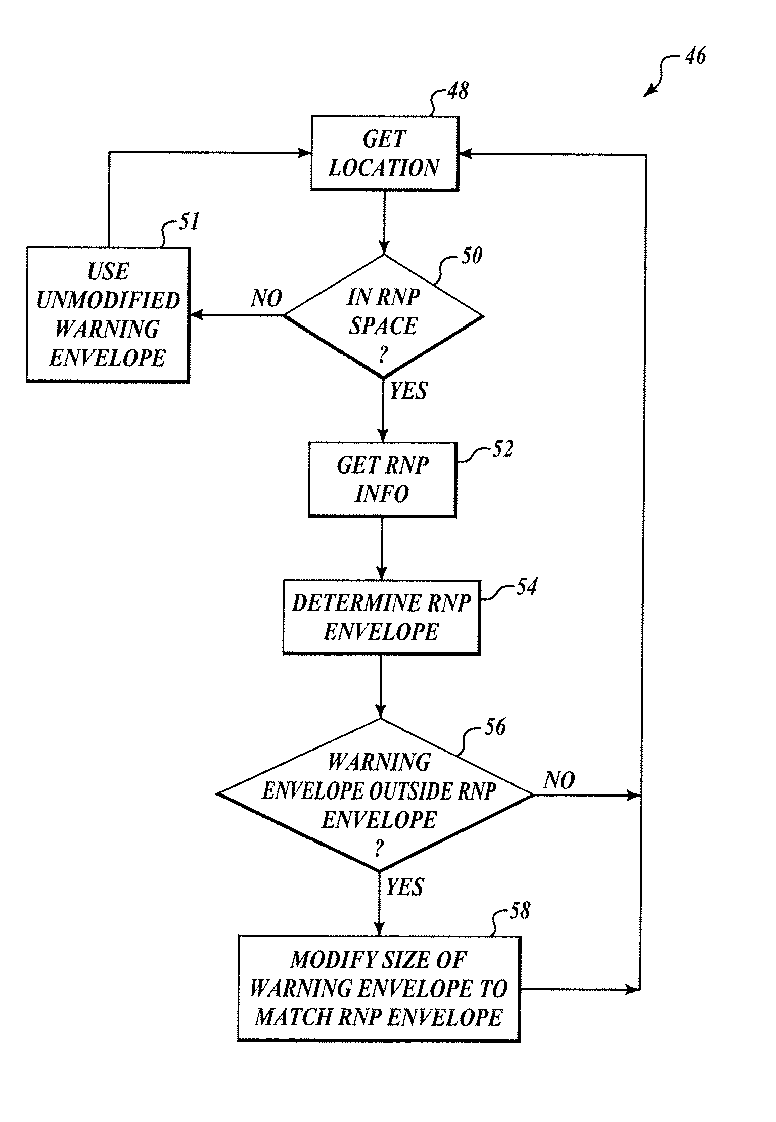
Systems and methods for monitoring Required Navigational Performance (RNP) Procedures and reducing nuisance Enhanced Ground Proximity Warning System warnings including a processor, a memory with RNP instructions and data, and a communication device. The processor accesses the RNP data and instructions from the memory, and uses the communication device to obtain flight information from a Flight Management System of an aircraft. When the processor determines that the aircraft is in RNP space, the processor projects an RNP envelope and modifies a warning envelope of an EGPWS to coincide with the RNP envelope if the EGPWS warning envelope extends farther than the RNP envelope.

Description

BACKGROUND OF THE INVENTION[0001]At present, many aircraft are equipped with Enhanced Ground Proximity Warning Systems (EGPWS), such as the system taught in U.S. Pat. No. 5,839,080, titled “Terrain Awareness System,” issued Nov. 17, 1998 to Muller et al., and herein incorporated by reference. The EGPWS combines a worldwide digital terrain database with a long-range navigation system such as Global Positioning System, INS (Inertial Navigation System), radio-dependant navigational systems, or a combination of the above. On-board computers can compare its current location with a database of the Earth's terrain. Pilots receive timely cautions and warnings of any obstructions to the aircraft's path. The EGPWS uses the intended flight path and projects a volume (or envelope) around the flight path. The volume is determined by the flight path, the aircraft capabilities, and a “buffer” zone of safety to allow for human and mechanical errors. If the projected volume intersects with terrain f...

Claims


Application Information

Patent Timeline
Patent Type & Authority Patents(United States)
IPC IPC(8): G08G5/00
CPCG01C23/005G08G5/0013G08G5/0078G08G5/0052G08G5/0021
Inventor JOHNSON, STEVE C.ISHIHARA, YASUO
Owner HONEYWELL INT INC
Learn More