
Navigation device, navigation method, and navigation program

a navigation device and navigation method technology, applied in surveying and navigation, navigation instruments, instruments, etc., can solve the problems of high cost and labor time, inability to create such dense and accurate data, and out-of-alignment of route guidance objects

Active Publication Date: 2012-08-07
PANASONIC CORP
View PDF18 Cites 20 Cited by
  • Summary
  • Abstract
  • Description
  • Claims
  • Application Information

AI Technical Summary

Benefits of technology

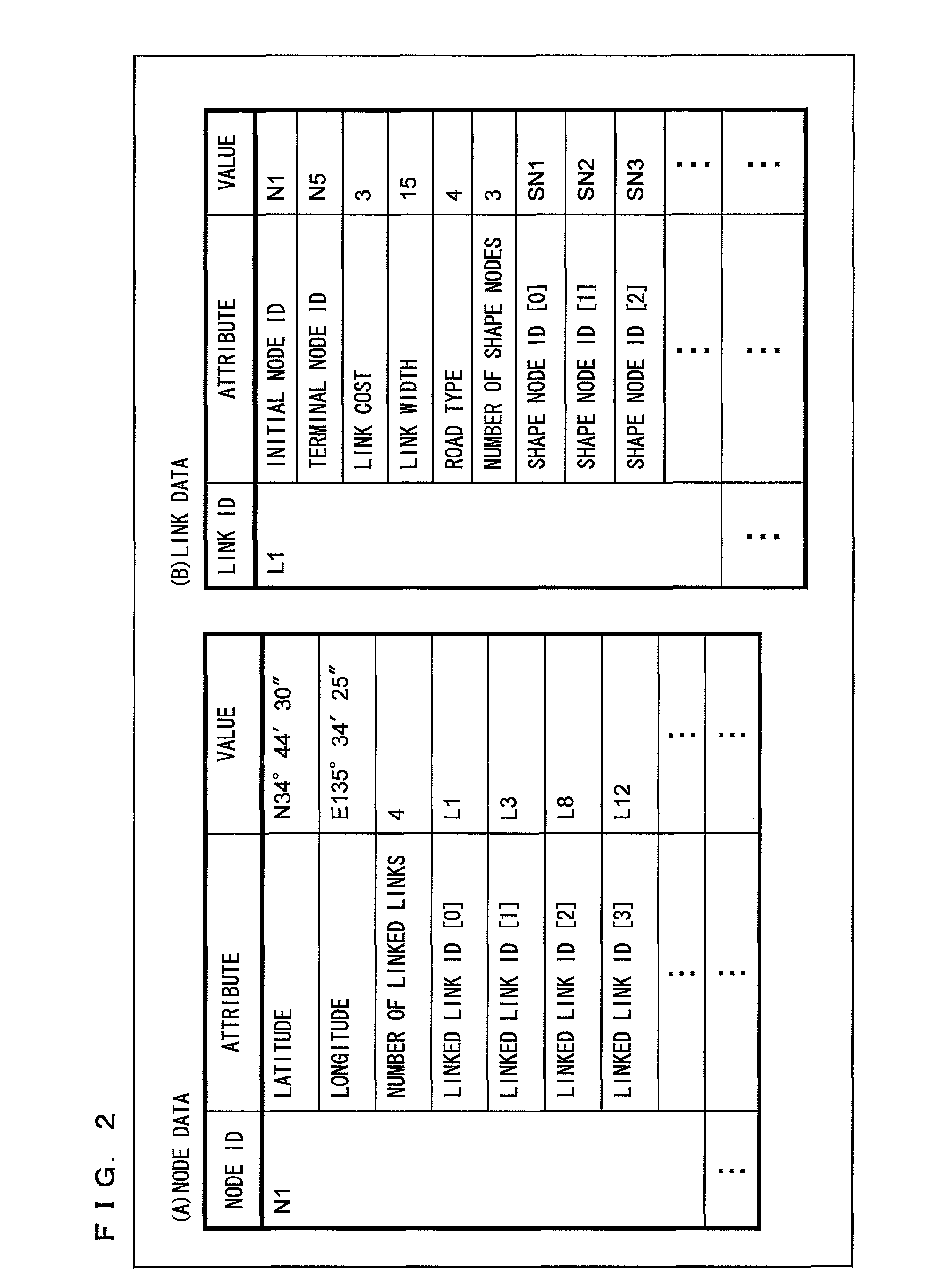
[0014]In order to draw the to-be-superimposed route guidance object so as to be in alignment with the road in the photographed image, highly dense and highly accurate road shape data is required. However, the location densities of the guidance point node and the shape node are not generally high, and it consumes high costs and labor time to create such highly dense and highly accurate data.
[0029]According to the present invention, the navigation device is provided which corrects the road shape data based on the white line detection result, so that the navigation device is capable of displaying the route guidance object so as to be superimposed on the photographed image in a manner that the route guidance object is in alignment with the road even if accuracy of the road shape data stored therein is at the current level.
[0032]At this time, the road shape data is corrected even in the area in which the white line cannot be detected, such that a road shape based on data is not distorted around the boundary between the area in which the white line is detected and the area in which the white line is not detected. As a result, the highly accurate route guidance object is drawn such that the route guidance object is not extremely bent around the boundary and allows the superimposed display to be recognized well.
[0033]Further, when a plurality of lanes lies in the traveling direction of the vehicle, the route guidance object is superimposed on a lane where the vehicle is currently traveling. Accordingly, there is a possibility that the driver is misguided to travel straight ahead on the currently traveling lane without changing lanes, so that the driver cannot change lanes even at a location where the driver has to change lanes, and consequently, the driver fails to timely change lanes. In order to avoid such a problem, the present invention displays the lane change object, which indicates the lane change direction, so as to be superimposed on the route guidance object, so that the driver is secure about the lane change. In addition, since the lane change object is displayed so as to be superimposed on the route guidance object, in comparison with a case of being displayed to be superimposed on another portion, a background of the photographed image is not hidden. Consequently, the driver can easily compare the photographed image with the actual scene.

Problems solved by technology

Accordingly, a problem occurs that when the route guidance object is displayed so as to be superimposed on the photographed image, the route guidance object is out of alignment as shown in FIG. 24.
When the route guidance object is out of alignment, a driver is likely to take a wrong route in some locations, whereby guidance is interrupted.
However, the location densities of the guidance point node and the shape node are not generally high, and it consumes high costs and labor time to create such highly dense and highly accurate data.

Method used


Image

  • Navigation device, navigation method, and navigation program
  • Navigation device, navigation method, and navigation program
  • Navigation device, navigation method, and navigation program

Examples


first embodiment

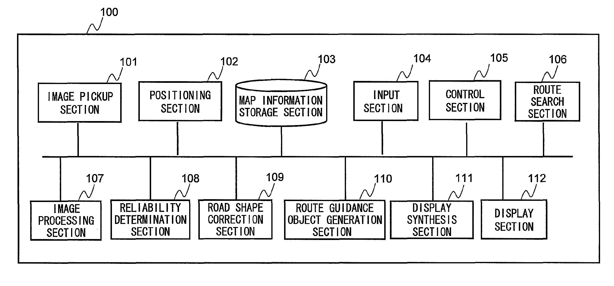
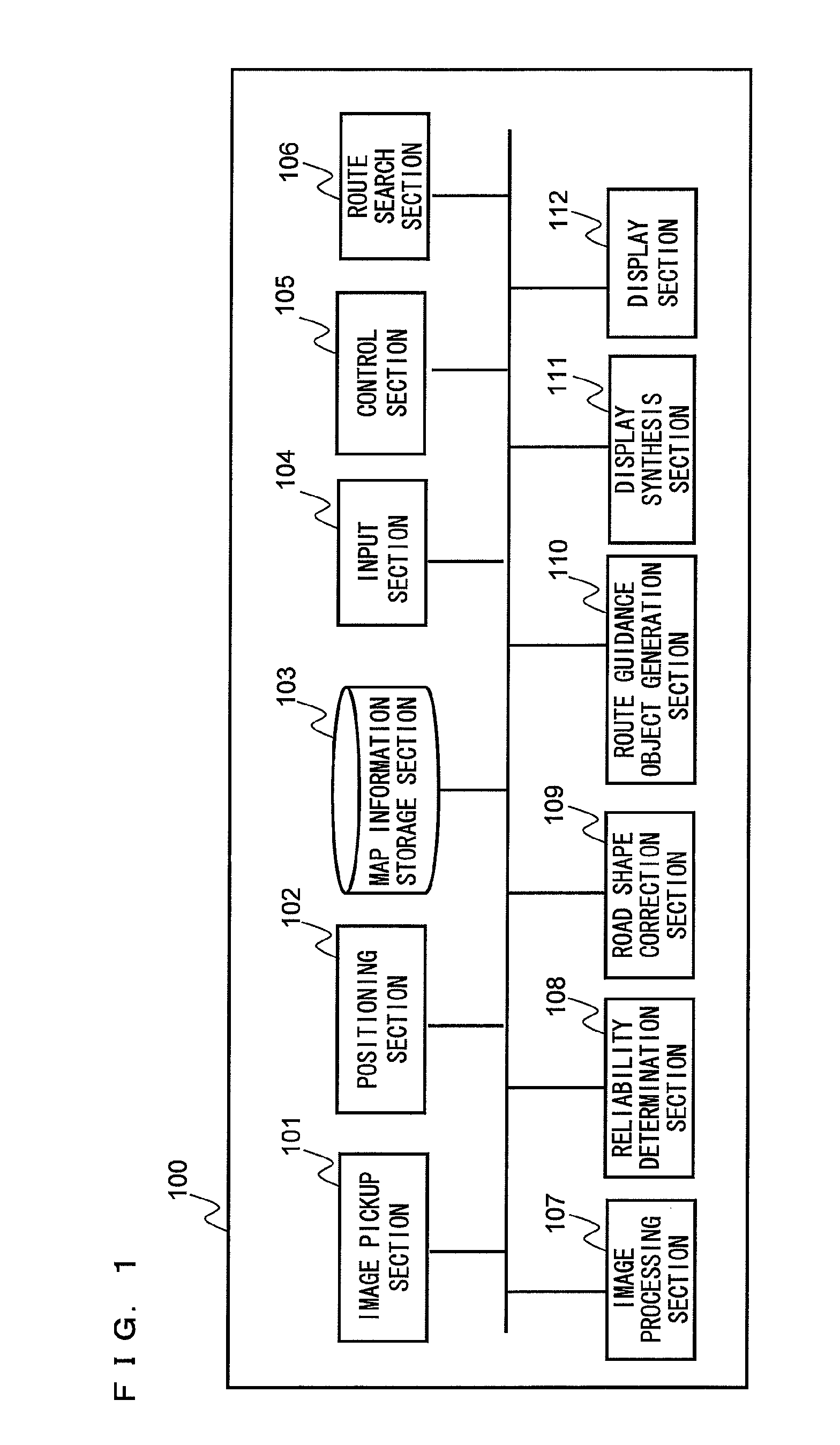
[0074]FIG. 1 is a block diagram illustrating a whole configuration of a navigation device according to a first embodiment of the present invention. As illustrated in FIG. 1, a navigation device 100 includes an image pickup section 101, a positioning section 102, a map information storage section 103, an input section 104, a control section 105, a route search section 106, an image processing section 107, a reliability determination section 108, a road shape correction section 109, a route guidance object generation section 110, a display synthesis section 111, and a display section 112.

[0075]The image pickup section 101 photographs a view ahead of a vehicle, and obtains the photographed image thereof. The image pickup section 101 is, for example, a digital camera. The image pickup section 101 is disposed, for example, on a rear surface of a rearview mirror so as to face ahead of a vehicle, or alternatively disposed on the outside of a roof portion of a vehicle so as to face ahead of...

second embodiment

[0120]Next, a second embodiment will be described with reference to drawings.

[0121]FIG. 13 is a block diagram illustrating a whole configure of a navigation device 200 according to the second embodiment. As illustrated in FIG. 13, the navigation device 200 includes an image pickup section 101, a positioning section 102, a map information storage section 103, an input section 104, a control section 105, a route search section 106, an image processing section 207, a reliability determination section 208, a road shape correction section 209, a route guidance object generation section 110, a display synthesis section 111, and a display section 112.

[0122]Among components illustrated in FIG. 13, components similar to those in FIG. 1 (first embodiment) are denoted by the same reference numerals and description thereof is omitted. The image processing section 207, the reliability determination section 208, and the road shape correction section 209, which have functions different from those ...


PUM


Abstract

A navigation device displays, on a screen, a route guidance object indicating a route along which the vehicle is to travel, and includes: an image pickup section that obtains a photographed image ahead of the vehicle; a white line detection section that detects a road white line in the photographed image; a map information storage section that stores map information including road shape data which represents the road shape; a road shape data correction section that corrects the road shape data, based on a detection result of the road white line, such that the route guidance object is displayed along the road white line; a route guidance object generation section that generates the route guidance object, based on the corrected road shape data; and the display section that displays the generated route guidance object on the screen.

Description

BACKGROUND OF THE INVENTION[0001]1. Technical Field[0002]The present invention relates to a navigation device, a navigation method, and a navigation program, and particularly to a navigation device, a navigation method, and a navigation program for displaying a route object, which indicates a traveling route of a vehicle, so as to be superimposed on a photographed image.[0003]2. Background Art[0004]Conventionally, disclosed is an in-vehicle navigation device in which a photographed image of a view ahead of a vehicle is obtained by image pickup means such as a video camera or the like, and which displays an arrow image, as a route guidance object indicating a traveling direction to which the vehicle is to travel, so as to be superimposed on the photographed image when an vehicle approaches a guidance point such as an intersection or the like (see Patent Document 1, for example).[0005]As described above, the navigation device, which displays the route guidance object so as to be super...

Claims


Application Information

Patent Timeline
IPC IPC(8): G01C21/00
CPCG01C21/30G01C21/3602G01C21/3647G01C21/365G01C21/3658G01C21/28
Inventor KINDO, TSUYOSHIAKITA, TAKASHINAKANO, NOBUYUKIIWAMI, RYOTAROKAWABATA, SUSUMU
Owner PANASONIC CORP
Learn More