
Method for localization of a route section in a map

a technology of route section and map, applied in surveying and navigation, navigation instruments, instruments, etc., can solve the problems of insufficient decoding without the use of further attributes, inability to determine unique maximums, and inability to take into account topology

Inactive Publication Date: 2013-06-11
ROBERT BOSCH GMBH
View PDF4 Cites 15 Cited by
  • Summary
  • Abstract
  • Description
  • Claims
  • Application Information

AI Technical Summary

Benefits of technology

The method described in this patent improves the process of finding the correct route sections in a digitized map. It focuses only on the tree points that correspond to certain types of traffic routes, avoiding a complicated tree structure that may include many points on side roads. The method also uses binary coding to reduce the amount of data transmitted.

Problems solved by technology

The decoding is often insufficient without the use of further attributes, since, for example, parallel roadways cannot be distinguished.
But even when further attributes are used, such as the direction of travel and the like, it often happens that a unique maximum cannot be determined.
This is required, however, since, during the correlating of the points in the first step, the topology cannot be taken into account.

Method used


Image

  • Method for localization of a route section in a map
  • Method for localization of a route section in a map
  • Method for localization of a route section in a map

Examples


Embodiment Construction

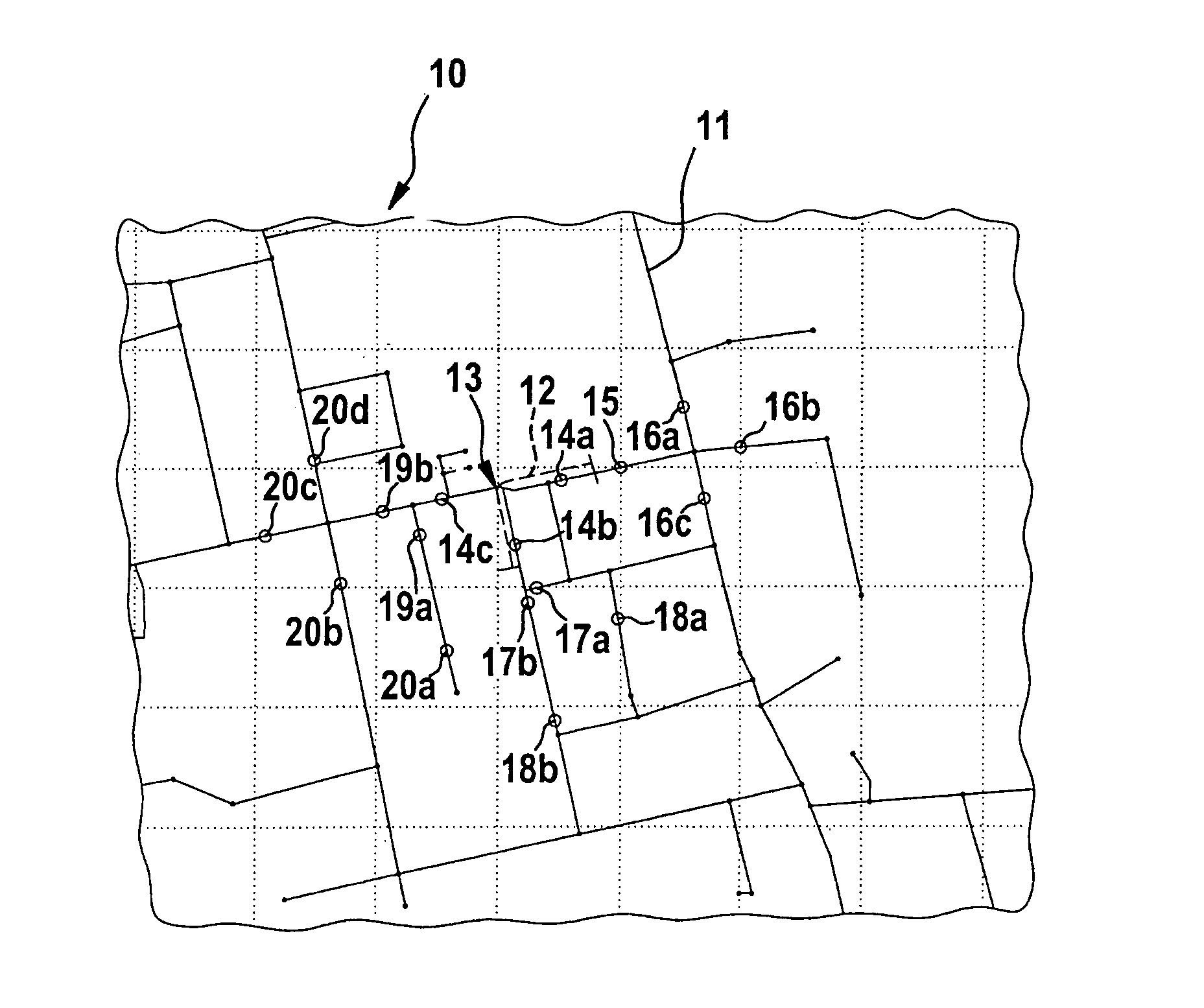
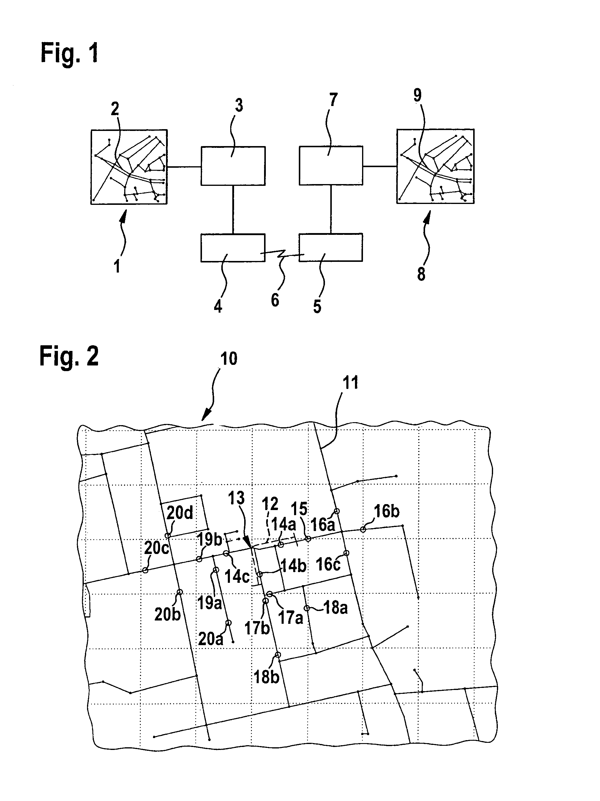
[0026]FIG. 1 shows a map illustration 1, in which there is a route section 2 of a section of a traffic network or road network which is to be localized. An application 3, such as a traffic control center, accesses map illustration 1, for instance, to report a traffic jam and / or a construction site in this route section 2. Additional possible applications of the method according to the present invention might be the referencing of points of interest, for example, the location of restaurants and / or hotels, or the insertion of new map data into digitized maps. Application 3 codes the corresponding road information, using the method according to the present invention described below, for identifying road section 2, and passes the coded data on to a suitable transmission device 4.

[0027]Transmission device 4 then transmits the coded road data to a receiving device 5. The transmission, shown in FIG. 1 by a jagged arrow 6, may be a wireless radio transmission, for instance, via digital tran...


PUM


Abstract

A method for the localization of a certain route section from a first digitized map in a second digitized map. An origin root point is established with regard to a route section in the first map, and the coordinates of this origin root point are determined. Starting from the origin root point, an origin tree structure is generated from a plurality of branches. A reference root point is established in the second map in the vicinity of the coordinates of the origin root point, and in a similar way, a reference tree structure is generated, starting from the reference root point, from a plurality of branches on which tree points are situated in such a way that they correspond in each case to a point of a traffic route in the second map.

Description

FIELD OF THE INVENTION[0001]The present invention relates to a method for the localization of a certain route section from a first digitized map of a traffic-route network in a second digitized map of a traffic-route network.BACKGROUND INFORMATION[0002]Navigation systems access digitized maps of the traffic-route network or road network as the basis for vehicle navigation. These maps are not standardized, so that in response to maps from different producers, deviations in the digitized map information may come about.[0003]In a dynamic navigation that is usual these days, the navigation system checks the route that has already been computed, based on received traffic data on the current traffic position, or it is computed again while taking into account the changed traffic situation. Traffic data are usually allocated to certain route sections of the traffic-route network, in order to make the localization possible. The navigation system now has uniquely to localize the route section...

Claims


Application Information

Patent Timeline
Patent Type & Authority Patents(United States)
IPC IPC(8): G01C21/00
CPCG01C21/3492G01C21/30G01C21/34
Inventor PFEIFFER, HEINZ-WERNERWARTENBERG, MAYLIN
Owner ROBERT BOSCH GMBH
Learn More