

Process and system for identifying damage
a technology of damage identification and damage detection, applied in image analysis, image enhancement, instruments, etc., can solve the problems of large volume of imagery, large human and infrastructure resources, and inability to accurately identify the damage of overhead imagery
- Summary
- Abstract
- Description
- Claims
- Application Information
AI Technical Summary
Benefits of technology
Problems solved by technology
Method used
Image

Examples
Embodiment Construction
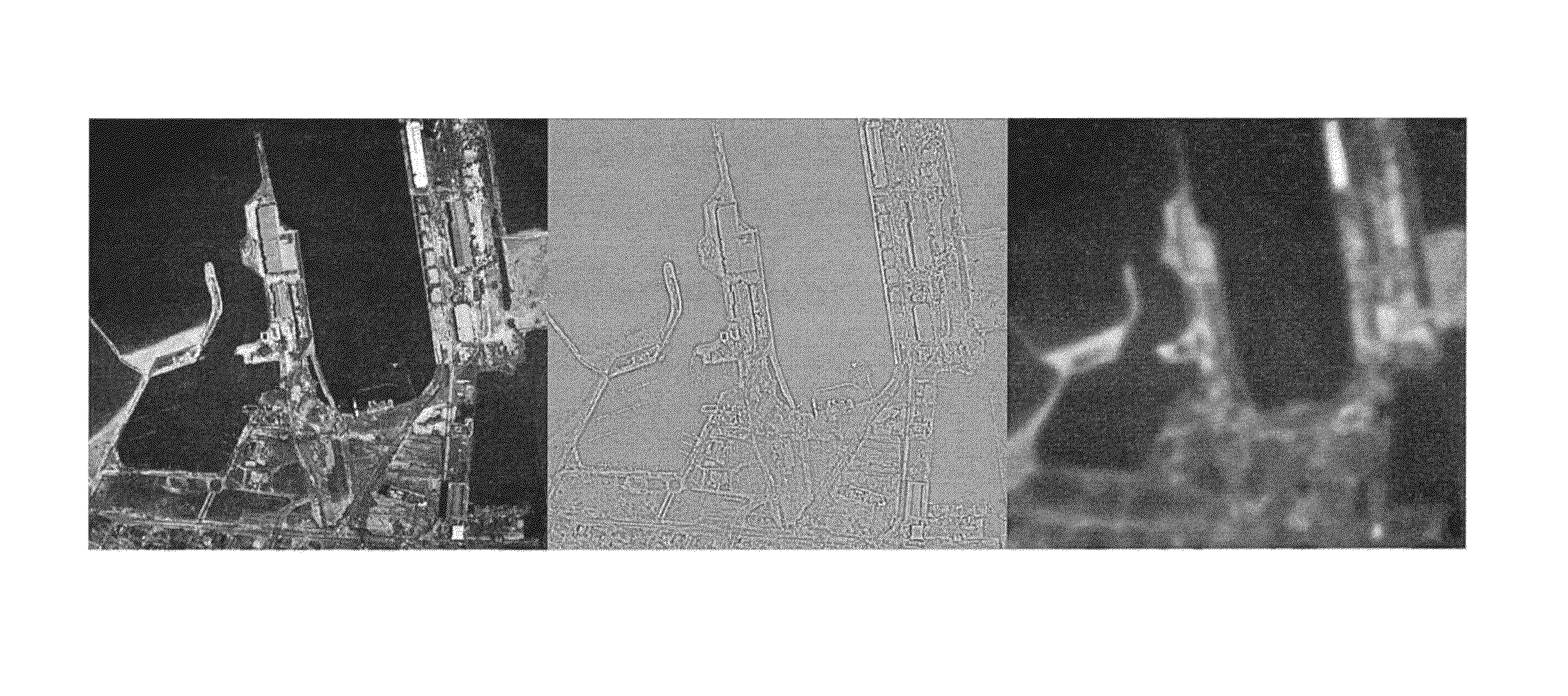
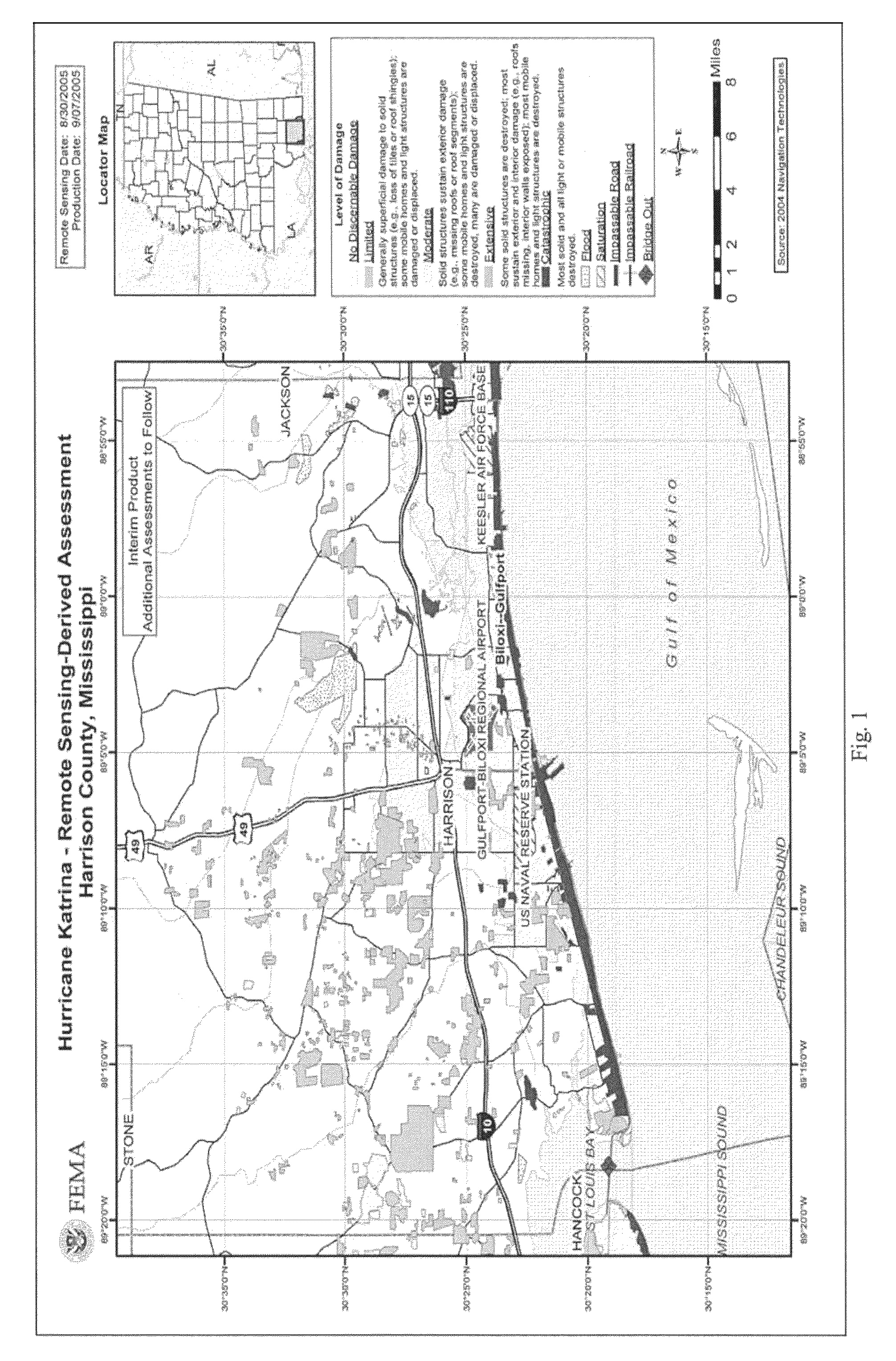
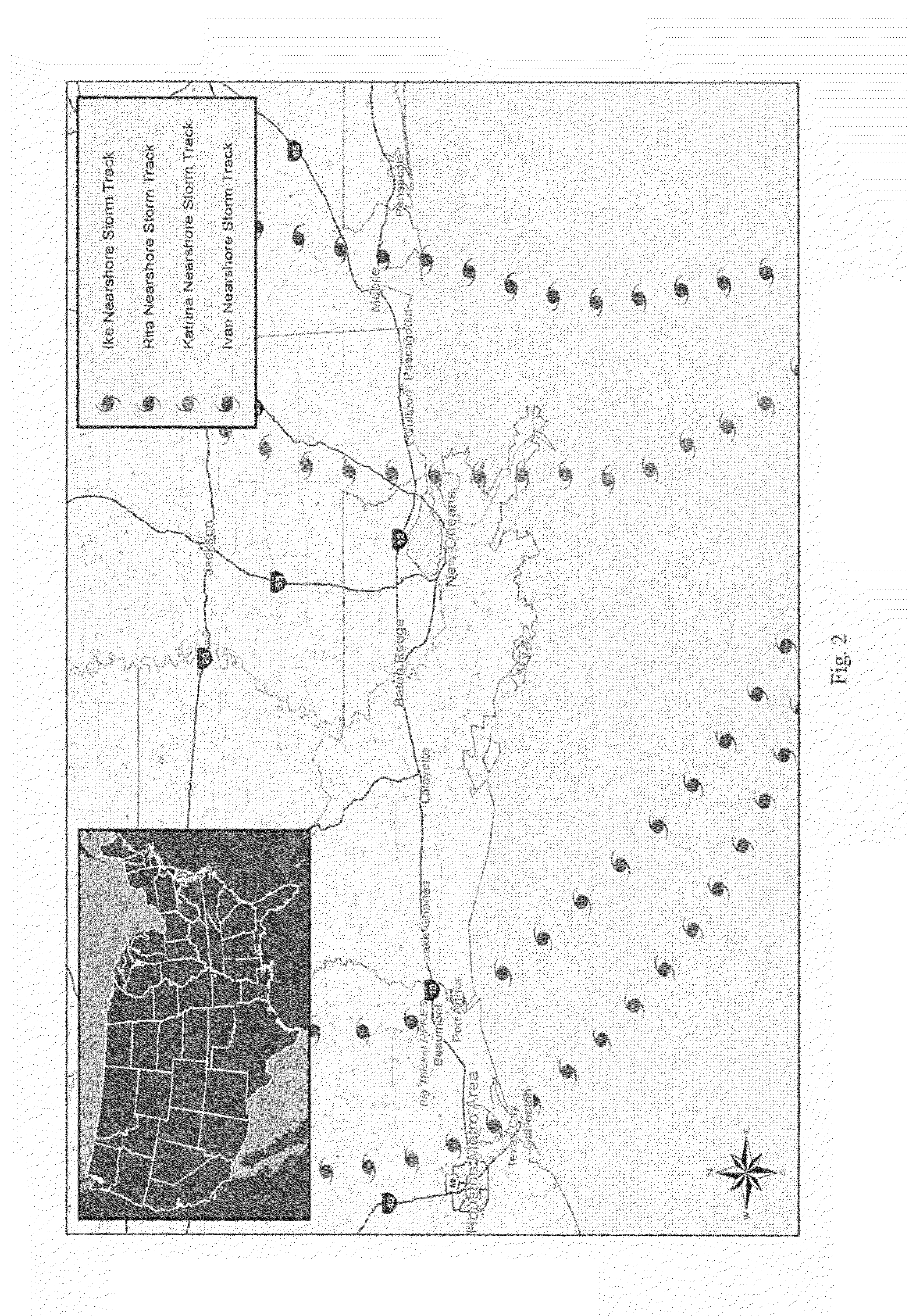
[0086]The disclosure and the various features and advantageous details thereof are explained more fully with reference to the non-limiting embodiments and examples that are described and / or illustrated in the accompanying drawings and detailed in the following description and attachment. The attachment hereto is incorporated herein by reference in its entirety as part of this disclosure. It should be noted that the features illustrated in the drawings and attachment are not necessarily drawn to scale, and features of one embodiment may be employed with other embodiments as the skilled artisan would recognize, even if not explicitly stated herein. Descriptions of well-known components and processing techniques may be omitted so as to not unnecessarily obscure the embodiments of the disclosure. The examples used herein are intended merely to facilitate an understanding of ways in which the invention may be practiced and to further enable those of skill in the art to practice the embod...
PUM
 Abstract
Description
Claims
Application Information