
System and related method for offering navigation guidance

a navigation guidance and navigation system technology, applied in navigation, surveying and navigation, instruments, etc., can solve the problems of high-end portable electronic devices that cannot track waypoints taken by users, high-end portable electronic devices are more expensive than their low-end portable electronic device counterparts, and consume more battery power

Active Publication Date: 2015-11-24
MITAC INT CORP
View PDF41 Cites 3 Cited by
  • Summary
  • Abstract
  • Description
  • Claims
  • Application Information

AI Technical Summary

Benefits of technology

The patent describes an improved system and method for offering navigation guidance. The system includes a server that receives a track file containing a plurality of waypoints, and adds a plurality of navigation points to the file based on a map database to create a modified track file. The navigation points include data for creating a graphical depiction of intersections associated with the path indicated by the modified track file. The server then sends the modified track file to a portable electronic device, which uses the navigation points to provide turn-by-turn navigation guidance to the user. The portable electronic device does not need to have a map database stored in memory to provide navigation guidance. The technical effect of this patent is to offer efficient and effective navigation guidance to users through the use of a server and portable electronic device.

Problems solved by technology

On the other hand, low-end portable electronic devices contain a position receiving device but do not contain a map database inside the portable electronic devices.
Consequently, the low-end portable electronic devices can only track waypoints taken by the users.
Unfortunately, due to their added functionality and the included map databases, high-end portable electronic devices are more expensive than their low-end portable electronic devices counterparts.
Also, high-end portable electronic devices consume more battery power.
Furthermore, the low-end portable electronic devices are not able to offer much in the way of navigation guidance to users.

Method used


Image

  • System and related method for offering navigation guidance
  • System and related method for offering navigation guidance
  • System and related method for offering navigation guidance

Examples


Embodiment Construction

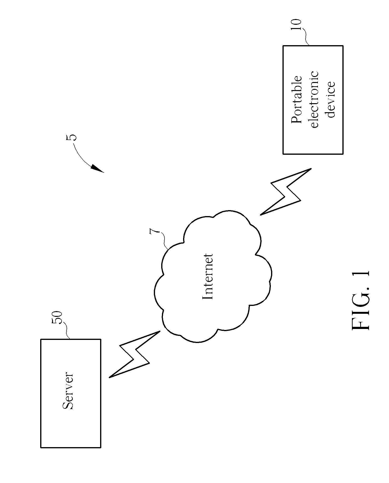
[0020]Please refer to FIG. 1. FIG. 1 is a block diagram of a navigation system 5 according to the present invention. The navigation system 5 contains a server 50 and a portable electronic device 10 that may communicate with one another via the internet 7. As will be explained in greater detail below, the server 50 receives an uploaded track file containing a plurality of waypoints, and modifies the track file to add navigation points containing navigation information. This modified track file is then downloaded into the portable electronic device 10 for providing navigation guidance to a user of the portable electronic device 10.

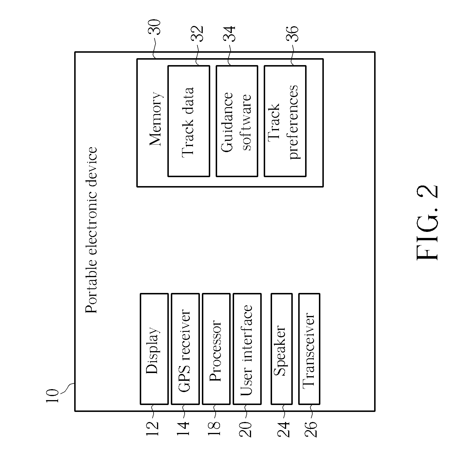
[0021]Please refer to FIG. 2. FIG. 2 is a functional block diagram of the portable electronic device 10 according to the present invention. The portable electronic device 10 contains a display 12 which can be a touch sensitive display or a non-touch sensitive display, a GPS receiver 14 for receiving position signals indicating the current position coordinate...


PUM


Abstract

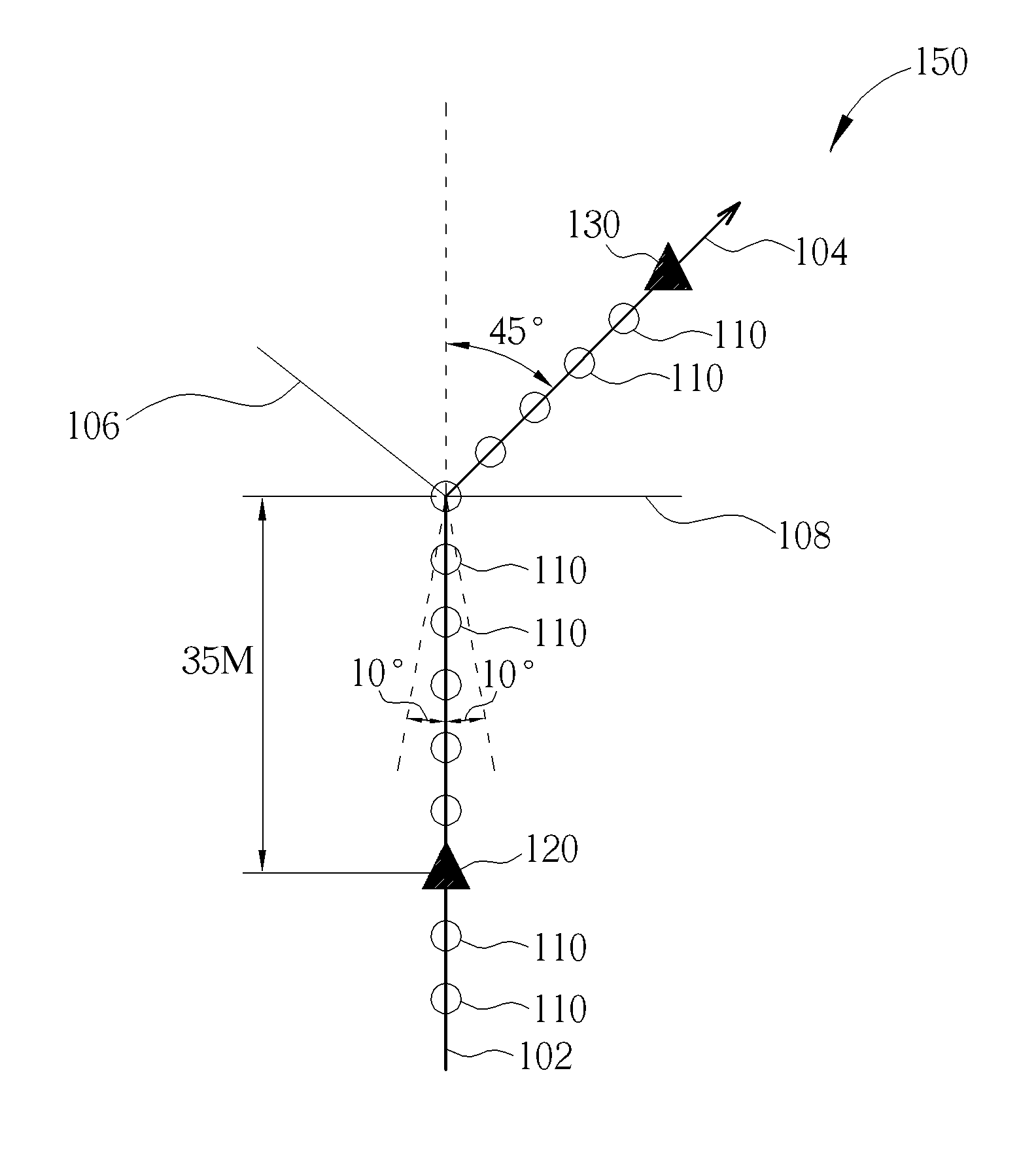
A method of providing navigation guidance information to a user of a portable electronic device includes uploading a track file to a server, the track file containing a plurality of waypoints that form a track, adding a plurality of navigation points to the plurality of waypoints to produce a modified track file, the plurality of navigation points providing navigation guidance to the user of the portable electronic device, and the plurality of navigation points containing data for creating a graphical depiction of intersections associated with the turn-by-turn navigation guidance. The method further includes downloading the modified track file to the portable electronic device, and providing bi-directional turn-by-turn navigation guidance to the user of the portable electronic device when the user reaches each of the plurality of navigation points as the user follows the path indicated by the modified track file.

Description

BACKGROUND OF THE INVENTION[0001]1. Field of the Invention[0002]The present invention relates to a portable electronic device not having a map database stored internally and capable of outputting to a user navigation guidance instructions generated in and by a server.[0003]2. Description of the Prior Art[0004]Global Positioning System (GPS) based navigation devices are well known and are widely employed as in-car navigation devices. Common functions of a navigation device include providing a map database for generating navigation instructions that are then shown on a display of the navigation device. These navigation devices are often mounted on or in the dashboard of a vehicle using a suction mount or other mounting means.[0005]The term “navigation device” refers to a device that enables a user to navigate to a pre-defined destination. The device may have an internal system for receiving location data, such as a GPS receiver, or may merely be connectable to a receiver that can rece...

Claims


Application Information

Patent Timeline
Patent Type & Authority Patents(United States)
IPC IPC(8): G01C21/36
CPCG01C21/3626G01C21/3676G01C21/3641
Inventor YANG, SHAN-CHIH
Owner MITAC INT CORP
Learn More