Geographical positioning track estimation method and system

A geolocation and geographic location technology, applied in satellite radio beacon positioning systems, positioning, radio wave measurement systems, etc., to solve problems such as users getting lost, users providing geographic location information, and the failure of GPS geolocation devices.

Inactive Publication Date: 2008-01-02
MITAC COMP (SHUN DE) LTD +1
View PDF0 Cites 64 Cited by
  • Summary
  • Abstract
  • Description
  • Claims
  • Application Information

AI Technical Summary

Problems solved by technology

[0003] Since the GPS geographic positioning device locates the user's current geographical location (usually represented by longitude and latitude) through the wireless signals transmitted by multiple satellites, if the satellite wireless signal reception is poor ( For example, when the weather is bad or when driving in a valley), this situation will temporarily disable the GPS geographic positioning device and cannot provide the user with geographic location information, which may cause the user to get lost

Method used


Image

  • Geographical positioning track estimation method and system
  • Geographical positioning track estimation method and system
  • Geographical positioning track estimation method and system

Examples


Embodiment Construction

[0011] The following describes in detail the embodiments of the geolocation trajectory calculation method and system of the present invention in conjunction with the accompanying drawings.

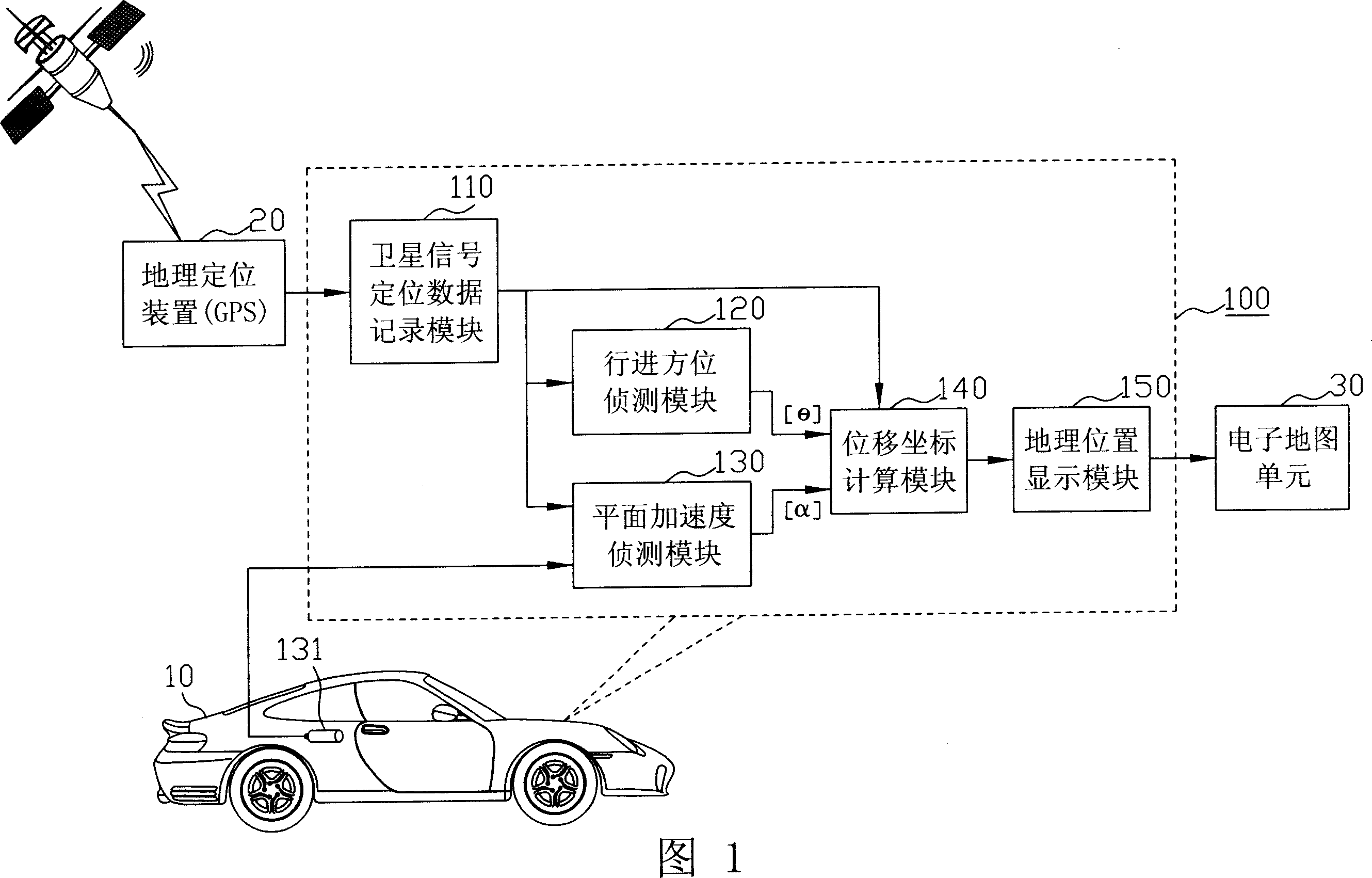
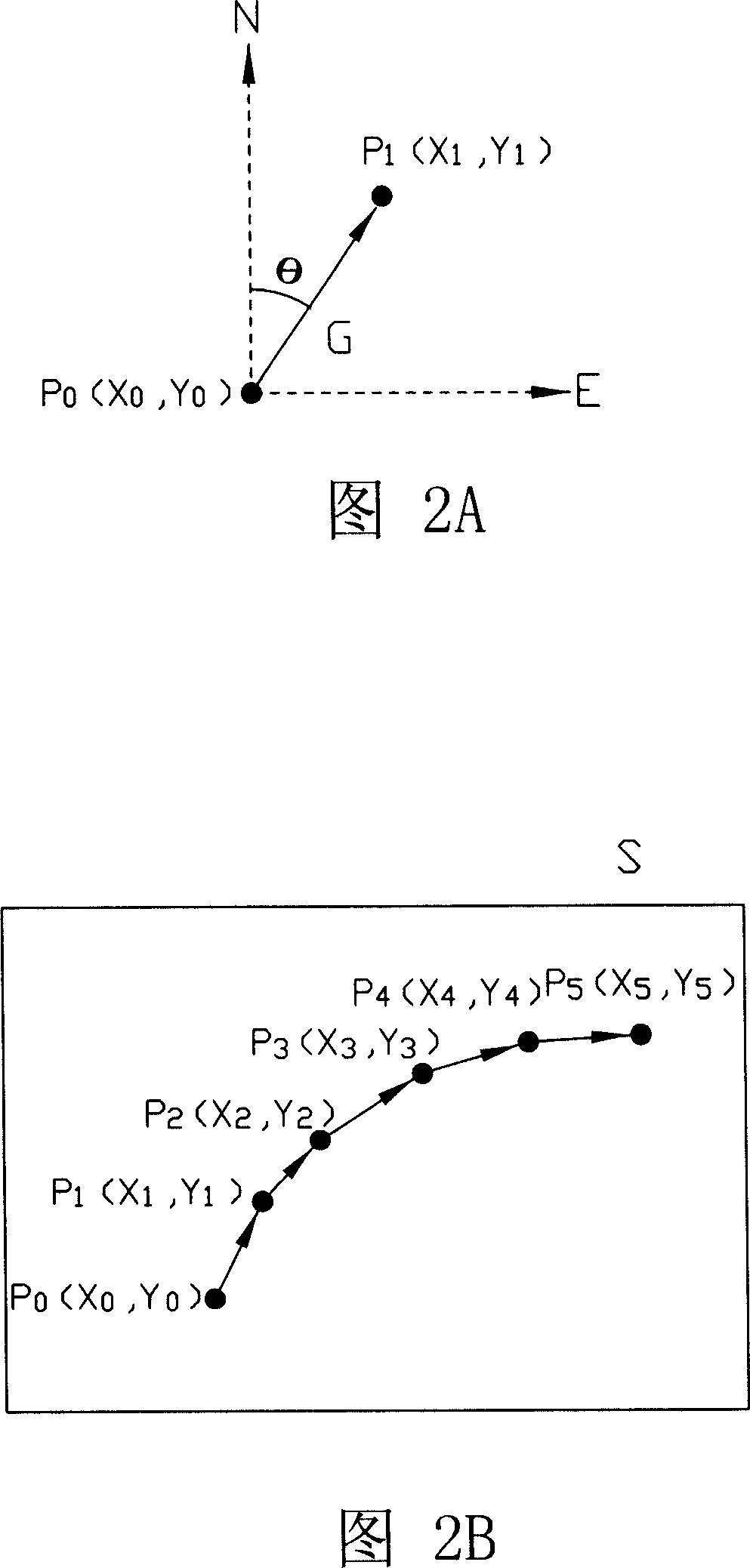
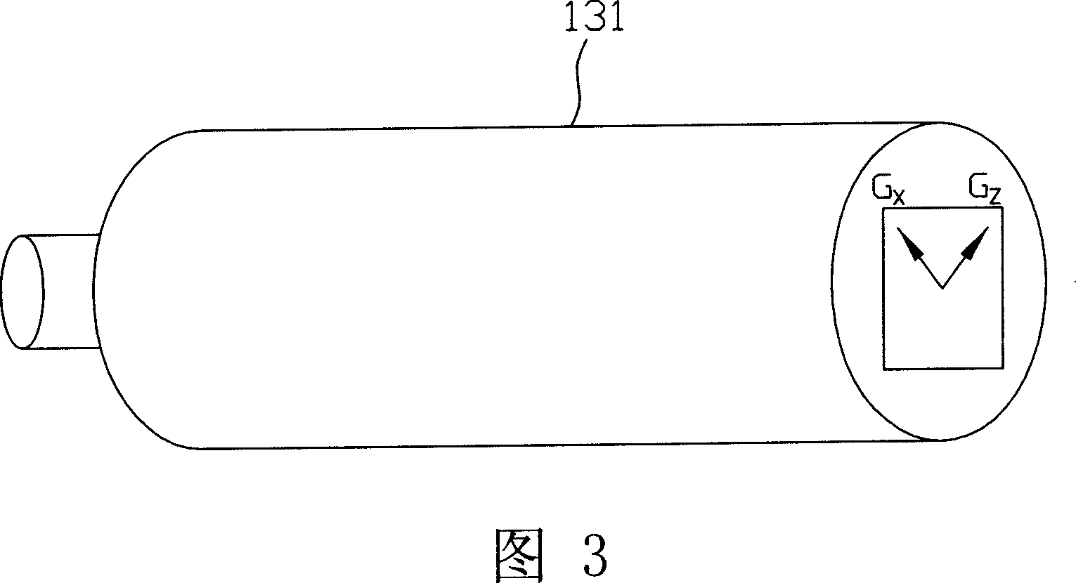
[0012] FIG. 1 shows the application mode and modular system architecture of the geolocation trajectory calculation system of the present invention (such as the part included in the dotted box indicated by the reference number 100 ). As shown in the figure, the geographic positioning trajectory calculation system 100 of the present invention is matched to a geographic positioning device 20 in practical applications, such as a global positioning system (Global Positioning System, GPS), and the GPS geographic positioning device 20 is installed In a moving vehicle, such as a vehicle 10 (that is, cars, trucks, buses, taxis, trains, military armored vehicles, etc.); geographic location.

[0013] Under normal usage conditions (that is, when the GPS geographic positioning device 20 can normally r...


PUM


Abstract

The invention discloses a geography orientation track calculating method and system which can be matched with a geography orientation device, for example, geography orientation device for GPS, and the geography orientation device is mounted on a moving carrier, such as vehicle, when it can not receive orientation satellite signal in a position, it can provide a geography orientation function for the vehicle; it can use a acceleration detector with two axes for output to resolve flat acceleration, and use mechanical gyroscope or digital electronic compass to resolve angle, it can use parameters to resolve geography position coordinate data in track calculating mode.

Description

technical field [0001] The present invention relates to a global positioning technology, in particular to a method and system for calculating a geographic positioning trajectory. Background technique [0002] Global Positioning System (Global Positioning System, GPS) is a kind of public global geographical positioning device, and it has also been widely used in various vehicles at present, for example, is long-distance passenger car, truck, private car, etc., It is used to allow users to use a portable electronic device, such as a palmtop computer, to view their current geographic location through an electronic map. Since the GPS geolocation device can immediately display the user's current geographic location on the electronic map, it has been widely integrated into various vehicles at present, so that users who go out by car can use the electronic map to find the location at any time. Understand its current geographic location, and find its destination with the help of an...

Claims


Application Information

Patent Timeline
Patent Type & Authority Applications(China)
IPC IPC(8): G01C21/20G01C21/26G01C21/28G01S5/14G01S19/50
Inventor 张哲甫
Owner MITAC COMP (SHUN DE) LTD
Why Eureka
Try Eureka