

Method for combining GIS system with split joint wall system and device thereof
A splicing wall and geographic information data technology, which is applied in the application field of GIS system, can solve the problems of inconvenient operation, low resolution of GIS terminal, and distant pixel spacing of display content, etc., and achieve small data transmission, high resolution and high resolution. , high definition effect
- Summary
- Abstract
- Description
- Claims
- Application Information
AI Technical Summary
Problems solved by technology
Method used
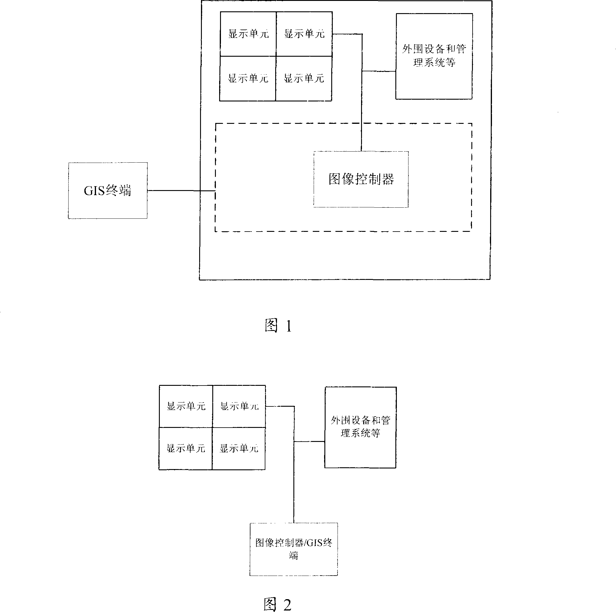
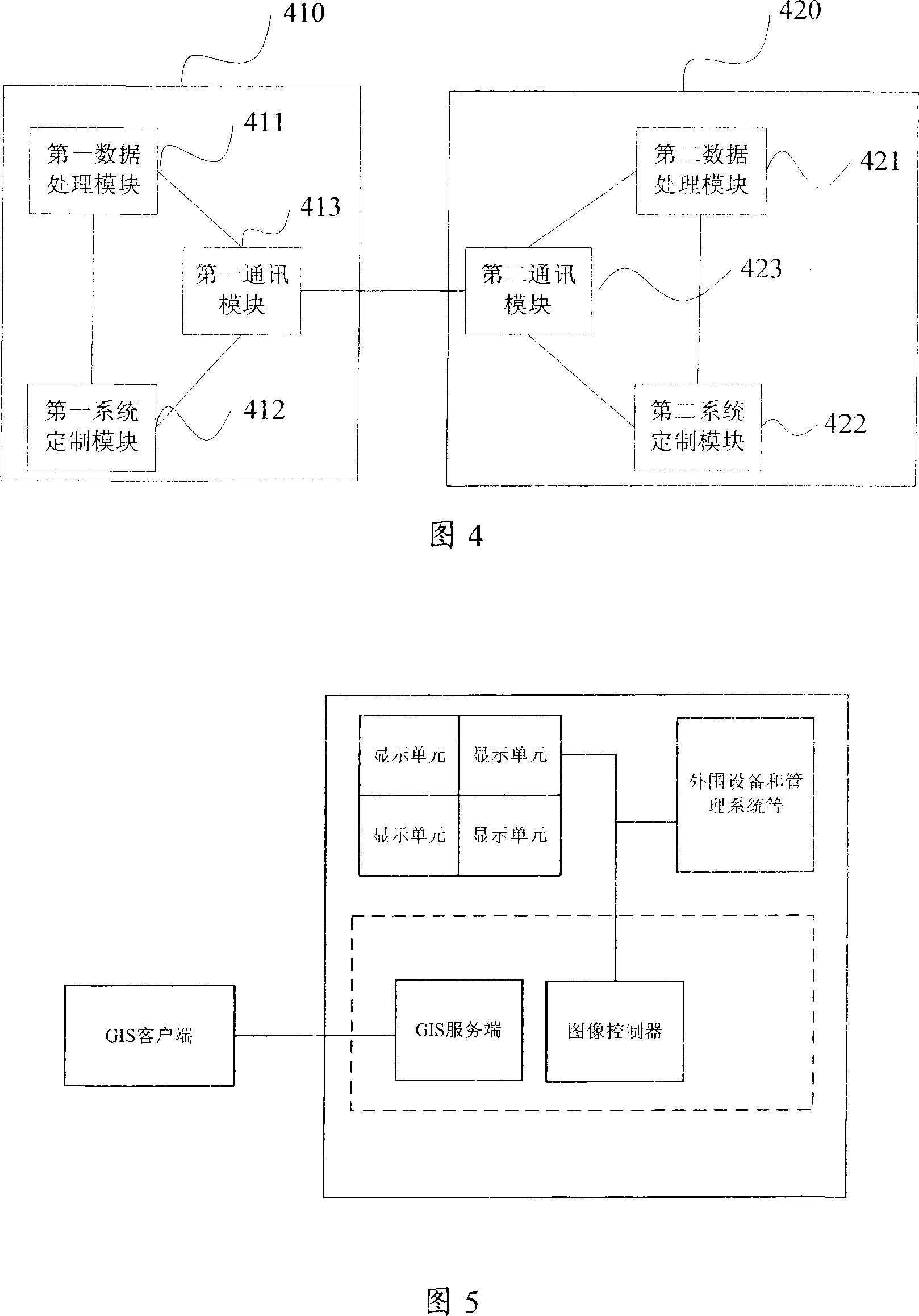
Image

Examples
Embodiment 1
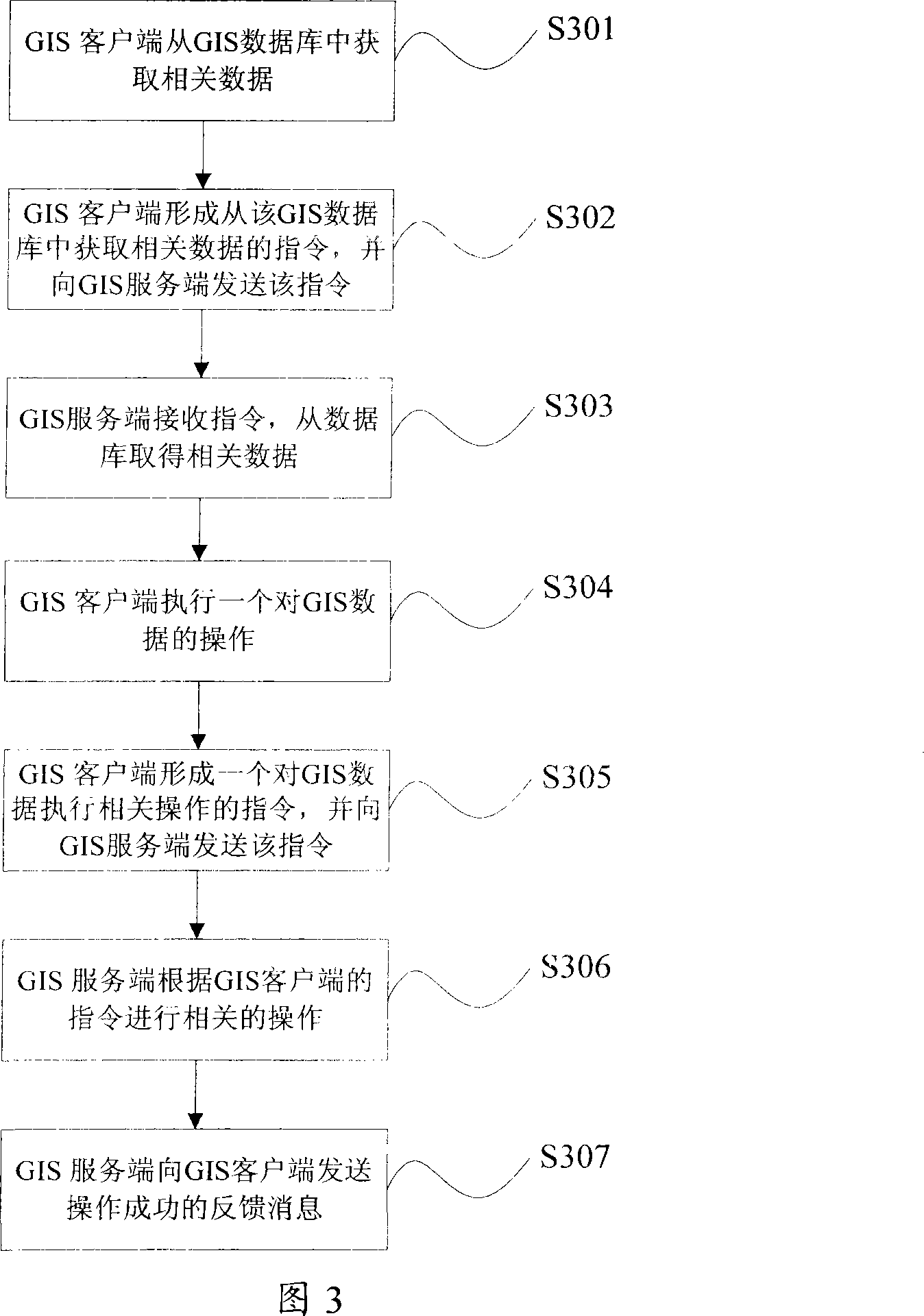
[0035] According to the first operation instruction input by the user through the keyboard or mouse, the GIS client performs a zoom-in operation on the geographic image currently displayed on the client. After the zoom-in operation is completed, the GIS client obtains the coordinate information of the zoomed-in geographic image data, And according to the first operation instruction to form a second operation instruction to perform the zoom-in operation, the second operation instruction may include the zoom-in ratio of the operation step and the geographical coordinate information of the geographical image after the zoom-in operation is completed, and then the GIS client The second operation instruction of the zoom-in operation is sent to the GIS server.
[0036] After the GIS server receives the second operation instruction sent by the above-mentioned GIS client, it analyzes the second operation instruction, obtains information such as the operation type and geographic coordina...
Embodiment 2
[0042] In this embodiment, when the GIS server receives the second operation instruction sent by the GIS client and parses the second operation instruction, the GIS server obtains the geographical coordinate information contained in the second operation instruction , that is, the geographical coordinate range information of the geographical information data after the image is enlarged, combined with the display screen size of the video wall, according to the expansion ratio currently input by the user or the predetermined expansion mode, the geographical coordinates contained in the second operation instruction The information is expanded, and the geographic information data within the expanded geographic coordinate range is displayed on the video wall, so that the geographic image displayed on the video wall screen includes the geographic image displayed by the GIS client, and is consistent with the geographic image displayed by the GIS client. The same portion of the displaye...
Embodiment 3
[0047] According to the first operation instruction input by the user through the keyboard or mouse, the GIS client performs zoom-in / zoom-out operations on the geographical image currently displayed on the client. The coordinate information of the geographic image data after the zoom-in / zoom-out operation of the GIS client, the size and resolution information of the display screen of the GIS client and the splicing wall, and the display position of the same content as the GIS client on the splicing wall are calculated. Finally, coordinate range information of the geographic information data displayed on the GIS server end, and generate a second operation instruction for performing the zoom-in / zoom operation, the second operation instruction includes the required data calculated by the GIS client. The range information of the geographic coordinates displayed on the GIS server, and sending the second operation instruction to the GIS server.
[0048] After the GIS server receives...
PUM
 Abstract
Description
Claims
Application Information