

Method for commercial scale vector map data gradual transmission and dynamic reconstruction
A vector map data, large-scale technology, applied in the field of spatial information
- Summary
- Abstract
- Description
- Claims
- Application Information
AI Technical Summary
Problems solved by technology
Method used
Image

Examples
Embodiment Construction
[0088] The present invention is a method for progressive transmission and dynamic reconstruction of large-scale vector map data, the process steps of which are as follows:
[0089] (1) Fast generation and reconstruction algorithm of multi-scale vector map data
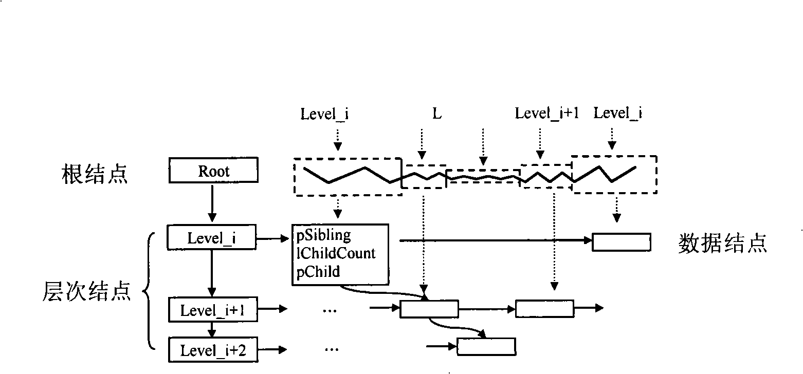
[0090] A multi-resolution curve tree is proposed to quickly construct a feature-based multi-scale vector map data model. The multi-resolution curve tree is a multi-fork tree, which consists of three types of nodes: root node, hierarchical node and data node. structured as figure 1 shown. Where Level_i represents the vector map data at the resolution of Leveli. pSibling points to the next curve segment at the same resolution. pChild and lChildCount respectively record the child nodes and their numbers of the current node in the next resolution level, which are used to establish the vertical index of the multi-resolution curve tree.
[0091] (1) When the client computer requests the data at the resolution of the i-t...
PUM
 Abstract
Description
Claims
Application Information