No-manned plane fixed radius convolved navigation method

A radius and aircraft technology, applied in the field of drone navigation, can solve problems such as difficult to obtain reconnaissance results

Inactive Publication Date: 2008-09-10
BEIHANG UNIV
View PDF0 Cites 18 Cited by
  • Summary
  • Abstract
  • Description
  • Claims
  • Application Information

AI Technical Summary

Problems solved by technology

Use the fixed roll angle deflection to make the aircraft circle around a certain circle center, but if it is disturbed by the crosswind during the circle, because the aircraft does not control its own position, the aircraft will not fly along the desired trajectory, so it is difficult to obtain accurate The reconnaissance results of

Method used


Image

  • No-manned plane fixed radius convolved navigation method
  • No-manned plane fixed radius convolved navigation method
  • No-manned plane fixed radius convolved navigation method

Examples


Embodiment Construction

[0040] The following is a further description of the UAV fixed-radius circle piloting method of the present invention in conjunction with the accompanying drawings.

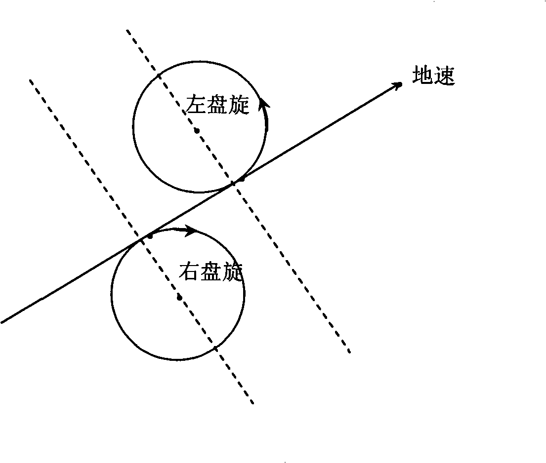
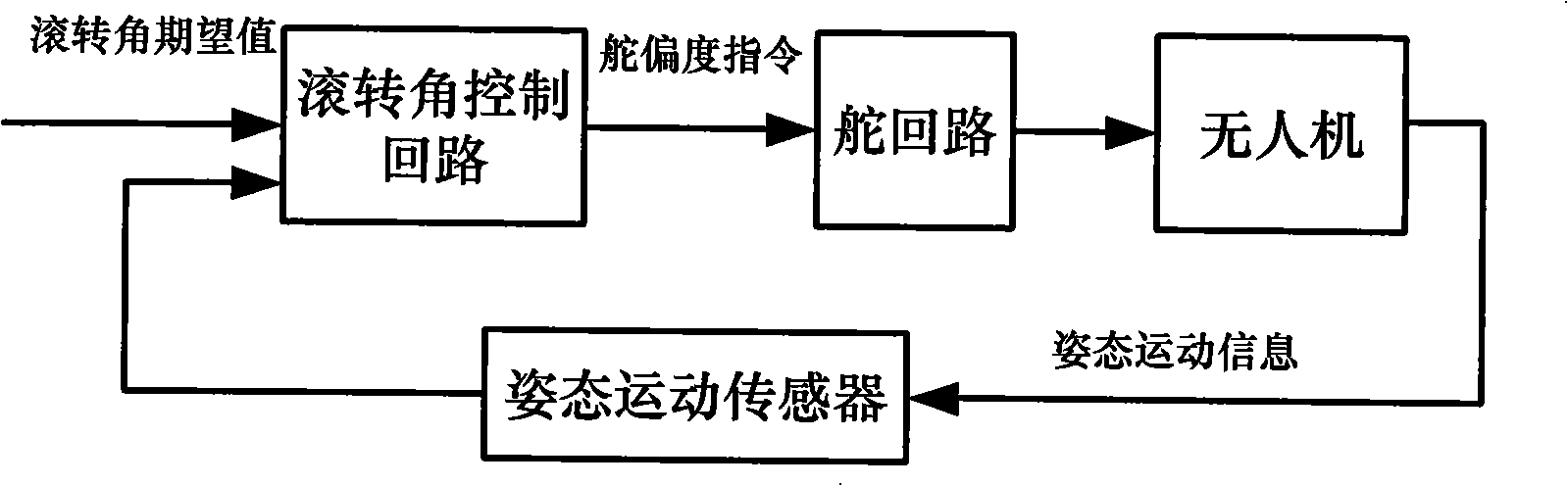
[0041] The working principle of the UAV fixed-radius hovering pilot method proposed by the present invention is as follows: Figure 4 As shown, the piloting method calculates the navigation parameters such as the lateral deviation and lateral deviation speed of the aircraft's expected trajectory continuously and in real time according to the predetermined circling radius, the desired circling mode, and the aircraft position, altitude and ground speed information obtained by the sensor. , and input the aircraft attitude motion information obtained by the attitude motion sensor to the lateral control loop to obtain the rudder deflection command, and finally guide the aircraft to fly along the desired route.

[0042] The hovering navigation method with fixed radius of the UAV of the present invention comprises the f...


PUM


Abstract

The invention discloses an unmanned aircraft fixed radius circling navigation method. The position and height of the aircraft and the ground speed information are gained according to the given circling radius, anticipant circling type and a sensor, the navigation parameters such as lateral deviation and lateral deviation velocity, etc., of the anticipant track of the aircraft continuously calculated in real time, together with the aircraft gesture motion information gained by a gesture motion sensor, are input into a lateral control circuit to obtain a rudder deflection instruction, and the aircraft is finally guided to fly along the anticipant flight course. The navigation method provided by the invention can realize guiding the aircraft to carry out the cycling flying with fixed radius and avoids the frequent shifting of straight flying and turning motion in the broken-line flying process; the aircraft body bears small overload, and can fly according to the anticipant track under the situation of wind interference.

Description

technical field [0001] The invention belongs to the field of unmanned aerial vehicle navigation, and specifically refers to an unmanned aerial vehicle fixed-radius hovering pilot technology. Background technique [0002] Because it is rarely restricted by weather conditions, it can sneak into the sky over enemy targets for day and night reconnaissance, and accurately transmit real-time target images and information to the combat command center, so that battlefield commanders can grasp the battlefield situation in time and formulate combat plans. It has gradually demonstrated its great power in local wars. [0003] The basic task of UAV navigation is to accurately determine the spatial position of the aircraft and enable it to fly along the desired trajectory. The current area navigation method can allow the aircraft to fly any desired flight path within the coverage area of ​​the reference station of the station-based navigation equipment or within the limited range of the ...

Claims


Application Information

Patent Timeline
Patent Type & Authority Applications(China)
IPC IPC(8): G01C21/20G01C21/00
Inventor 王养柱崔中兴方晓星田波王瑛
Owner BEIHANG UNIV
Why Eureka
Try Eureka