Navigation positioning method

A technology for navigation and positioning and navigation information, which is applied in the field of digital information transmission and can solve the problems of inability to complete ranging and navigation and positioning functions, and inability to distinguish received signals.

Inactive Publication Date: 2009-01-14
TSINGHUA UNIV
View PDF0 Cites 20 Cited by
  • Summary
  • Abstract
  • Description
  • Claims
  • Application Information

AI Technical Summary

Problems solved by technology

In the single frequency network, the signals of each transmitting station are kept strictly synchronized, so it is impossible to distinguish which transmitting station the received signal is transmitted from, and thus it is impossible to complete the ranging and navigation and positioning functions

Method used


Image

  • Navigation positioning method
  • Navigation positioning method
  • Navigation positioning method

Examples


Embodiment Construction

[0025] The specific implementation manners of the present invention will be further described in detail below in conjunction with the accompanying drawings and embodiments. The following examples are used to illustrate the present invention, but are not intended to limit the scope of the present invention.

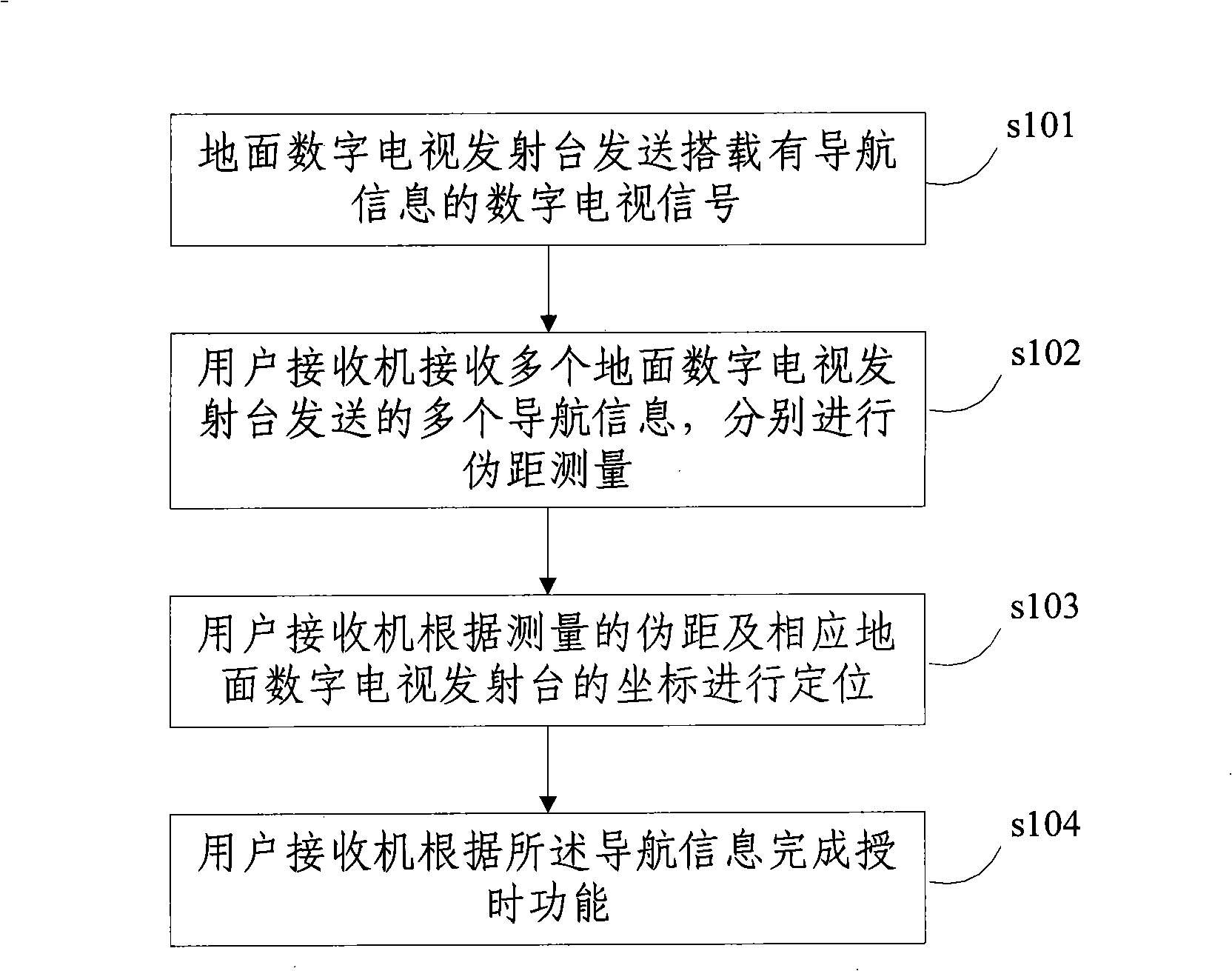
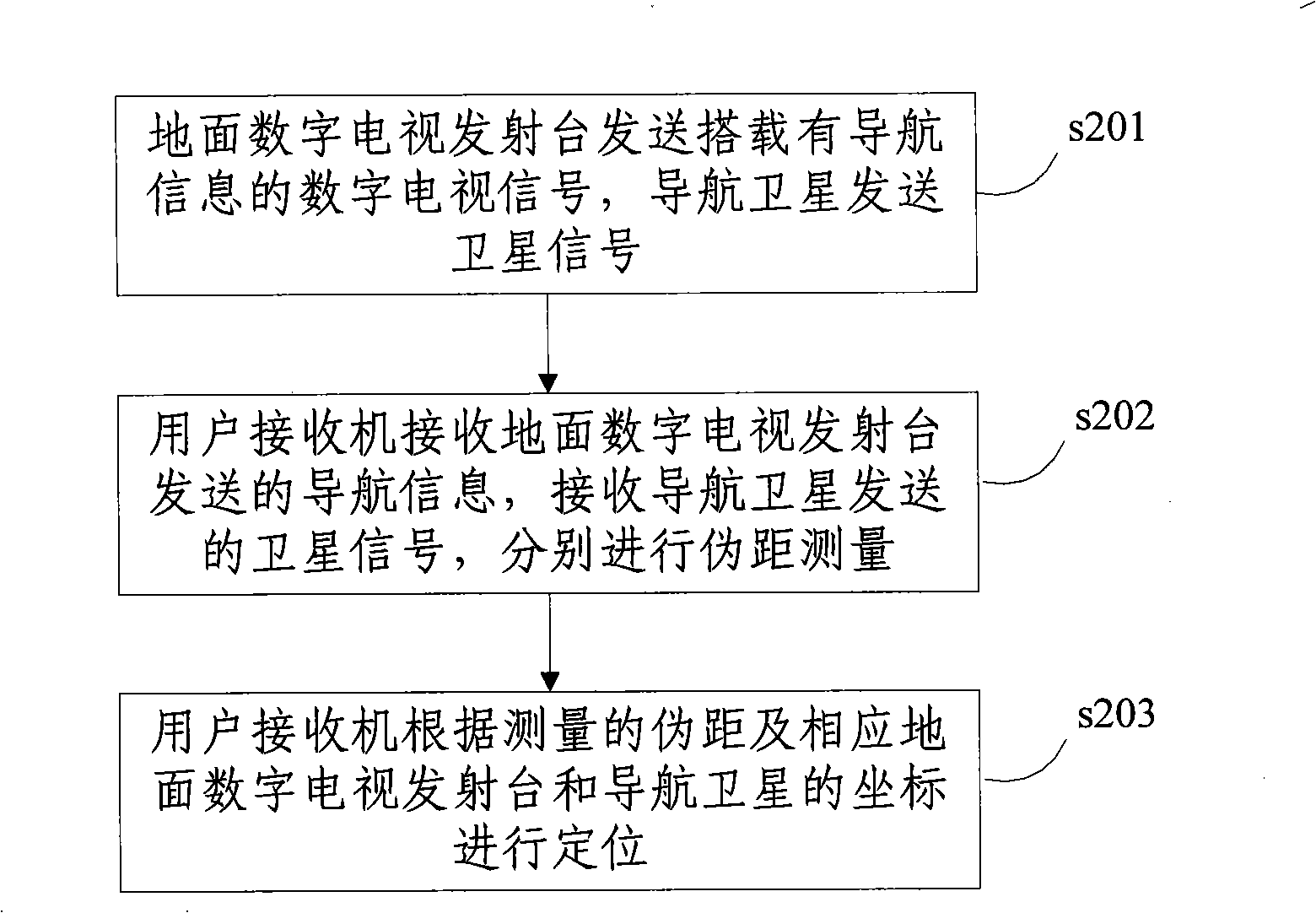
[0026] The flow of a navigation and positioning method in an embodiment of the present invention is as follows: figure 1 shown, including the following steps:

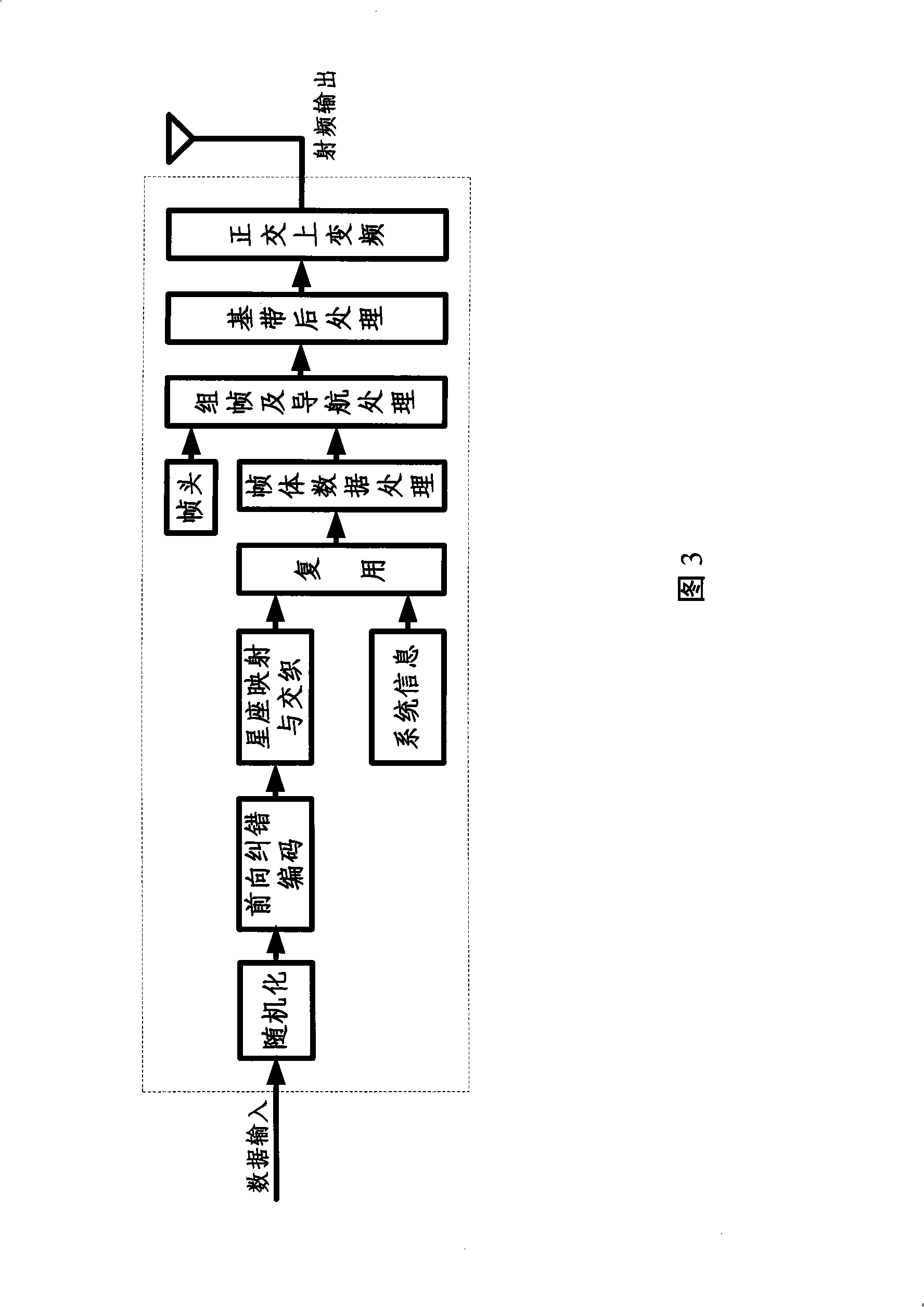
[0027] In step s101, the terrestrial digital TV transmitting station sends a digital TV signal carrying navigation information. The loading position of the navigation information is located at the frame head, frame body or the whole frame of the terrestrial digital TV signal frame, and its information transmission method is selected to be sent in turn or broadcast according to whether the content transmitted by each transmitting station is the same, and the navigation information frame and digital The TV signal f...


PUM


Abstract

The invention discloses a navigation locating method, including the following steps: a digital terrestrial television launcher sends out digital television signals carrying navigation information; a user receiver receives a plurality pieces of navigation information sent by a plurality of digital terrestrial television launchers for pseudo-range measurement one by one; the user receiver carries out location according to the measured pseudo range and the corresponding digital terrestrial television launcher. The invention also discloses a combination locating method adopting the digital television signals and navigation satellite signals. The invention adopts the digital terrestrial television launcher to realize the navigation locating function independently or adopts both the digital terrestrial television launcher and a navigation satellite to realize the navigation locating function together in virtue of the digital terrestrial television broadcast standard signals carrying the navigation locating signals, which can resist stronger interruptions and even can complete the navigation locating function successfully indoors or when the satellite signal is shielded.

Description

technical field [0001] The invention relates to the technical field of digital information transmission, in particular to a method for completing navigation and positioning by using terrestrial digital television signals. Background technique [0002] The most commonly used navigation and positioning method today is to utilize the GPS (GlobePosition-finding System, Global Navigation and Positioning System) developed by the United States for positioning. The system consists of space segment, control segment and user segment. The space segment is the satellite constellation. The basic configuration consists of 24 satellites, located in 6 orbital planes, with 4 satellites in each plane. The task of the control segment is to maintain the satellite and maintain its normal function, including keeping the satellite in the correct orbital position and monitoring the health and status of the satellite subsystem. The user section is composed of user receiving equipment, which is use...

Claims


Application Information

Patent Timeline
Patent Type & Authority Applications(China)
IPC IPC(8): G01S5/02G01S5/14H04N5/38H04N7/08G01S19/42
Inventor 张彧万晓峰杨知行潘长勇王劲涛
Owner TSINGHUA UNIV
Why Eureka
Try Eureka