

Water traffic risk evaluation and prediction method based on geographic information system
A geographic information system and risk assessment technology, applied in the field of water traffic risk assessment and prediction based on geographic information systems, can solve the problems of inability to predict water traffic risks, inability to intuitively reflect regional risk differences, and difficulty, and achieve good results. Navigation environment and navigation order, strengthening practical significance and guiding significance, and realizing the effect of resource allocation
- Summary
- Abstract
- Description
- Claims
- Application Information
AI Technical Summary
Problems solved by technology
Method used
Image

Examples
Embodiment Construction
[0021] The present invention will be further described in detail below in conjunction with the accompanying drawings and embodiments.
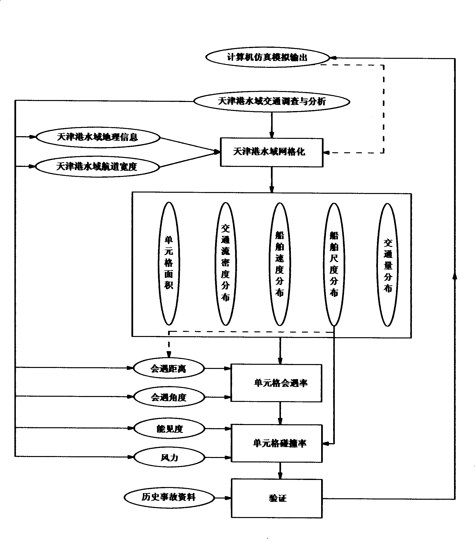
[0022] The present invention determines the characteristic factors of traffic accidents in the water area of Tianjin Port through detailed statistics and analysis of the historical data of water traffic accidents and ship traffic in Tianjin Port in recent years, and proposes a risk assessment method based on grid units, which can analyze the collision and accident of ships in the water area of Tianjin Port. The geographical distribution of stranding risks is studied. The specific implementation steps are as follows:
[0023] Establish ship collision risk assessment and prediction model:
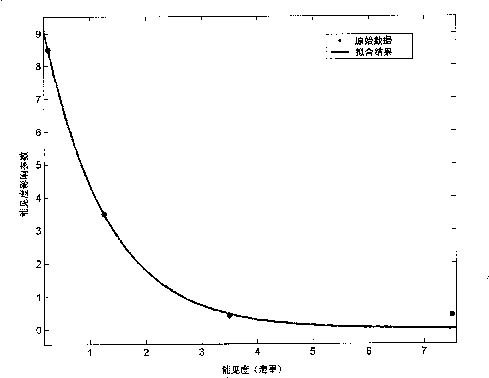
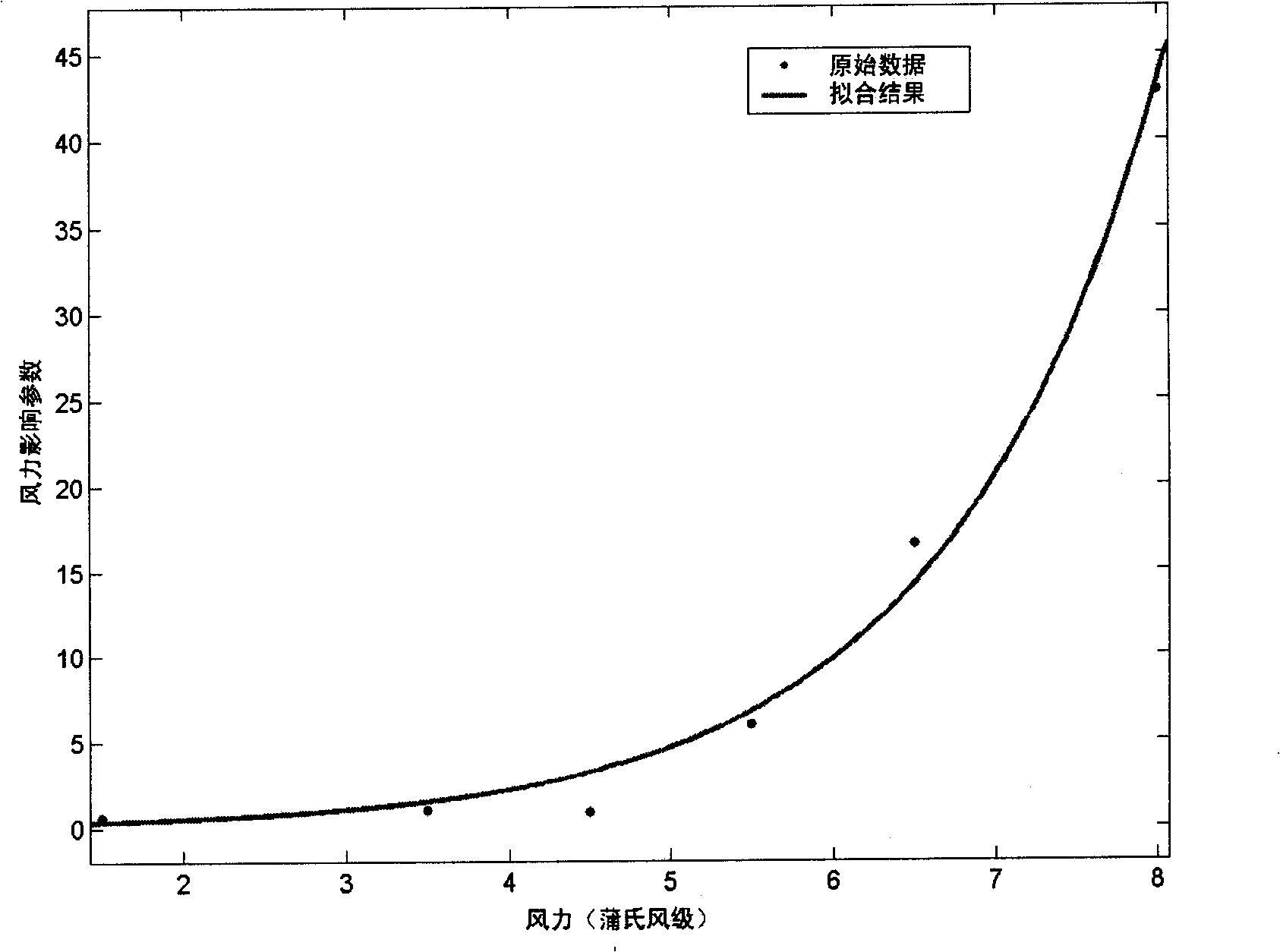
[0024]Step 1: Obtain ship type distribution, scale distribution, speed distribution, encounter distance (different ship scales), traffic volume distribution, and traffic flow density in the research waters by means of traffic survey, historical data coll...
PUM
 Abstract
Description
Claims
Application Information