Geometrical shape difference detection method and device for electronic map

A difference detection and geometric shape technology, applied in the field of electronic surveying and mapping, can solve the problems of low efficiency of processing methods, time-consuming spatial indexing, and cumbersome processing, so as to reduce the possibility of missed judgments, simplify the number of comparison operations, and improve efficiency.

Active Publication Date: 2009-04-08
NAVINFO
View PDF0 Cites 3 Cited by
  • Summary
  • Abstract
  • Description
  • Claims
  • Application Information

AI Technical Summary

Problems solved by technology

[0007] The disadvantage of method 1 is that the processing method from raster image to vector data is inefficient and has errors, while the disadvantage of method 2 is that the establishment of spatial index is very time-consuming, and it is cumbersome and inefficient to deal with some special situations on the road

Method used


Image

  • Geometrical shape difference detection method and device for electronic map
  • Geometrical shape difference detection method and device for electronic map
  • Geometrical shape difference detection method and device for electronic map

Examples


Embodiment Construction

[0052] Before the detailed description of the method and device for detecting the geometric shape difference of the electronic map of the embodiment of the present invention, some concepts involved in the embodiment of the present invention will be described first, so as to facilitate a better understanding of the embodiment of the present invention.

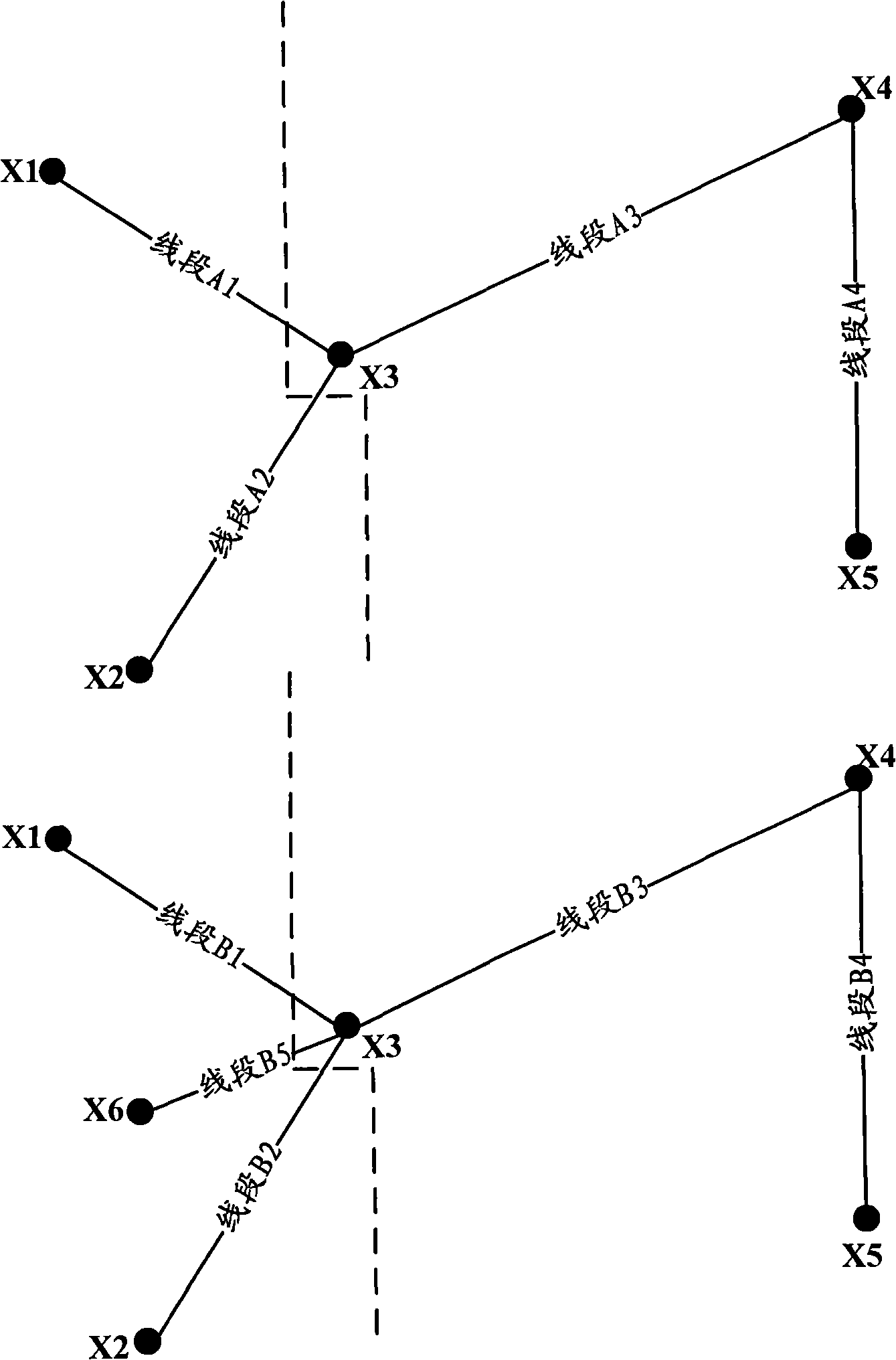
[0053] Line segment, used to represent the road on the electronic map, with direction;

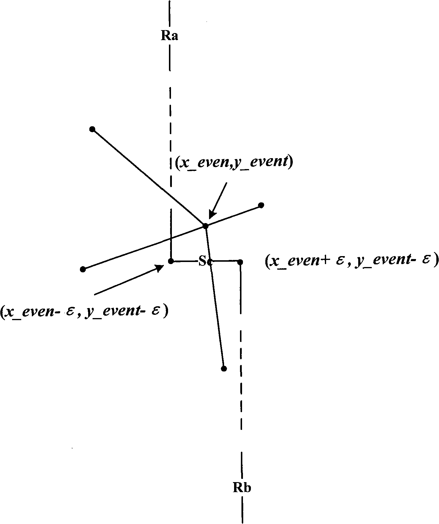
[0054] The event point, described by coordinates (x, y), is used to represent the end point or internal point of the line segment of the road on the electronic map;

[0055] The size of the event point is determined according to the coordinates of the event point. For example, the size of the event point can be limited by the following rules:

[0056] Suppose the coordinates of event point 1 and event point 2 are (x1, y1) and (x2, y2) respectively, if x1 is smaller than x2, it means that event point 1 is smaller than event point 2, if x1 is ...


PUM


Abstract

The invention provides a geometric shape difference detection method and a device of electronic maps, which is used for the geometric shape difference detection of at least two electronic maps. In the method, each event spot is regarded as the current event spot, and the following operating steps are executed: a segment related to the current event spot is selected to form a first segment concourse from all the segments of the two electronic maps; a segment from the first segment concourse is selected to taken as the current segment; the current segment and the second segment concourse are compared to obtain a compared result, the segments of the first segment concourse except the current segment form the second segment concourse, and when the compared result shows no superposition segment is existed between the second segment concourse and the current segment, the current segment is estimated to be a difference segment. The invention reduces the geometric shape difference detection errors of the electronic maps, and the measuring efficiency is improved.

Description

technical field [0001] The invention relates to the technical field of electronic surveying and mapping, in particular to a method and device for detecting geometric shape differences of electronic maps. Background technique [0002] With the accumulation of road data collection results year by year, it is often necessary to compare road vector data of different years to find the changes among them. [0003] The current solutions to this problem are mainly summarized as the following methods: [0004] The first method is to use the remote sensing raster data of different years in the same area to calculate the difference between pixels, and connect the result with the existing road vector data to find the geometric changes on the road. [0005] The second method is to use a road vector map as the background and establish a spatial index, use a certain road in other years to query using the spatial index, and compare the query results with this road one by one to find the di...

Claims


Application Information

Patent Timeline
Patent Type & Authority Applications(China)
IPC IPC(8): G01B11/24G09B29/00
Inventor 张韵曹晓航
Owner NAVINFO
Why Eureka
Try Eureka