Outdoor blind guidance service system and method oriented to blind disturbance people
A service system and outdoor technology, applied in the field of urban outdoor blind guide service system, can solve problems such as single service form, lack of data support data integration, blind guide problems, etc., to achieve huge promotion potential, convenient use, and convenient interaction Effect
- Summary
- Abstract
- Description
- Claims
- Application Information
AI Technical Summary
Problems solved by technology
Method used
Image
Examples
Embodiment 1
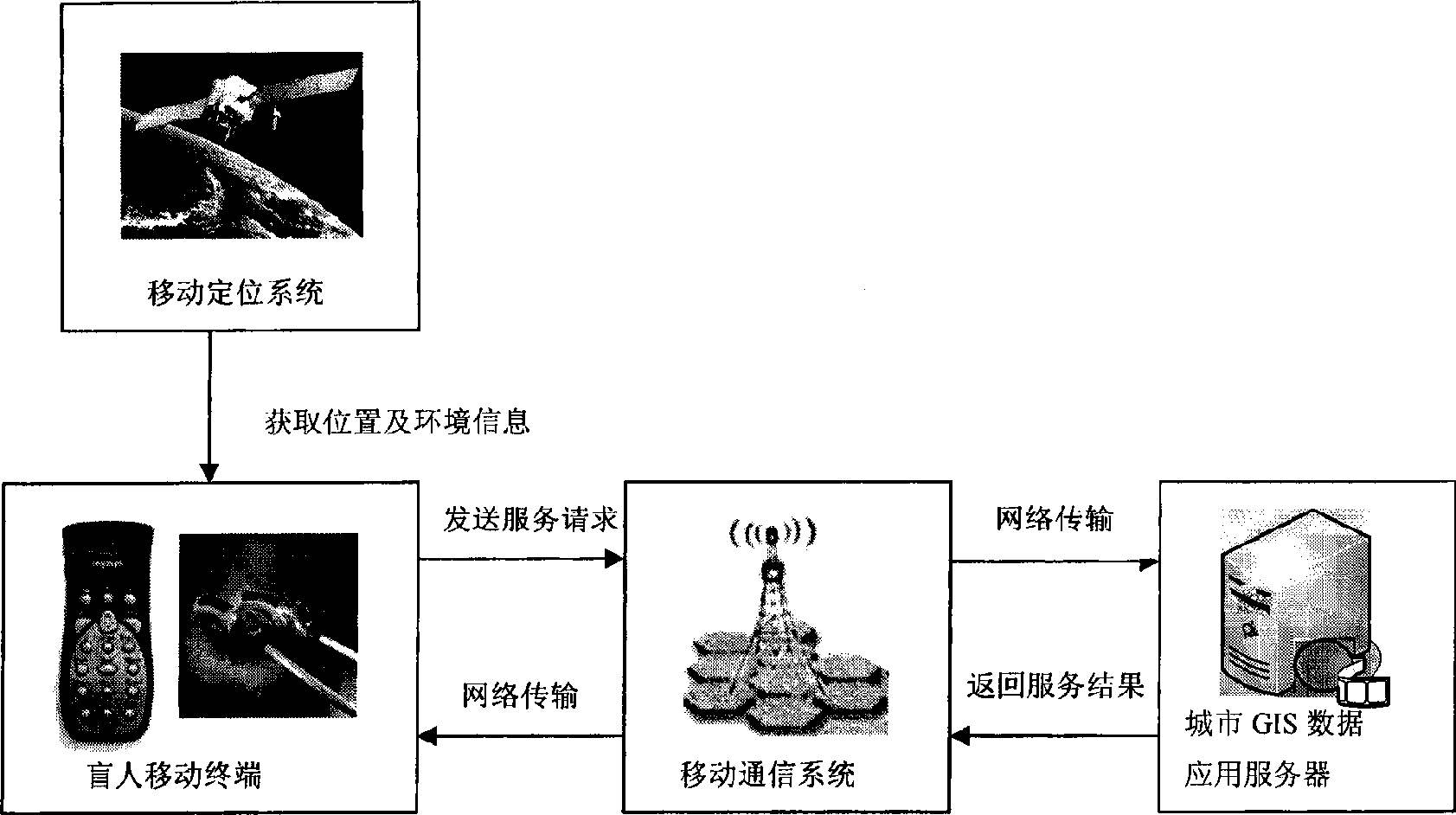
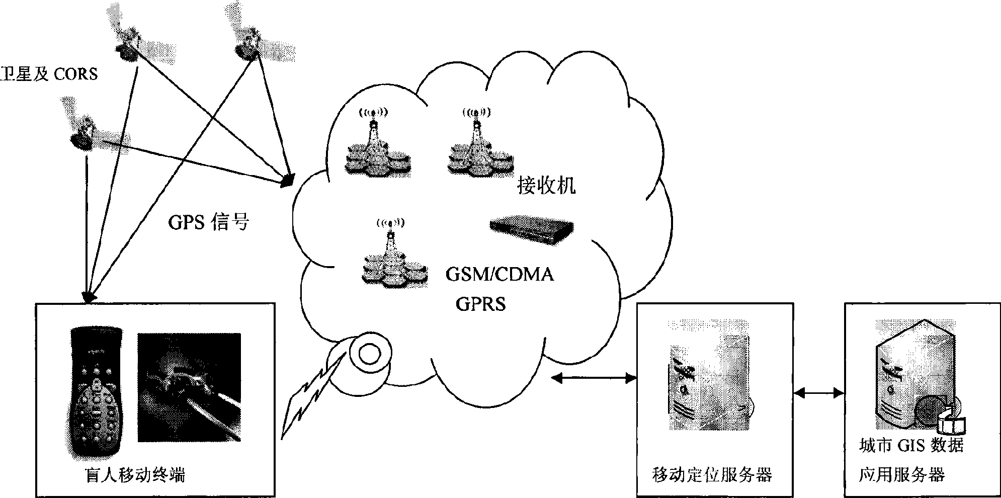
[0044] Such as figure 1 and figure 2 As shown, the outdoor guide service system for visually impaired people includes handheld mobile terminals, mobile communication systems, mobile positioning systems (GPS, CORS), blind obstacle detection equipment and walking sticks, and urban GIS data application servers.
[0045] Handheld mobile terminal: use special voice interaction equipment for the blind, such as a special PDA for the blind, such as a special mobile phone for the blind.
[0046] Blind obstacle detection equipment and cane: including special blind obstacle detection radar and blind cane, to realize the detection and identification of the user's surrounding environment.
[0047] Mobile communication system: including GSM or CDMA or GPR wireless communication system and mobile communication server, which is the link between mobile terminal and urban GIS database server; it is used to transmit the environmental information and personal needs of users during travel to the...
Embodiment 2
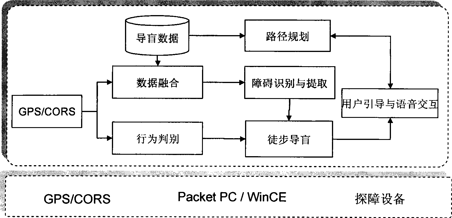
[0057] Based on the above system, the method of urban outdoor blind guide serving users' travel path planning is as follows:
[0058] Before traveling, the user submits a travel request to the mobile positioning server, and the mobile positioning server sends the starting point and destination to the GIS data server. The process of this service method is as follows: Figure 6 . The specific steps are as follows:
[0059] 1. Start the client software;
[0060] 2. The mobile terminal obtains the current location through the mobile positioning system, obtains the multimedia data of the location according to the location information, and provides it to the user in the form of voice at any time;
[0061] 3. Obstacle detection radar and cane will return the collected obstacles and environmental information around the user's location to the server through the mobile communication network; after the server confirms the information, it will send a message to the user in the form of v...
Embodiment 3
[0067] Based on the above system, the method of urban outdoor blind guide serving real-time fine guide is as follows:
[0068] During the travel process, the user submits a service request to the GIS data server according to the location and the surrounding information. The service process is as follows: Figure 7 . The specific steps are as follows:
[0069] 1. Start the client software;
[0070] 2. The mobile terminal obtains the current location through the mobile positioning system, obtains the multimedia data of the location according to the location information, and provides it to the user in the form of voice at any time.
[0071] 3. The obstacles and environmental information collected by the obstacle detection radar and cane will be returned to the city GIS data server through the mobile communication network. After the city GIS data server confirms the information, it will send a message to the user in the form of voice.
PUM
 Abstract
Description
Claims
Application Information
 - R&D
- Intellectual Property
- Life Sciences
- Materials
- Tech Scout
- Unparalleled Data Quality
- Higher Quality Content
- 60% Fewer Hallucinations
Browse by: Latest US Patents, China's latest patents, Technical Efficacy Thesaurus, Application Domain, Technology Topic, Popular Technical Reports.
© 2025 PatSnap. All rights reserved.Legal|Privacy policy|Modern Slavery Act Transparency Statement|Sitemap|About US| Contact US: help@patsnap.com


