Map image thinning and linear tracking method based on bit arithmetic

A map image, bit operation technology, applied in the directions of map/plan/chart, image coding, image data processing, etc., can solve the problems of large editing workload, low semi-automation, and many manual interventions, and achieve high vectorization accuracy, Fast operation speed and wide range of effects

Inactive Publication Date: 2009-09-02
INST OF GEOGRAPHICAL SCI & NATURAL RESOURCE RES CAS +2
View PDF0 Cites 3 Cited by
  • Summary
  • Abstract
  • Description
  • Claims
  • Application Information

AI Technical Summary

Problems solved by technology

In the topographic map vectorization system that has been launched so far, there are still many problems to be solved urgently, mainly manifested in the low degree of semi-automaticity, cumbersome operation, too much manual inter

Method used


Image

  • Map image thinning and linear tracking method based on bit arithmetic
  • Map image thinning and linear tracking method based on bit arithmetic
  • Map image thinning and linear tracking method based on bit arithmetic

Examples


Embodiment Construction

[0036] The technical solutions of the present invention will be further described below in conjunction with the accompanying drawings and embodiments.

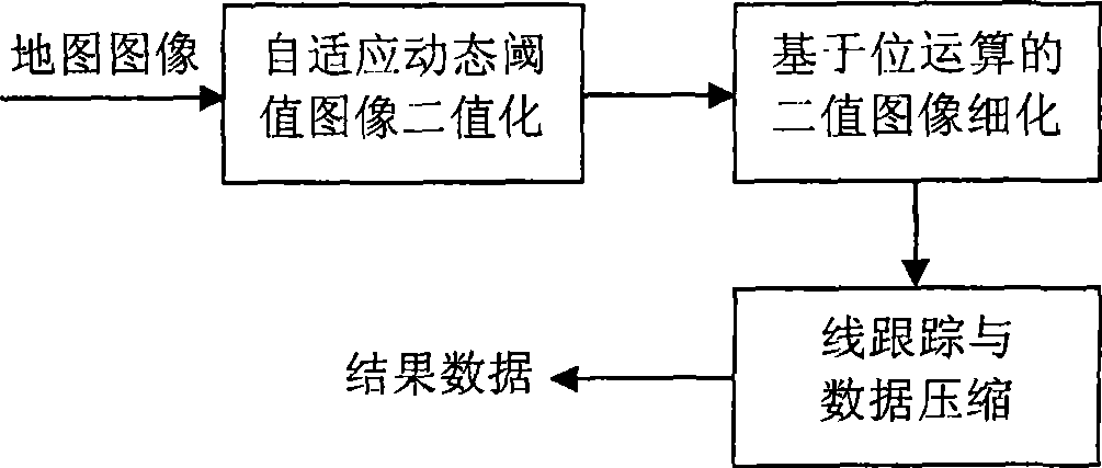
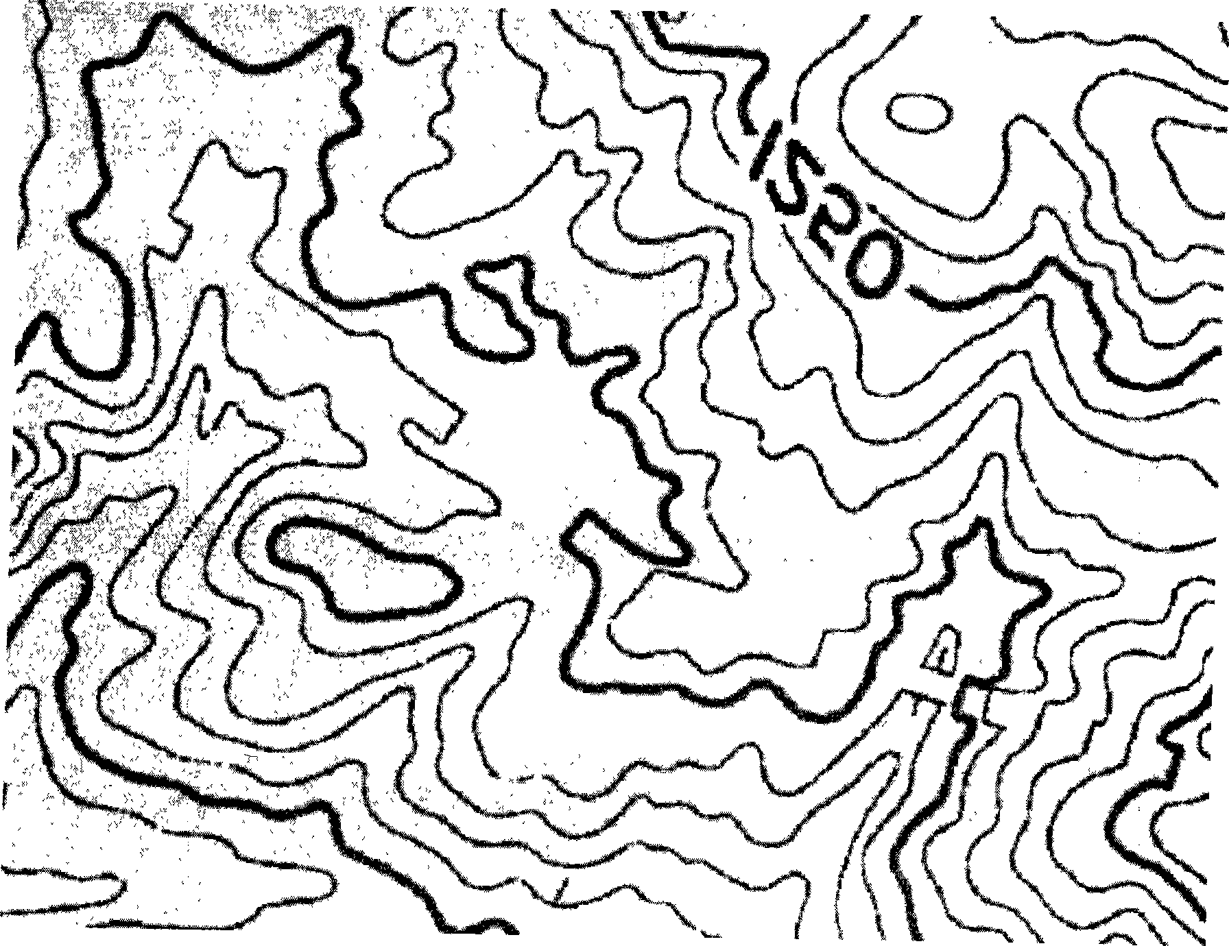
[0037] In this embodiment, local images such as image 3 The original image shown is taken as an example, the map image thinning and line tracing of its bit operation; the schematic flow chart of the method is as follows figure 1 As shown, it specifically includes the following steps:

[0038] 1. Using the adaptive dynamic threshold based on curve detection technology for map image binarization method, the original map scan image is binarized.

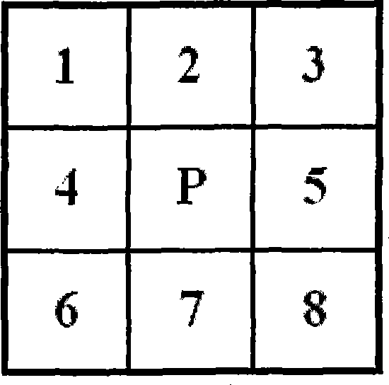
[0039] The adaptive binarization method based on the curve detection technology is to judge whether the center point of the window is a point on the curve in a 5×5 window. In the practical method, using semi-linear operators to consider the curve segment with a length of 3 pixels, 18 possible situations can be induced. The curve detection operator is defined as follows:

[0040] BS...


PUM


Abstract

The invention relates to a map image thinning and linear tracking method based on bit arithmetic, belonging to the field of geographic information identification and extraction. The method comprises the following steps: A, adopting a method based on adaptive thresholds to carry out the binarization treatment of map images; B, adopting a full eight-neighborhood connecting thinning algorithm based on the bit arithmetic to carry out the thinning treatment of the binary map images; and C, finally, sequentially carrying out linear tracking and data compression (removing redundant points) on the binary map images after the thinning treatment and storing result data. The new high-efficiency map image thinning and linear tracking method based on the bit arithmetic can be widely applied to the fields, such as the identification and the vector quantization of line symbols of the scanned map images, and the like.

Description

technical field [0001] The invention belongs to the field of geographic information identification and extraction, and relates to a map scanning image refinement and line tracking method based on bit operations. Background technique [0002] With the development of technology, people's requirements for maps have further increased. Due to the low efficiency, speed and accuracy of traditional paper maps, it is difficult to adapt to modern and future technological developments. The disadvantages of the analog expression carrier of geographic information (such as paper maps) are mainly as follows: ①The number of maps is very large, which makes its preservation, management and use very inconvenient; ②It is not conducive to the rapid update of geographic information; ③It is not conducive to geographic Rapid transmission of information; ④In practical applications, people need geographic information, which is difficult to meet the needs of high-level operations such as various spat...

Claims


Application Information

Patent Timeline
IPC IPC(8): G06T9/00G06K9/00G09B29/00
Inventor 陈荣国周成虎卢战伟张明波程昌秀谢炯颜勋陈应东赵彦庆冯登国徐震张敏陈驰景宁熊伟陈宏盛
Owner INST OF GEOGRAPHICAL SCI & NATURAL RESOURCE RES CAS
Why Eureka
Try Eureka