Taxi driving range metering method based on GPS and electronic geographic information

A technology of geographical information and geographical location information, which is applied in the field of taxi meters, can solve the problems of uncertainty and achieve the effect of accurate measurement and high repeatability

Inactive Publication Date: 2009-10-14
XIAN XINWEI INFORMATION TECH
View PDF0 Cites 12 Cited by
  • Summary
  • Abstract
  • Description
  • Claims
  • Application Information

AI Technical Summary

Problems solved by technology

Secondly, the long-term wear and tear of the wheels will also produce pricing results that exceed the actual mileage
[0003] Not only that, but an unchangeable problem of existing taximeters is how many roads and their mile

Method used


Image

  • Taxi driving range metering method based on GPS and electronic geographic information
  • Taxi driving range metering method based on GPS and electronic geographic information
  • Taxi driving range metering method based on GPS and electronic geographic information

Examples


Embodiment 1

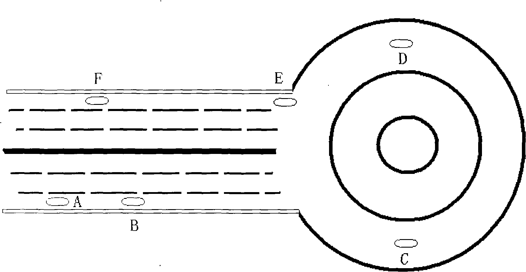
[0022] When a taxi equipped with such a taxi meter is driving in figure 1 On the graph line, after starting to drive from point A, the processor continuously detects the GPS geographic information of the taxi departure point A and the GPS geographic information of each point of the taxi driving process path, such as B, C, D, E, All geographic location information on the taxi travel route is stored in storage unit 12 in advance, and these geographic location information include surveying and mapping by GPS and surveying and mapping device in advance, find out actual driving by the geographic information given by current GPS by geographic location information The route name and the title of important point can calculate the actual mileage of each point of the driving process path such as B, C, D, E by the geographic location information in the memory 12. Due to the influence of the GPS measurement accuracy we use (the poor accuracy is about 10 meters), relying entirely on GPS to...

Embodiment 2

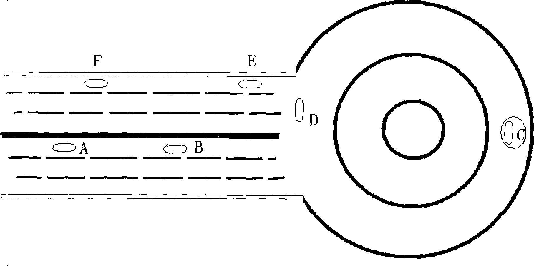
[0024] Of course, due to the influence of GPS measurement accuracy, in figure 2 Under the situation of the situation, the U-turn of the taxi at the crossing will also affect the measurement of the actual mileage result. In this case, the processor 7 can also be used by the route as long as the geographic location information storehouse of the taxi route track and memory 12 is stored. The trajectory is converted to the actual mileage information.

Embodiment 3

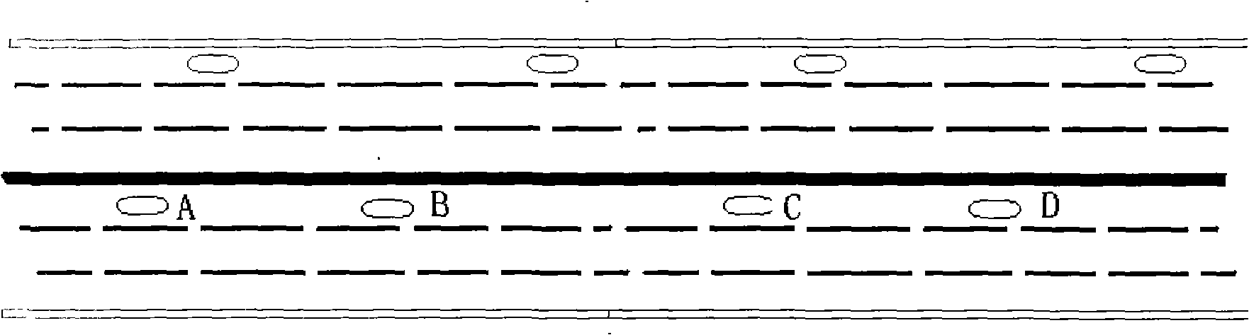
[0026] figure 1 and figure 2 Most of the cases in the city appear. However, when the condition of the line is good and the accuracy of GPS measurement is improved (such as after the application of the Beidou system developed by our country), the cumulative calculation is carried out completely relying on GPS geographic information, and all driving routes can be counted with the geographic location information. Such as image 3 As shown, if the road is straight on the high-speed driving route, it is completely possible to use GPS geographic information to continuously accumulate and calculate.

[0027] Figure 4 It is a current state display 4 of the display 1 that the present invention can provide different driving routes 2 for passengers to reach the destination before the taxi 3 travels. After the passenger arrives at the destination given by the input unit 11 such as the touch screen circuit or the voice recognition circuit, the display 1 shows that there can be two li...


PUM


Abstract

The invention relates to a taximeter, in particular to a taxi driving range metering method based on GPS and electronic geographic information, which is characterized in that: by continuously detecting GPS geographic information of a starting place of the taxi and the current GPS geographic information of the taxi, a driving range result and a valuation result are calculated and adjusted on a display according to geographic position information stored by a storage unit; and when the taxi arrives at a destination, a processor can control a printer to output the GPS geographic information of the starting place and the current GPS geographic information, and provides the final driving range result and valuation result after calculation and adjustment. The method has the advantages of accurate metering and being capable of determining the driving range of a plurality of roads between the starting place and the destination in advance.

Description

technical field [0001] The invention relates to a taxi meter, in particular to a taxi meter method based on GPS and electronic geographic information. Background technique [0002] Existing taximeters all utilize sensors to detect wheel speeds, and processors perform mileage calculations to finally provide pricing results. The detection of the wheel speed by the sensor is to give an electric pulse when the wheel rotates one circle, and then convert the speed from the circumference of the wheel. If the wheels are determined to be constant, the speed given is theoretically very accurate. However, taximeters are uniformly calibrated when installed, and then run without detection. Therefore, by changing the wheel size, it is very easy to give a price that is greater than the actual mileage. Secondly, the long-term wear of the wheels will also produce pricing results that exceed the actual mileage. [0003] Not only that, but an unchangeable problem of existing taximeters is ...

Claims


Application Information

Patent Timeline
IPC IPC(8): G07B13/00G07B13/02G01C22/00
Inventor 刘珉恺
Owner XIAN XINWEI INFORMATION TECH
Why Eureka
Try Eureka