
Positioning service method without electronic map

A positioning service and electronic map technology, applied in the direction of electrical digital data processing, special data processing applications, instruments, etc., can solve the problems of inability to popularize, trouble and inconvenience to users, and inability to correctly display roads or road name changes, etc. Achieve the effect of preventing the display of wrong routes or crashes, and reducing development and production costs

Inactive Publication Date: 2009-10-28
INVENTECSHANGHAI TECH
View PDF0 Cites 11 Cited by
  • Summary
  • Abstract
  • Description
  • Claims
  • Application Information

AI Technical Summary

Problems solved by technology

Also, in order to clearly display the roads, facilities and related signs of the electronic map, the traditional navigation device 10 is generally equipped with a high-resolution display screen 14. All these factors have caused the development and production costs of the traditional navigation device 10. remain high, and thus make the price of the navigation device 10 expensive, and cannot be popularized to all consumer classes
In addition, because roads, facilities and related signs will be added, deleted or changed over time, the user must pay to update (update) the electronic map and navigation program in the traditional navigation device 10 regularly, otherwise, the navigation device 10 will not be able to correctly Therefore, when the user uses the navigation device 10 on a newly opened road, the navigation device 10 will not only fail to display the correct navigation route 23, but may even display Wrong routes or crashes, etc., causing serious distress and inconvenience to users

Method used


Image

  • Positioning service method without electronic map
  • Positioning service method without electronic map
  • Positioning service method without electronic map

Examples


Embodiment Construction

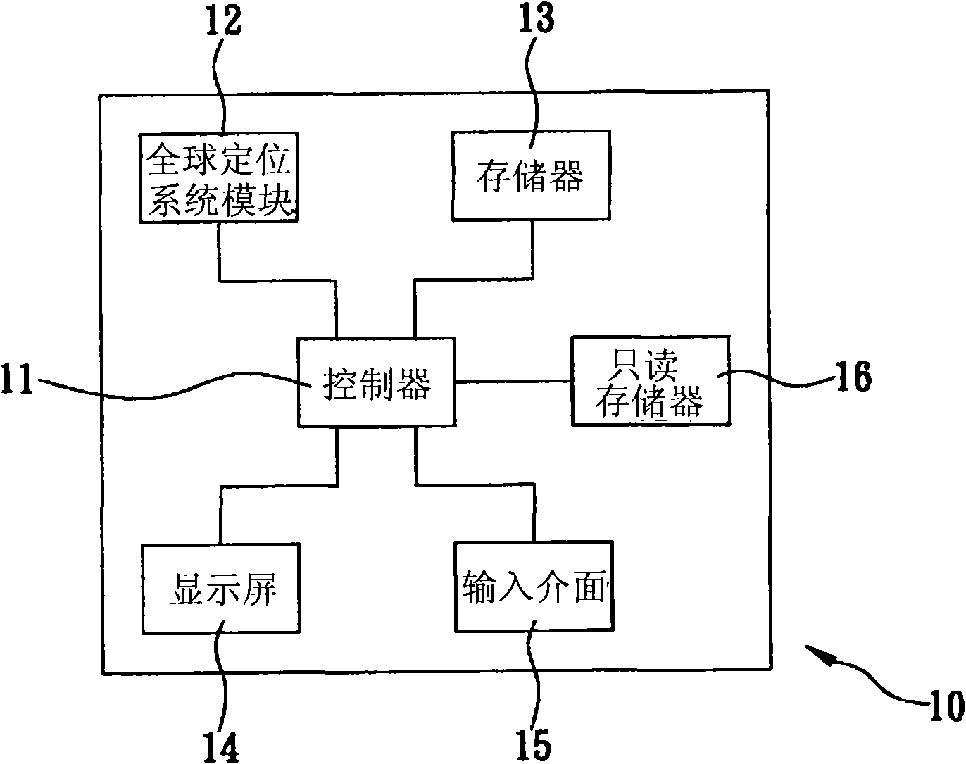
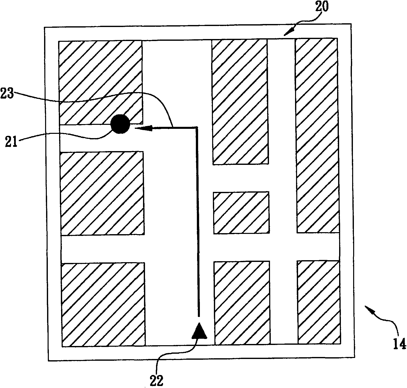
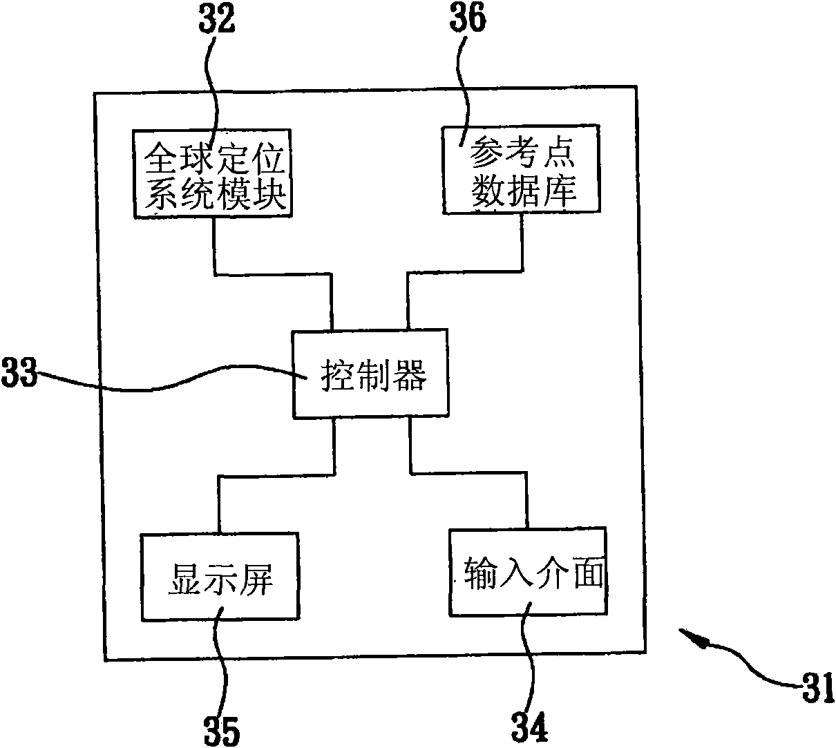
[0051] The present invention is a method of positioning service without an electronic map, the method is applied to a navigation device, refer to image 3 As shown, the navigation device 31 includes a global positioning system (Global Positioning System, GPS) module 32, a controller 33, an input interface 34 (such as: keyboard or touch screen), a display screen 35 and a reference point database 36, wherein the controller 33 is respectively connected to the GPS module 32, the input interface 34, the display screen 35 and the reference point database 36, and the reference point database 36 is for the user to input multiple reference points (such as: a certain agency , a certain business name and a certain hotel... etc.), the method makes the controller 33, according to the following steps, refer to Figure 4 As shown, the position and name of a virtual path and the reference point coordinates adjacent to the virtual path are output to the display screen 35:

[0052] (400) The c...


PUM


Abstract

The invention relates to a positioning service method without an electronic map. The method comprises the steps of utilizing a navigation device and a GPS module to read the current position coordinates, then comparing the current position coordinates with a target position coordinates input by a user, displaying a virtual path on a display screen, reading reference coordinates and names input by the user in advance in a reference data base and displaying the positions and names of the reference coordinates on the display screen for reference. The virtual path is the linear distance between the current position coordinates and the target position coordinates and the direction of the current position. The positioning service method does not need to develop or use an expensive electronic map by authorization or use a large number of memories for storing electronic maps or is fitted with a high-resolution display screen, thereby the development and manufacturing cost of a satellite navigation device is greatly reduced, and the user can easily judge the distance between the current position and the target position and the orientation of the current position according to the reference coordinates and the names near the virtual path to arrive at the target position smoothly.

Description

technical field [0001] The present invention is a positioning service method without an electronic map, especially a positioning service method applied to a navigation device without an electronic map. After the navigation device reads the coordinates of the current position, the current position can be The coordinates are compared with the destination coordinates input by the user, and a virtual route and the location and name of the reference point coordinates are displayed for the user's reference. Background technique [0002] When a user wants to drive a vehicle in an area with an unfamiliar route, traditionally, he or she will refer to a paper map, complete the route planning in advance, and then move according to the planned route. However, if the user moves a long distance, or When a user wants to move between multiple counties, cities or regions, he must purchase several paper maps to understand the routes of each county, city or region. Therefore, the user must not...

Claims


Application Information

Patent Timeline
Patent Type & Authority Applications(China)
IPC IPC(8): G01C21/26G01C21/34G01C21/36G06F17/30
Inventor 张汝南刘琪
Owner INVENTECSHANGHAI TECH
Learn More