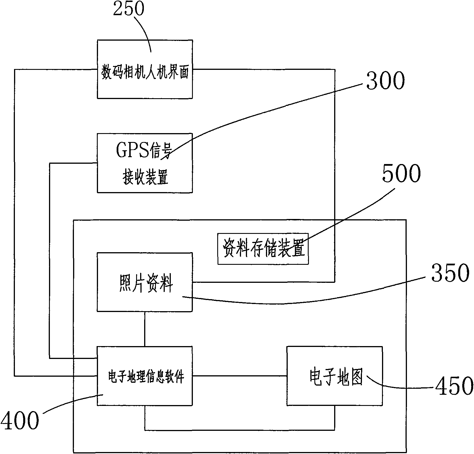
Terminal service method for providing geographic information tags for digital photos
A technology of geographic information and digital photos, applied in image communication, measuring devices, instruments, etc., can solve the problems that the intention cannot be obtained, digital photos cannot be automatically added, etc., and achieve the effect of effective organization
- Summary
- Abstract
- Description
- Claims
- Application Information
AI Technical Summary
Problems solved by technology
Method used
Image
Examples
Embodiment Construction
[0035] The present invention will be further described in detail below in conjunction with the accompanying drawings and embodiments.
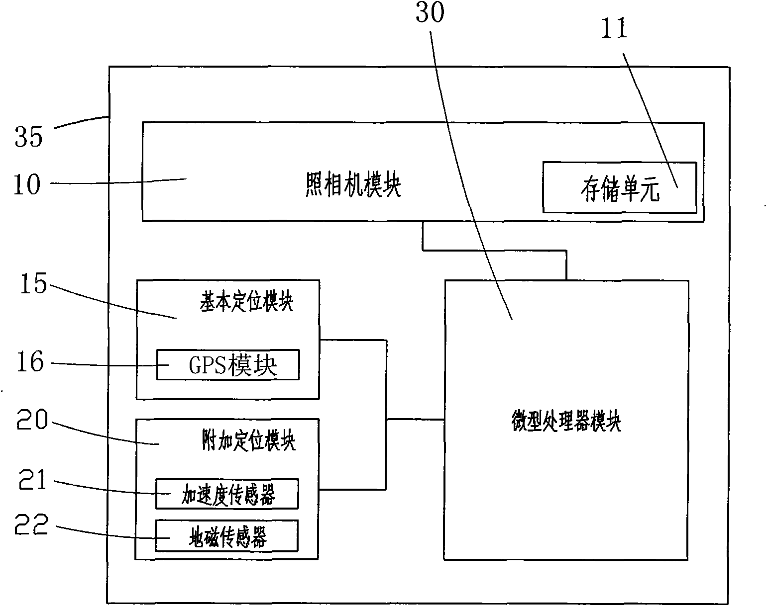
[0036] Embodiment 1 of the present invention, such as image 3 As shown, the device of the present invention is a terminal 35 , which includes a camera module 10 , a basic positioning module 15 , an accessory positioning module 20 and a microprocessor module 30 , and the camera module 10 contains a storage unit 11 . Among them, the basic positioning module 15 provides the X, Y, and Z coordinate values of the terminal 35 in the earth coordinate system through the GPS global satellite positioning module 16, and the accessory positioning module 20 uses the multi-degree-of-freedom sensor including the acceleration sensor 21 and the geomagnetic sensor 22. The sensing system gives the orientation angle φ and inclination angle θ of the terminal 35 in the above coordinate system. The microprocessor module 30 calculates the included angles α, β, and...
PUM
 Abstract
Description
Claims
Application Information
 - R&D
- Intellectual Property
- Life Sciences
- Materials
- Tech Scout
- Unparalleled Data Quality
- Higher Quality Content
- 60% Fewer Hallucinations
Browse by: Latest US Patents, China's latest patents, Technical Efficacy Thesaurus, Application Domain, Technology Topic, Popular Technical Reports.
© 2025 PatSnap. All rights reserved.Legal|Privacy policy|Modern Slavery Act Transparency Statement|Sitemap|About US| Contact US: help@patsnap.com


