Multimedia integration method based on user trajectory
A synthesis method and user trajectory technology, applied in special data processing applications, color TV parts, TV system parts, etc., to achieve the effect of security, strong commemorative significance, and good security
- Summary
- Abstract
- Description
- Claims
- Application Information
AI Technical Summary
Problems solved by technology
Method used
Image
Examples
preparation example Construction
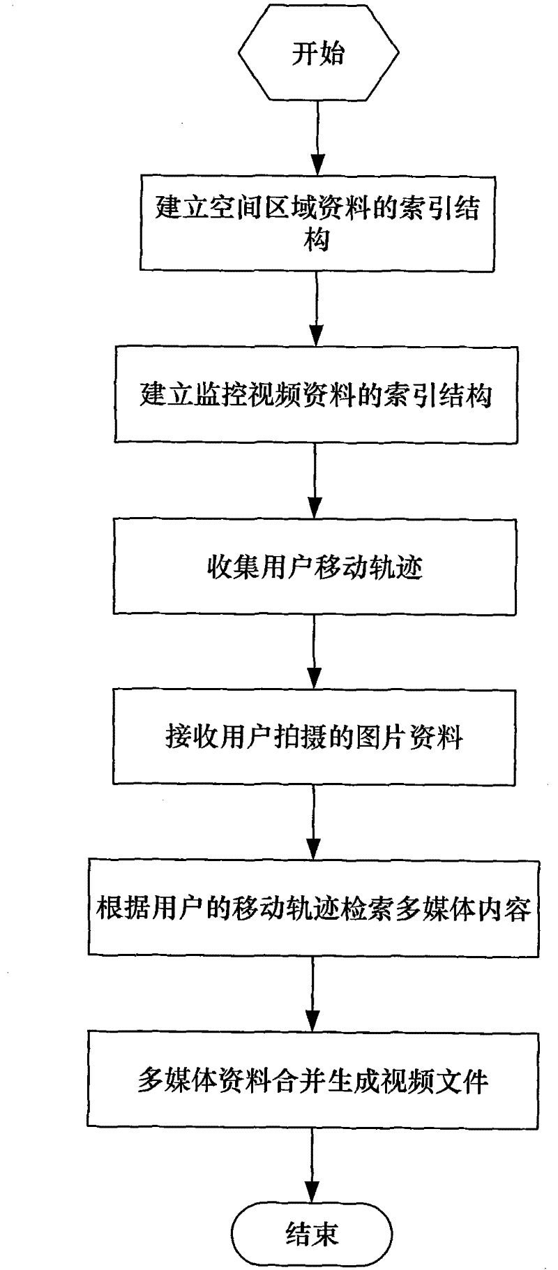
[0031] The present invention is a kind of multimedia synthesis method based on user trajectory, the process is as follows figure 1 shown, including the following steps:
[0032] Step 1: Establish the index structure of the spatial region data;
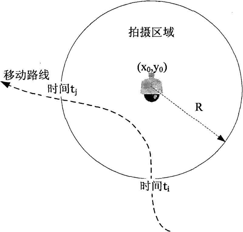
[0033] Divide the target scene into several spatial regions according to the geospatial region and function, and the geometric model of the spatial region is the set of spatial positions of the midpoint of the spatial region and the radius of the spatial region. If the spatial region has relevant video, audio, and text information, then establish a mapping relationship between the relevant video, audio, and text information and the geographic location in the spatial region, and construct an index structure for the spatial region data, which can be retrieved through a given spatial region to the multimedia material corresponding to the spatial region containing the region;
[0034] Step 2: establishing an index structure of surveillan...
Embodiment
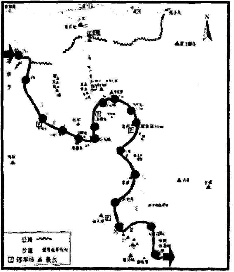
[0048] In this paper, the present invention is described by taking a travel scene as an example. Since tourist scenes rarely have the phenomenon of different scenic spots at different altitudes at the same latitude and longitude coordinates, this paper simplifies the spatial area and expresses it as a plane area, that is, the set of latitude and longitude coordinates and the radius of the area; simplifies the spatial location and expresses it with plane coordinates, that is, the latitude and longitude coordinates . In step 1, the entire scenic area is divided according to the area of the scenic spot, and the object of the introduction of the scenic spot may include the introduction of the entire scenic spot and the introduction of the scenic spot. All of them can use a geographic area to represent the target of the described scenic spot, for example, a circular closed area can be used to describe a scenic spot, and a polygon can be used to describe the entire scenic spot.
...
PUM
 Abstract
Description
Claims
Application Information
 - R&D
- Intellectual Property
- Life Sciences
- Materials
- Tech Scout
- Unparalleled Data Quality
- Higher Quality Content
- 60% Fewer Hallucinations
Browse by: Latest US Patents, China's latest patents, Technical Efficacy Thesaurus, Application Domain, Technology Topic, Popular Technical Reports.
© 2025 PatSnap. All rights reserved.Legal|Privacy policy|Modern Slavery Act Transparency Statement|Sitemap|About US| Contact US: help@patsnap.com


