
InSAR (Interferometric Synthetic Aperture Radar) block adjustment interferometric parameter calibration and control point densification method

A technology of block adjustment and encryption method, which is applied in the field of InSAR interferometric parameter calibration, can solve problems such as large relative error, elevation difference, image dislocation, etc., to improve overall consistency and continuity, reduce the number of ground control points, The effect of reducing variance

Inactive Publication Date: 2010-11-10
THE PLA INFORMATION ENG UNIV
View PDF4 Cites 28 Cited by
  • Summary
  • Abstract
  • Description
  • Claims
  • Application Information

AI Technical Summary

Problems solved by technology

[0003] In terms of InSAR research and application, the domestic research on InSAR technology in the past was mainly focused on the interference processing of a single interference image pair, which affected the actual mapping application of InSAR technology in my country.
[0004] If the method of processing individual interferometric image pairs is used to process multiple sets of InSAR data covering a large area, there will be the following problems: (1) For each pair of interferometric data, a sufficient number of reasonably distributed ground control points are required to determine the orbit parameters, Calculation of parameters such as baseline parameters and interferometric phase offset
Therefore, to complete the interferometric processing of all interferometric image pairs and the acquisition of DEM (Digital Elevation Model, Digital Elevation Model) and orthophoto in the entire large area, it is necessary to obtain a large number of reasonably distributed ground control points, which consumes a lot of time. human and financial resources
In this case, it is difficult for InSAR technology to play a role in topographic surveying and mapping of domestic unmapped areas, sparsely controlled areas and overseas areas
(2) Interferometric processing is performed separately for each interference image pair. Since the connection conditions and correlations between the data are not considered and utilized, there are relatively large relative errors between DEM and orthophotos obtained from different interference data, especially There will be obvious elevation difference at the border of DEM, and there will be obvious image misalignment at the border of orthophoto

Method used


Image

  • InSAR (Interferometric Synthetic Aperture Radar) block adjustment interferometric parameter calibration and control point densification method
  • InSAR (Interferometric Synthetic Aperture Radar) block adjustment interferometric parameter calibration and control point densification method
  • InSAR (Interferometric Synthetic Aperture Radar) block adjustment interferometric parameter calibration and control point densification method

Examples


Embodiment Construction

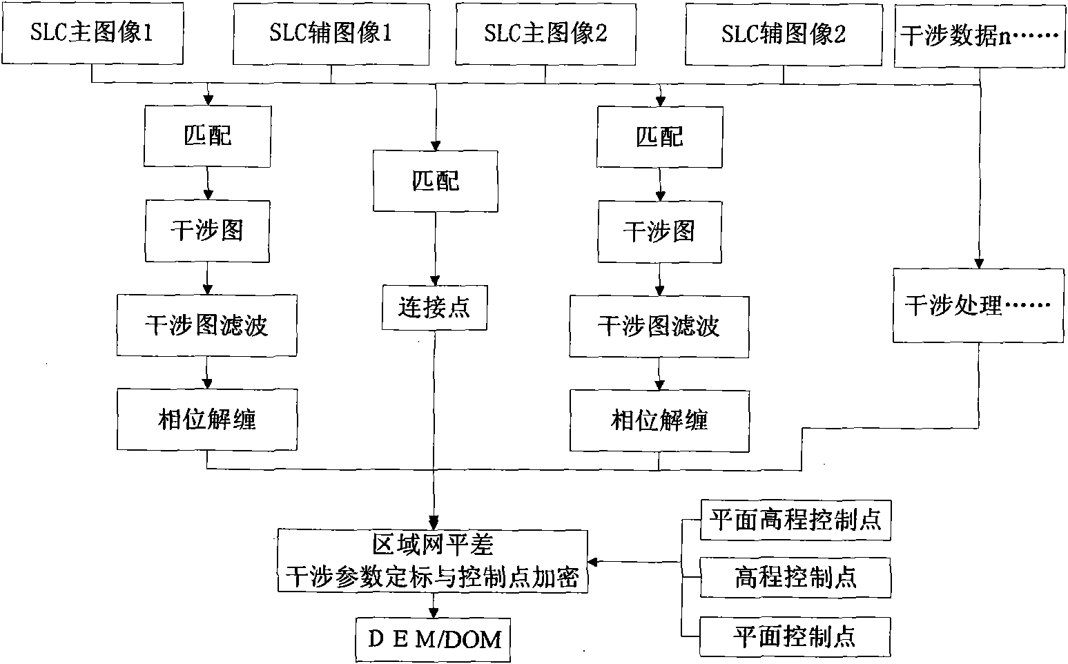
[0036] Such as figure 1 As shown, the InSAR area network adjustment interference parameter calibration and control point encryption method of the present invention includes the following processing steps:

[0037] ① Obtain the unwrapping results of each interferogram;

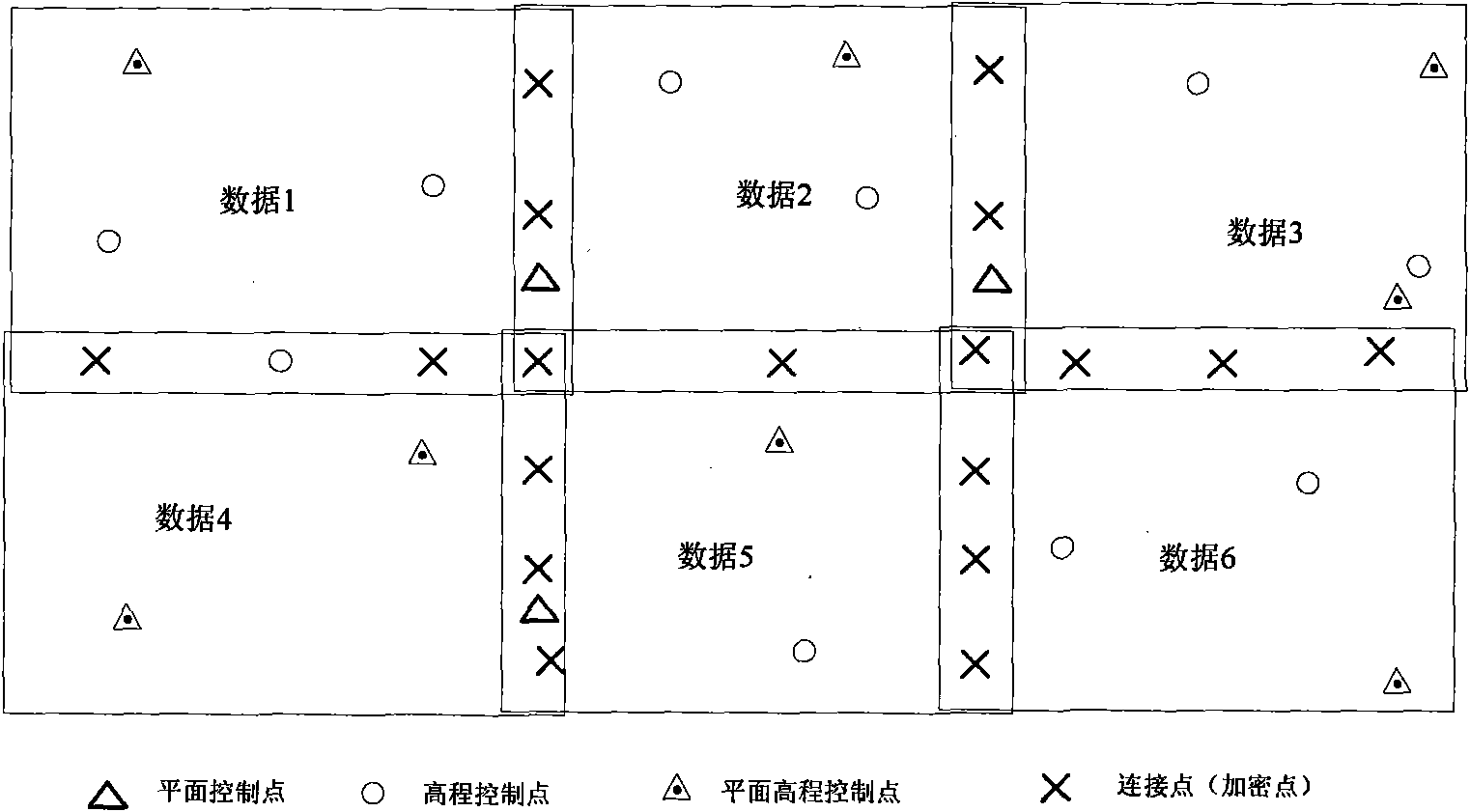
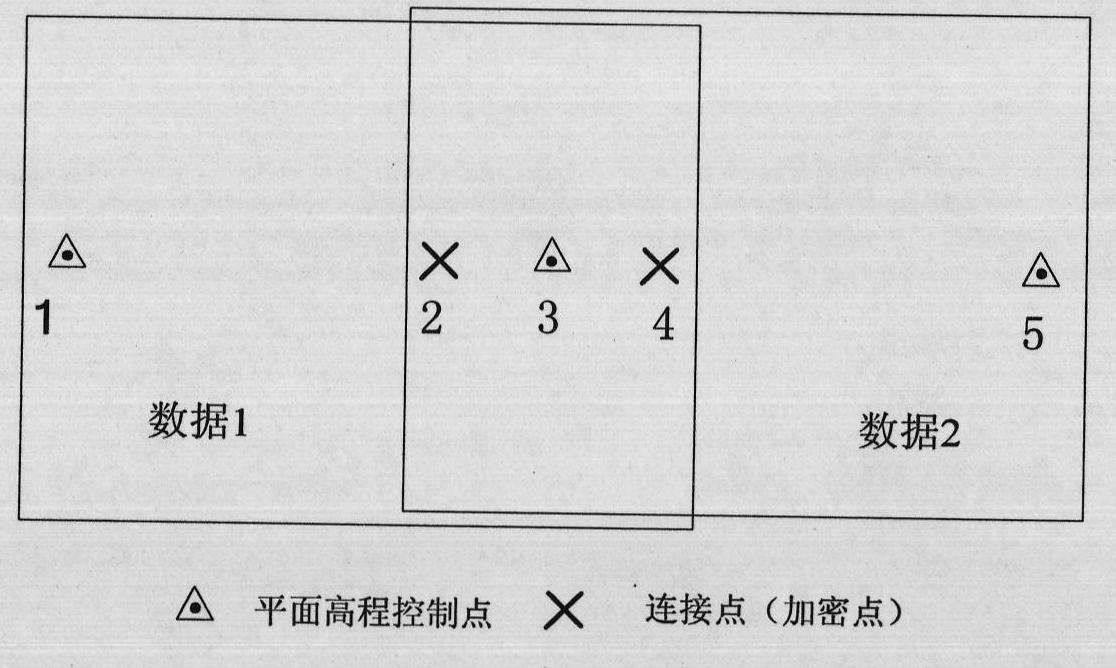
[0038] ② Perform interference parameter calibration and control point encryption according to the obtained interference diagram wrapping results. That is, using the connection points of the same name in the overlapping range of each interference data and the ground control points in the image coverage area, the regional network adjustment method is used to calculate the orbit parameters, baseline parameters, interference phase offset and other parameters, and the ground for interference processing is encrypted Control points; it should be noted that the above-mentioned ground control points include plane elevation control points, elevation control points, and plane control points.

[0039] ③Reconstruction of DEM and ...


PUM


Abstract

The invention discloses an InSAR (Interferometric Synthetic Aperture Radar) block adjustment interferometric parameter calibration and control point densification method. The method comprises the following steps of: (1) acquiring untwisting results of all interferometric figures; (2) resolving orbital parameters, baseline parameters and interferometric phase offsets by adopting a block adjustment method according to the acquired interference figure untwisting results by utilizing homonymic connecting points in an image overlay region and ground control points within an image coverage range and encrypting the control points used for interferometric processing; and (3) reconstructing a DEM (Dynamic Effect Model) and manufacturing an orthophotomap. In the method, the block adjustment method is used for carrying out the interferometric parameter calibration of large-area multi-set InSAR data, which can effectively reduce the quantity of the ground control points required by the interferometric parameter calibration of the large-area multi-set InSAR data, improve the property of the interferometric parameter calibration, reduce the difference of inversion elevations at overedging parts of different interferometric data, improve the whole consistency and continuity of acquiring the DEM and the orthophotomap and encrypt out a large quantity of ground control points used for the interferometric processing.

Description

Technical field [0001] The invention relates to InSAR interference parameter calibration technology, in particular to an InSAR area network adjustment interference parameter calibration and control point encryption method. Background technique [0002] InSAR (Interferometric Synthetic Aperture Radar, synthetic aperture radar interferometry) technology is a new high-precision earth observation technology that has developed rapidly with the development of information technology, photogrammetry technology, digital signal processing technology and other related technologies. It has outstanding advantages in topographic surveying and mapping, surface deformation monitoring, and glacier movement research. It has outstanding advantages such as fast, high-precision, all-weather, and all-weather. InSAR technology has become one of the new technologies of earth observation and surveying and mapping with rapid development and great potential. [0003] In terms of InSAR research and applicati...

Claims


Application Information

Patent Timeline
IPC IPC(8): G01S7/40G01S13/90
Inventor 靳国旺张红敏徐青秦志远周杨孙伟
Owner THE PLA INFORMATION ENG UNIV
Learn More