Three-dimensional digital earth-space data organizing and rendering method based on quad-tree index

A quadtree index and three-dimensional digital technology, which is applied in image data processing, 3D image processing, instruments, etc., can solve the problem that data is difficult to achieve real-time transmission and display

Inactive Publication Date: 2010-11-17
WUHAN IMMERSION ENVIRONMENT
View PDF3 Cites 127 Cited by
  • Summary
  • Abstract
  • Description
  • Claims
  • Application Information

AI Technical Summary

Problems solved by technology

In the current network environment or on PCs, it is difficult to meet the requirements of real-time transmission and display of such huge data, so

Method used


Image

  • Three-dimensional digital earth-space data organizing and rendering method based on quad-tree index
  • Three-dimensional digital earth-space data organizing and rendering method based on quad-tree index
  • Three-dimensional digital earth-space data organizing and rendering method based on quad-tree index

Examples


Embodiment Construction
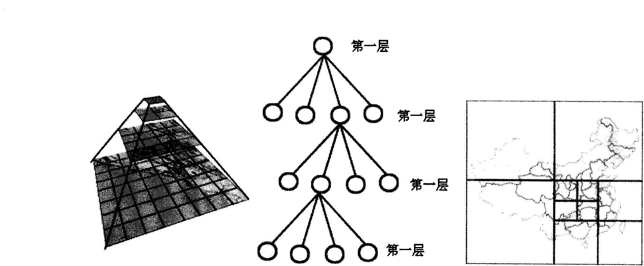
[0046] Introduce the design idea of ​​the present invention below in conjunction with accompanying drawing of description.

[0047] 1 Layered block mechanism of Digital Earth data

[0048] 1.1 Surface tile division mechanism

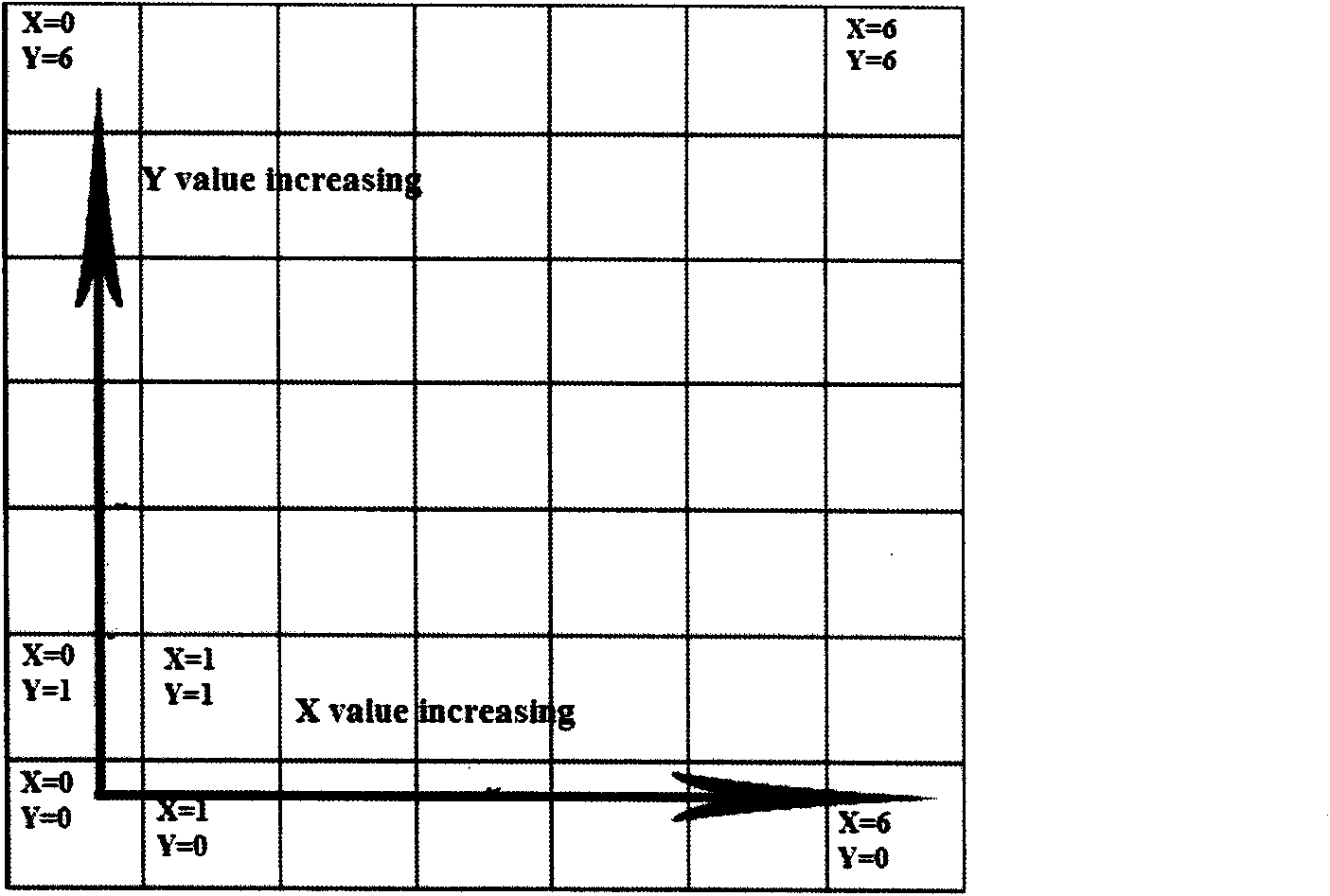
[0049] Taking Cartesian coordinates, the origin (X=0, Y=0.) is at the lower left of the projected coordinates, that is, the South Pole (-90, -180) (expressed in latitude and longitude), see figure 2 and image 3 .

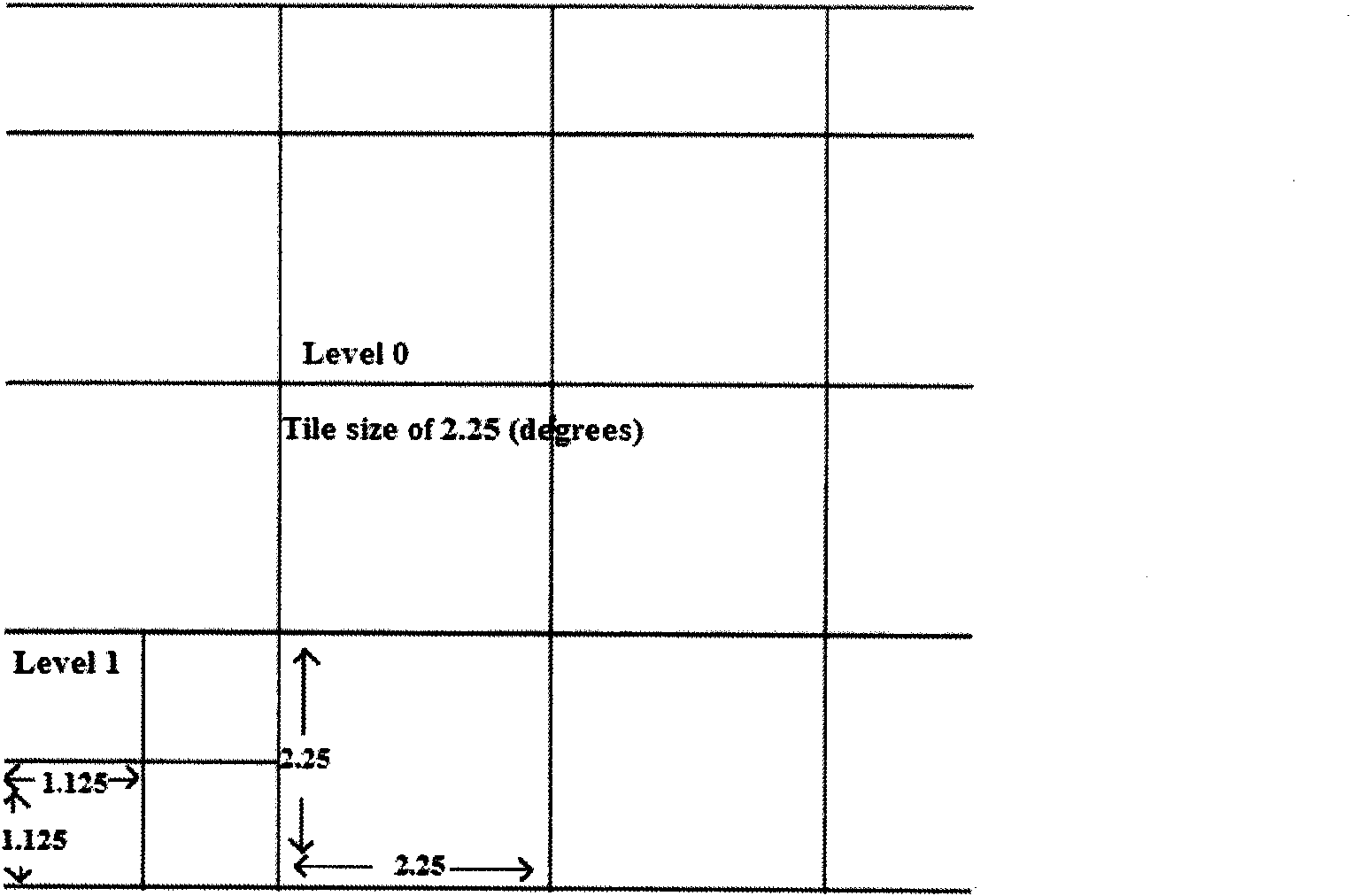
[0050] Such as image 3 , use "Level Zero Tile Size" to determine the width and height of each tile (all tiles are square. The standard level zero tile size has not yet been formulated, but it must be divisible by 180.

[0051] Taking the earth's 360-degree longitude and 180-degree latitude as the standard, the first layer is divided by 36 degrees, see Figure 4 .

[0052] It is divided into (360 / 36)*(180 / 36)=50 layers, the second layer is 18 degrees, the third layer is 9 degrees and so on, see Figure 5 and Figure 6 .

[0053] 1.2...


PUM


Abstract

The invention provides a three-dimensional digital earth-space data organizing and rendering method based on a quad-tree index, which belongs to the technical fields of cartography, geography information systems and virtual reality. The method comprises the following steps of: unifying common spatial data formats under multi-scale and multi-projection conversion, multispectral, multi-temporal and high-resolution remote sensing satellite images and aerial images as well as digital thematic maps with different scales into same coordinate system, carrying out operation on the attribute of each element and the parameter regulation of quad-tree tiles, outputting in the form of the quad-tree tiles, carrying out quad-tree cutting on three-dimensional landscape map data, leading spatial data into a relevant database, and carrying out unified management. By using the method, common vector data, raster data, altitude data and three-dimensional map data are organically integrated and issued into a three-dimensional digital earth prototype, thereby shortening the time of data preprocessing, improving the execution efficiency and providing a new integration method for three-dimensional digital earth fundamental geographic data dissemination.

Description

technical field [0001] The invention belongs to the technical fields of geographic information system, cartography and virtual reality, and in particular relates to a method for organizing and rendering three-dimensional digital earth spatial data based on a quadtree index. Background technique [0002] Digital Earth is based on computer technology, multimedia technology and large-scale storage technology, and uses a large amount of earth information to describe the earth in three dimensions with multiple resolutions, scales, time and space, and types through broadband networks. [0003] Digital Earth is mainly composed of spatial data, text data, operating platform and application model. Spatial data mainly includes global large, medium and small scale spatial data, various multi-spectral, multi-temporal, high-resolution remote sensing satellite images of the earth, aerial images, and various digital thematic maps of different scales. A basic idea of ​​Digital Earth is to ...

Claims


Application Information

Patent Timeline
IPC IPC(8): G06T15/10G06T17/50
Inventor 吕智涵张小磊韩勇陈戈
Owner WUHAN IMMERSION ENVIRONMENT
Why Eureka
Try Eureka