Improved method for making tropical cyclone wind zone
A tropical cyclone and wind belt technology, which is used in the evaluation of the overall intensity of tropical cyclones and the evaluation of the impact range
- Summary
- Abstract
- Description
- Claims
- Application Information
AI Technical Summary
Problems solved by technology
Method used
Image
Examples
no. 1 example
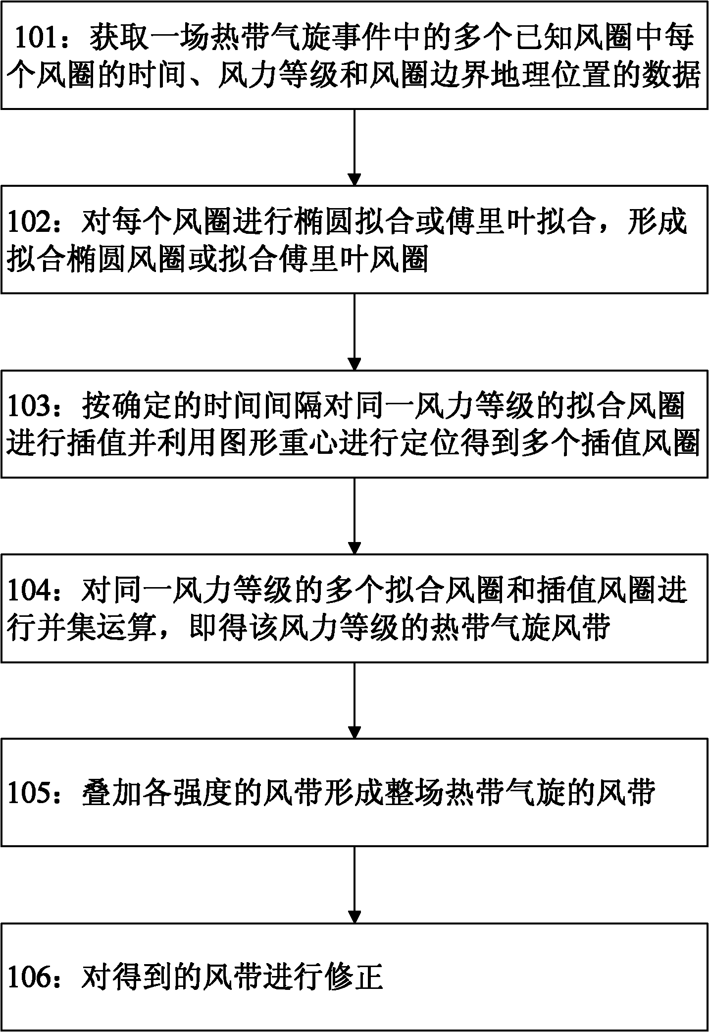
[0059] figure 1 It shows a flow chart of a method for creating a tropical cyclone wind belt by only using the graphic center of gravity to locate and interpolate the wind circle according to the first embodiment of the present invention. The method for making tropical cyclone wind belt of the present invention comprises the following steps:
[0060] Step 101: Obtain the data of the time, wind level and geographical location of the wind circle boundary of each wind circle in a plurality of known wind circles in a tropical cyclone event.
[0061] The data on gale of tropical cyclone events in different historical periods are recorded in different data forms. For the gale area evolution map of tropical cyclone events recorded in paper form, it is first necessary to digitize the evolution map to extract the required data for making tropical cyclone wind belts. Various data about the tropical cyclone gale wind circle recorded in digital form, including observation time, wind lev...
no. 2 example
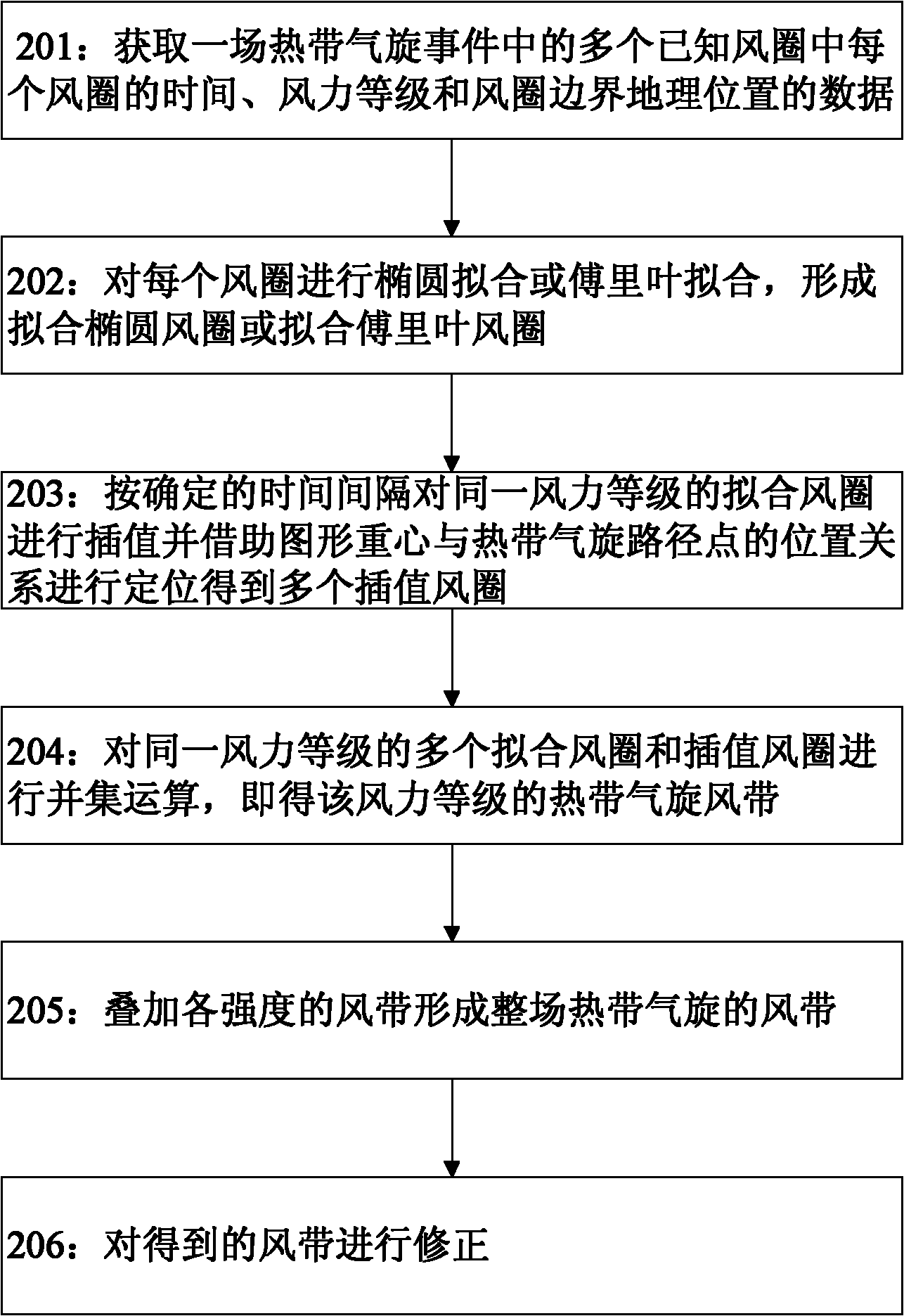
[0105] figure 2 A flowchart showing a method for creating a tropical cyclone wind belt according to the second embodiment of the present invention by combining the barycenter of the fitted wind circle graph and the center path to locate and interpolate the wind circle.
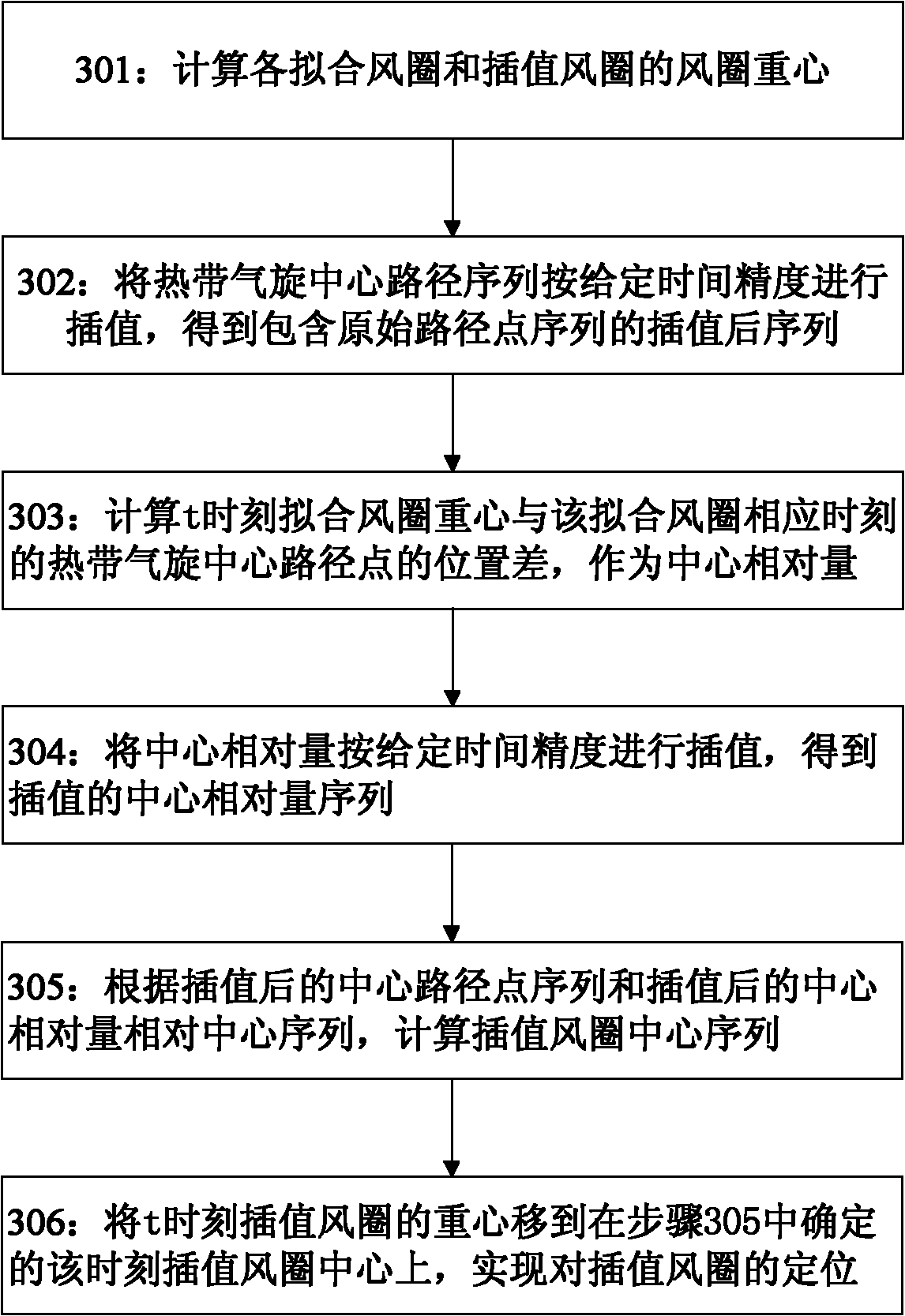
[0106] different from figure 1 As shown in step 103 of using the center of gravity of the graphic to locate the interpolated wind circle, the second embodiment combines the center of gravity of the graphic with the central path pair in the evolution diagram of the gale area in step 203 figure 1 The interpolated wind circle obtained in step 103 is used for positioning.
[0107] Step 203: Interpolate the fitted wind circles of the same wind force level according to the determined time interval, and use the graphic center of gravity of the fitted wind circles combined with the center path information to locate the interpolated wind circles to obtain multiple time-intensive interpolated wind circles.
[0108]...
example 1
[0127] Example 1 of the present invention is by means of Figure 8 , Figure 9 and Figure 10 The diagram illustrates the Figure 7 Each wind circle shown in carries out ellipse fitting, adopts the method as described in embodiment 1, obtains Figure 6 Wind bands of the indicated tropical cyclone event. Figure 8 shows the right Figure 7 The ellipse fitting schematic diagram of No. 17 wind circle in , the fitting similarity rate between the fitted ellipse wind circle and the original wind circle is 89.65%. Figure 9 show right Figure 7 Fitting and interpolation with the accuracy of 2 hours for the 6-level wind circle in , and use the center of gravity of the interpolated wind circle to locate the fitted wind circle and the interpolated wind circle. Figure 10 shown with Figure 9 The wind circle of level 8 and level 10 are respectively processed in the same manner as shown, and finally a schematic diagram of the wind belt of the tropical cyclone event is obtained.
PUM
 Abstract
Description
Claims
Application Information
 - R&D
- Intellectual Property
- Life Sciences
- Materials
- Tech Scout
- Unparalleled Data Quality
- Higher Quality Content
- 60% Fewer Hallucinations
Browse by: Latest US Patents, China's latest patents, Technical Efficacy Thesaurus, Application Domain, Technology Topic, Popular Technical Reports.
© 2025 PatSnap. All rights reserved.Legal|Privacy policy|Modern Slavery Act Transparency Statement|Sitemap|About US| Contact US: help@patsnap.com


