Distributed remotely-sensed data managing system and method
A technology of remote sensing data and management system, applied in the field of remote sensing data management, can solve the problems of inability to guarantee timely data update, unfavorable database data sharing, consumption of storage space, etc., to avoid updating, save storage space, and reduce costs.
- Summary
- Abstract
- Description
- Claims
- Application Information
AI Technical Summary
Problems solved by technology
Method used
Image
Examples
Embodiment Construction
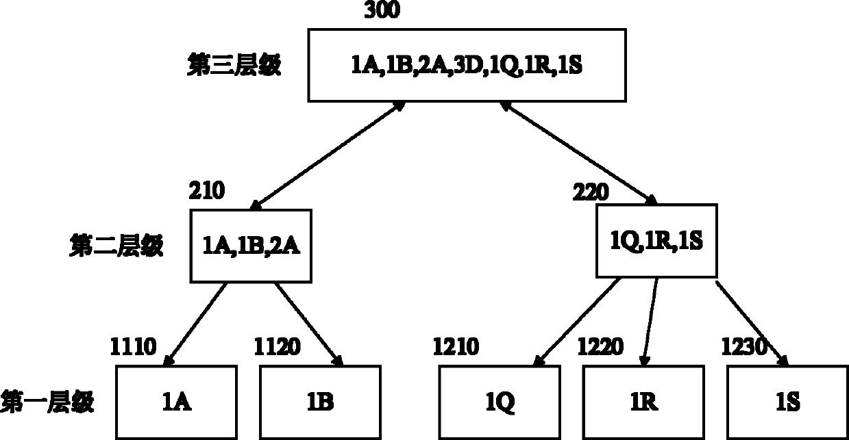
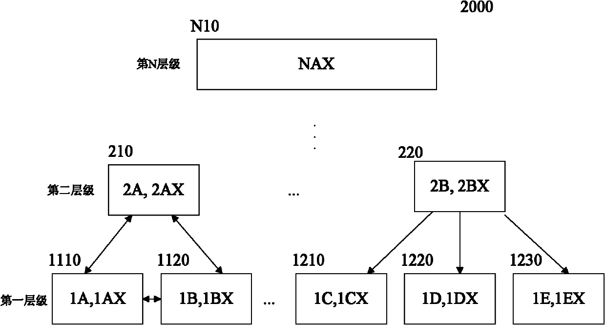
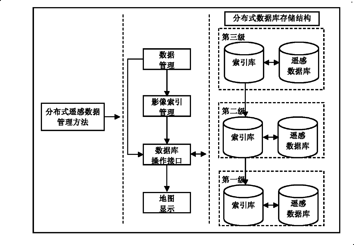
[0035] The distributed remote sensing image data management system of the present invention includes an N-level server for storing a database, a client application end, a database access interface and a display device. The distributed database of the present invention can be distributed on multiple spatial data servers of different levels. Users of different levels can access data of other levels through a network such as a private network. Users at each level are responsible for the construction and management of remote sensing databases and index databases of remote sensing images at the same level. Users with access rights can access the lower-level databases by indexing the lower-level index databases to obtain the required lower-level remote sensing image data.
[0036] figure 2 A schematic diagram showing a server hierarchy structure of a management system 2000 for distributed remote sensing image data according to the present invention. The distributed remote sensing...
PUM
 Abstract
Description
Claims
Application Information
 - R&D
- Intellectual Property
- Life Sciences
- Materials
- Tech Scout
- Unparalleled Data Quality
- Higher Quality Content
- 60% Fewer Hallucinations
Browse by: Latest US Patents, China's latest patents, Technical Efficacy Thesaurus, Application Domain, Technology Topic, Popular Technical Reports.
© 2025 PatSnap. All rights reserved.Legal|Privacy policy|Modern Slavery Act Transparency Statement|Sitemap|About US| Contact US: help@patsnap.com


