Method and device for realizing information sharing between SCADA and GIS

A geographic information system and public information model technology, applied in special data processing applications, instruments, electrical digital data processing, etc., can solve problems such as flexibility, openness, reduced upgradeability, poor interface versatility, etc., to reduce maintenance Effect of workload, good interface versatility

Inactive Publication Date: 2010-06-23
STATE GRID CORP OF CHINA +1
View PDF0 Cites 61 Cited by
  • Summary
  • Abstract
  • Description
  • Claims
  • Application Information

AI Technical Summary

Problems solved by technology

In the process of realizing the present invention, the inventor found that this special interface mode will make the interface between SCADA and GIS poor in versatility, and the flexibility, openness and upgradeability of the system will also be reduced.

Method used


Image

  • Method and device for realizing information sharing between SCADA and GIS
  • Method and device for realizing information sharing between SCADA and GIS
  • Method and device for realizing information sharing between SCADA and GIS

Examples


Embodiment Construction

[0028] The specific implementation manners of the present invention will be described in detail below with reference to the accompanying drawings.

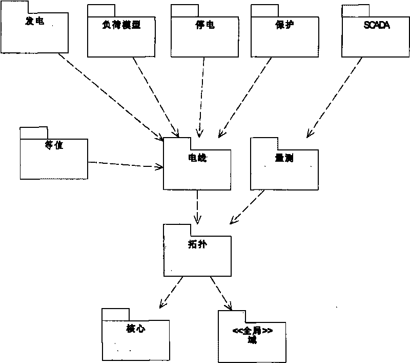
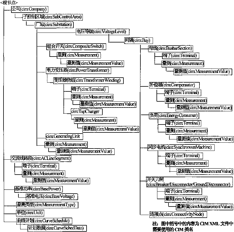
[0029] figure 1It is a schematic diagram of the packages defined in IEC 61970-301 and the dependencies among the packages according to the exemplary embodiment of the present invention. Between SCADA and GIS systems, it is first necessary to solve the problem of model sharing between the two systems. The model content shared by SCADA and GIS is the electrical logic equipment and equipment connection relationship of the power grid. The canonical representation of this information can be done in accordance with IEC 61970 CIM. CIM (Common Information Model) provides standard objects for the interoperability and application of systems for production, transmission, distribution, marketing, and retailing in the electricity, water, and gas industries. In the field of power, CIM defines the standard object model of the power industry, ...


PUM


Abstract

The invention discloses a method for realizing information sharing between data collection and monitoring system and geographic information system. The method includes the following steps: taking one of the data collection and monitoring system and the geographic information system as a model export party, converting an electric system model inside thereof into an electric system model document meeting public information model regulations; transmitting the converted electric system model system into another system from the data collection and monitoring system and the geographic information system as the model export party; the model export party resolves the electric system model document according to the public information model regulations and converts the data obtained through resolving into an electric system model inside the model export party. The invention can meet the regulation of physical isolation required in General Framework for Secondary System Safety Protection of National Electric Systems, and can realize excellent interface generality simultaneously.

Description

technical field [0001] The present invention relates to the information interaction of the power system network, and more specifically relates to a system for realizing information sharing between a supervisory control and data acquisition system (SCADA) and a geographic information system (GIS). Methods and Apparatus. Background technique [0002] The power system network is a spatial network closely related to geographic information. Every link from power transmission, power transformation, power distribution to power consumption shows the characteristics of space and complexity. In the production and operation management of power enterprises, power GIS plays an important role in effectively managing these complex space resources, while SCADA, Energy Management System (Energy Management System, EMS for short), Distribution Management System (Distribution Management System, DMS for short) is to monitor and analyze the power grid in real time. These several application sy...

Claims


Application Information

Patent Timeline
Patent Type & Authority Applications(China)
IPC IPC(8): G06F17/30G06F19/00
Inventor 刘润生邹跃中陈守军陈秀海何莹董宁李晓露赵奕
Owner STATE GRID CORP OF CHINA
Why Eureka
Try Eureka