A Coding Method for Spatial Features of Vector Data

A technology of spatial features and encoding methods, which is applied in the field of encoding of vector data spatial features, can solve the problems of manual intervention in the encoding process, non-uniform encoding standards of primitives, and artificial error images, so as to reduce computational complexity and simplify spatial operations Effect

Inactive Publication Date: 2011-12-21
NANJING NORMAL UNIVERSITY
View PDF1 Cites 19 Cited by
  • Summary
  • Abstract
  • Description
  • Claims
  • Application Information

AI Technical Summary

Problems solved by technology

[0011] The technical problem to be solved by the present invention is that, in order to overcome the problems that the existing graphic element encoding standards are not uniform, the uniqueness of the encoding is ambiguous, the encoding process is subject to m...

Method used


Image

  • A Coding Method for Spatial Features of Vector Data
  • A Coding Method for Spatial Features of Vector Data
  • A Coding Method for Spatial Features of Vector Data

Examples


Embodiment Construction

[0036] Below in conjunction with accompanying drawing and example, the present invention is described in further detail.
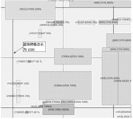
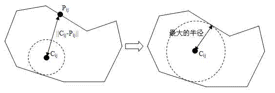
[0037] The basic idea of ​​the present invention is to uniquely identify a geometric body through the characteristic information such as the spatial position, geometric shape, collection type, outline, etc. of the vector elements. Therefore, the spatial feature encoding proposed by the present invention is a combined code, which is composed of four parts: quadtree grid row and column encoding, representative point coordinate encoding, orientation encoding and contour encoding. The total code length is 32 bits, of which 3 azimuth codes are expressed in decimal, and the other 29 bits are expressed in hexadecimal. The circumference of the equator is 2*PI*R=2*20037508.3427892, that is, the value range of the X axis is: [-20037508.3427892, 20037508.3427892]. The maximum value of a seven-digit hexadecimal number is 167 , that is, 268435455, which is greater tha...


PUM


Abstract

The invention discloses a coding method based on the spatial characteristics of vector data primitives, the steps of which are: determining the coded quadtree grid reference; Row number and column number, perform quadtree row and column encoding; select the point that best represents the primitive, and generate a representative point code according to the relative position of this point in the quadtree grid reference; base on the regional characteristics of the primitive Contour encoding; and then encode the orientation of the primitive data based on the direction of the head point of the primitive relative to the representative point; finally, according to the unified coding rules, combine the four sub-codes into the spatial feature code of the primitive, as the unique identification of the primitive . The invention comprehensively considers multiple spatial features of vector data elements, solves the influence of area re-division on coding, eliminates the interference of artificial classification, and improves the efficiency and accuracy of coding vector data primitives.

Description

technical field [0001] The invention utilizes the features such as spatial position and geometric form of the vector data to carry out the unique encoding of the graphic elements, so that the encoding rules are standardized and unified, and are convenient for automatic computer generation. Background technique [0002] Geographic entity data adopts an entity-oriented modeling method to describe "geographic entities" that exist independently in the objective world. There are many geographic feature classes, and the instance data of the feature is huge, so the coding work is bound to be very complicated. To achieve that each geographic feature instance should have only one code, and a code can only uniquely represent a geographic feature instance, a certain amount of time is required. Standards provide guidance. Each graph element is assigned a unique graph element identifier, classification identifier, and life cycle identifier, and linked to relevant social economy and natu...

Claims


Application Information

Patent Timeline
IPC IPC(8): G06F17/30
Inventor 孙毅中姚驰
Owner NANJING NORMAL UNIVERSITY
Why Eureka
Try Eureka