Calibration method of aerial remote sensing integrated system

An integrated system and aerial remote sensing technology, applied in the field of aerial remote sensing integrated systems, can solve problems such as the development of low-performance POS and stable platform systems

Inactive Publication Date: 2012-07-04
CHINESE ACAD OF SURVEYING & MAPPING +1
View PDF5 Cites 21 Cited by
  • Summary
  • Abstract
  • Description
  • Claims
  • Application Information

AI Technical Summary

Problems solved by technology

my country has not yet systematically developed high-performance POS and stable platf

Method used


Image

  • Calibration method of aerial remote sensing integrated system
  • Calibration method of aerial remote sensing integrated system
  • Calibration method of aerial remote sensing integrated system

Examples


Embodiment Construction

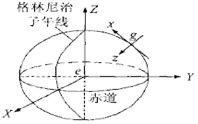
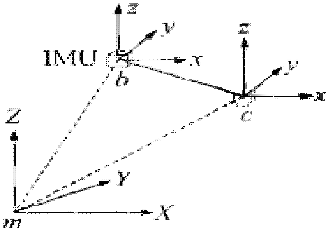
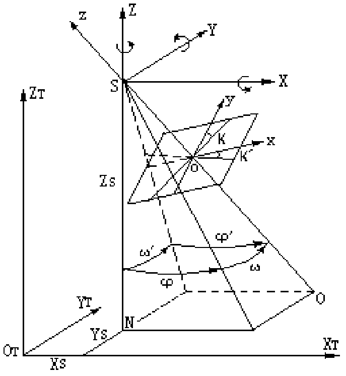
[0026] Referring to Figures 1-3, this specific implementation adopts the following technical solutions: on the basis of high-precision camera calibration and integrated navigation data solution, high-precision system aviation remote sensing integrated system calibration is performed, and the calibration method is as follows:

[0027] 1. Use the POS to record the posture information to obtain the initial value of the external orientation element of the image directly by geolocation, and obtain the external orientation element as the true value by the single-chip rear intersection method to calculate the external orientation element;

[0028] 2. Using POS-based position and attitude parameters and GPS-assisted external orientation element interactive verification method to check multi-sensor data;

[0029] 3. Use the POS to record the posture information to directly geolocate the external orientation elements of the image through conversion, and directly use the control point for absolu...


PUM


Abstract

The invention relates to a calibration method of an aerial remote sensing integrated system, relating to the aerial remote sensing integrated system. Based on high-precision camera calibration and combined navigation data calculation, the calibration of the aerial remote sensing integrated system of a high-precision system is performed, and the calibration method comprises the steps of: (1), recording attitude information by using POS, converting the attitude information to obtain an initial value of an image direct geo-location exterior orientation element, acquiring the exterior orientation element as a true value by a monolithic resection method, and calculating the exterior orientation element; (2), checking multi-sensor data by using a position attitude parameter based on the POS and a method for cross validation of the exterior orientation element based on GPS (Global Position System) auxiliary aerial three methods; and (3), recording the attitude information by using the POS, converting the attitude information to obtain the image direct geo-location exterior orientation element, absolutely orienting by using control points directly, and uniformly acquiring field check points in a calibration field for verification. According to the calibration method provided by the invention, high-precision detection and calibration on the aerial remote sensing integrated system can be realized.

Description

[0001] Technical field: [0002] The invention relates to an aviation remote sensing integrated system, in particular to a calibration method for an aviation remote sensing integrated system. Background technique: [0003] The accuracy of the integrated aerial remote sensing system is not only affected by the accuracy of core components such as digital aerial survey cameras, LIDAR, POS, and inertial stabilization platforms, but also depends on the accuracy of the multi-sensor space-time parameters and dynamic change models in the integrated system. At present, there is no high-precision air-to-ground and ground-to-ground inspection and calibration field in China. The complexity of multi-sensor time-space reference and flight environment makes it difficult to accurately determine the time-space reference and conversion parameters of the remote sensing integrated system, which makes the high-precision calibration of the multi-sensor combination the foundation The key technical probl...

Claims


Application Information

Patent Timeline
IPC IPC(8): G01C25/00
Inventor 关艳玲左建章刘先林刘宗杰李军杰杨铁利苏玉杨姚继峰马浩冯玮炜
Owner CHINESE ACAD OF SURVEYING & MAPPING
Why Eureka
Try Eureka