

Joint positioning method of airborne lidar point cloud and high-resolution imagery for spatial points
A high-resolution, joint positioning technology, applied in satellite radio beacon positioning system, image enhancement, image data processing, etc., can solve the problems of low plane accuracy and elevation accuracy, and achieve the effect of shortening the cycle and cost
- Summary
- Abstract
- Description
- Claims
- Application Information
AI Technical Summary
Problems solved by technology
Method used
Image

Examples
Embodiment Construction
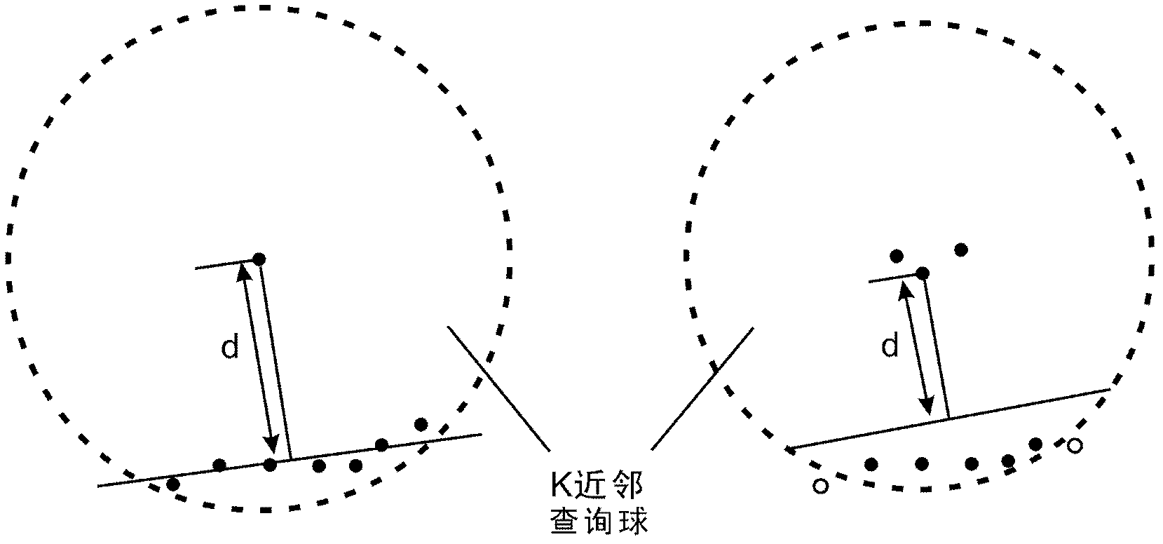
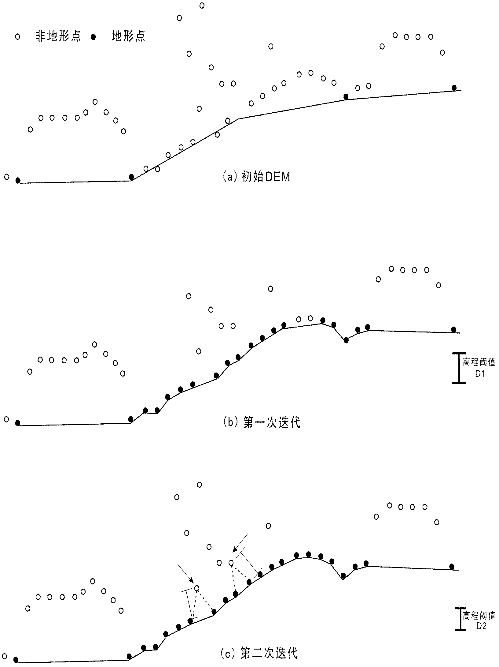
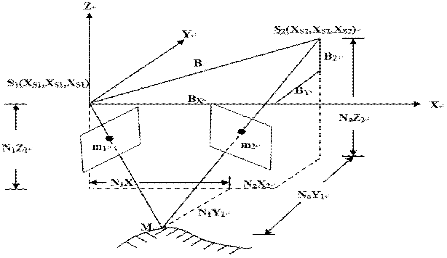
[0027] The present invention provides a method for joint precise positioning of airborne LiDAR point clouds and high-resolution images, whose essence lies in utilizing the advantages of multiple data sources, that is, utilizing the advantages and high elevation accuracy of point cloud data. The plane accuracy advantage of the object space coordinates obtained by the multi-slice intersection of high-resolution images finally realizes the high-precision and fast multi-slice forward intersection based on the airborne LiDAR point cloud data constraints, thereby achieving the goal of high-precision direct geolocation.
[0028] The implementation of the present invention will be described in detail below in conjunction with the accompanying drawings, but they do not constitute a limitation to the present invention, they are only examples, and the advantages of the present invention will become clearer and easier to understand.
[0029] The present invention provides a method for join...
PUM
 Abstract
Description
Claims
Application Information