Method, device and system for optimizing GPS track

A trajectory optimization and GPS terminal technology, applied in the field of information processing, can solve problems such as high algorithm complexity, large algorithm complexity, and inability to realize GPS trajectory optimization

Active Publication Date: 2012-10-03
DATANG MOBILE COMM EQUIP CO LTD +1
View PDF5 Cites 42 Cited by
  • Summary
  • Abstract
  • Description
  • Claims
  • Application Information

AI Technical Summary

Problems solved by technology

[0013] The real-time correction algorithm of vehicle trajectory based on vector map has strong real-time performance, but the algorithm is complex, especially when there is a large amount of data, the algorithm complexity is very

Method used


Image

  • Method, device and system for optimizing GPS track
  • Method, device and system for optimizing GPS track
  • Method, device and system for optimizing GPS track

Examples


Embodiment Construction

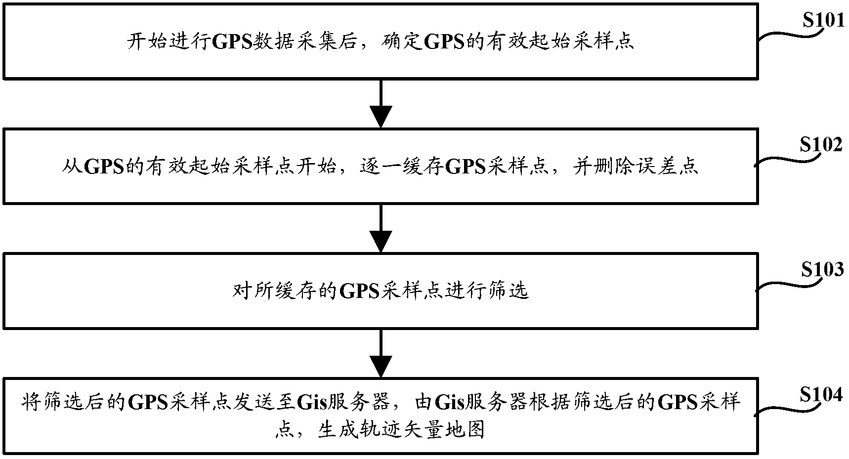
[0037] Embodiments of the present invention provide a GPS trajectory optimization method, device, and system. After determining the effective initial sampling point of GPS, the GPS sampling points are cached from the effective initial sampling point of GPS, and error points are deleted during the caching process. Filter the cached GPS sampling points and then send them to the Gis server. The Gis server generates a trajectory vector map based on the filtered GPS sampling points. The track vector map is generated to realize the optimization of the GPS track.

[0038] Such as figure 1 As shown, the GPS trajectory optimization method provided by the embodiment of the present invention includes:

[0039] Step S101, after starting the GPS data collection, determine the effective starting sampling point of GPS;

[0040] Step S102, starting from the effective starting sampling point of GPS, buffering GPS sampling points one by one, and deleting error points;

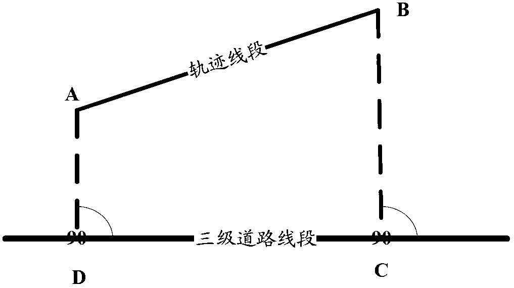
[0041] Step S103, scr...


PUM


Abstract

The invention discloses a method, a device and a system for optimizing a GPS track and relates to the information processing technology. The method comprises the following steps of: after a valid starting sampling point of the GPS is determined, beginning to cache CPS sampling points from the valid starting sampling point of the GPS, deleting error points during the caching; screening the cached GPS sampling points and then transmitting the Cached GPS sampling pints to a Gis server; generating a track vector map by the Gis server according to the screened GPS sampling points; and realizing optimization of the GPS track after the GPS sampling points are subjected to the operations of deletion and screening of the error points, and the track vector map is generated by the Gis server.

Description

technical field [0001] The present application relates to information processing technology, and in particular to a GPS trajectory optimization method, device and system. Background technique [0002] GPS (Global Positioning System, Global Positioning System) positioning technology has been widely used in various fields, such as clock synchronization, vehicle navigation, real-time location monitoring, etc. People can combine GPS information with Gis (Geographic Information System, Geographic Information System) map information Combination, intuitively monitor the driving trajectory of the object, but now the combination of GPS and Gis system generally has the following problems: [0003] Due to signal or equipment problems, the GPS point may be offset by a long distance, causing the instantaneous location point to be inconsistent with the map, and making the processed connection trajectory highly deviated. Such location points that do not match the map can be called error po...

Claims


Application Information

Patent Timeline
IPC IPC(8): G01S19/39
Inventor 周文千宋红兵姚友群王叶青
Owner DATANG MOBILE COMM EQUIP CO LTD
Why Eureka
Try Eureka