Submarine topography data establishment method based on topographical sampling point positions

A technology of terrain data and establishment method, applied in the space field of geographic information system, can solve problems such as rough terrain, impossibility of interpolation, affecting terrain continuity and authenticity, etc., and achieve the effect of reducing terrain interpolation error

Active Publication Date: 2012-12-12
哈尔滨哈船导航技术有限公司
View PDF2 Cites 22 Cited by
  • Summary
  • Abstract
  • Description
  • Claims
  • Application Information

AI Technical Summary

Problems solved by technology

[0007] For the existing Laplace interpolation, interpolation cannot be performed at the boundary of the seabed terrain sampling point area, result...

Method used


Image

  • Submarine topography data establishment method based on topographical sampling point positions
  • Submarine topography data establishment method based on topographical sampling point positions
  • Submarine topography data establishment method based on topographical sampling point positions

Examples


Embodiment Construction

[0020] The present invention will be described in detail below in conjunction with the accompanying drawings.

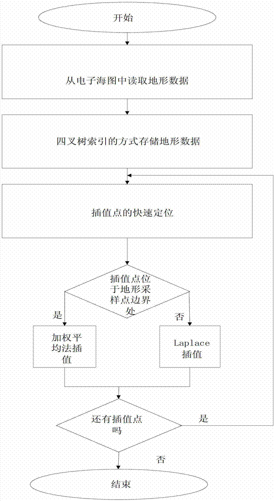
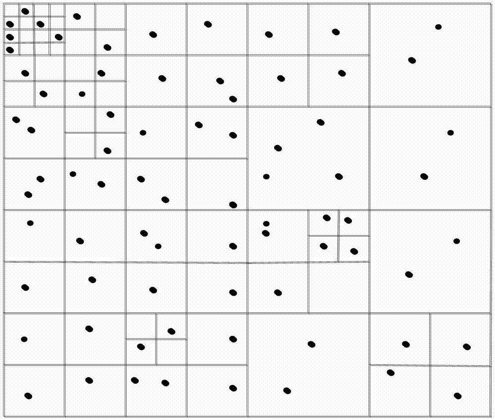
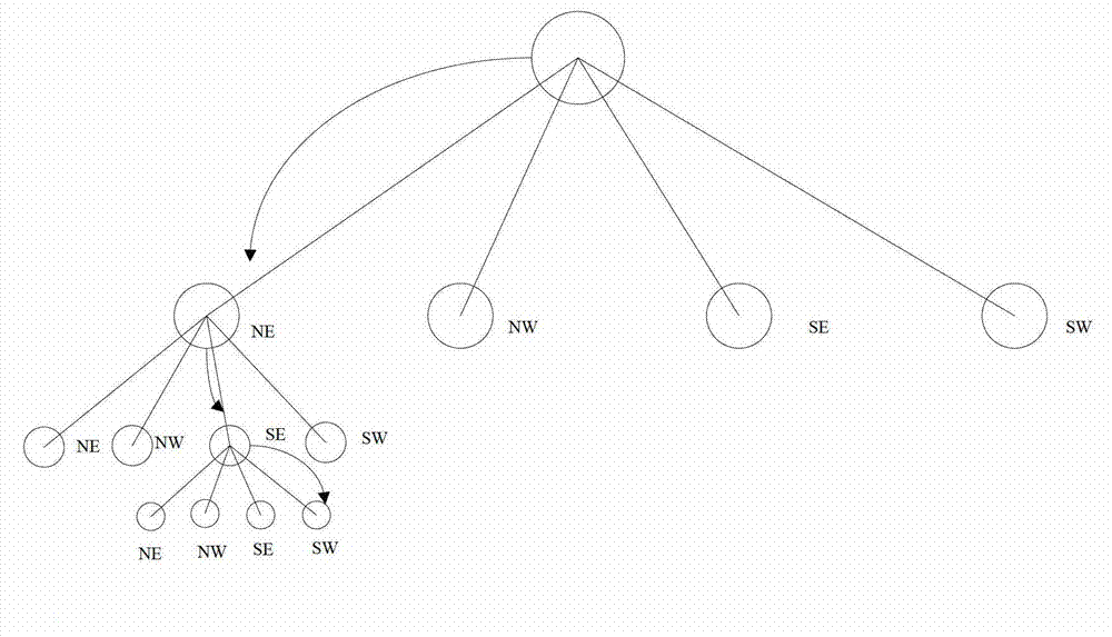
[0021] The present invention proposes a seabed terrain hybrid interpolation method based on the position of the seabed terrain sampling point, such as figure 1 The process shown specifically includes the following steps:

[0022] Step 1: Extract seabed topographic data from the electronic chart.

[0023] The method of reading seabed terrain data from the electronic chart is as follows:

[0024] Step 1.1. Read the header file of the electronic chart. The header file of the electronic chart contains the basic information of the entire electronic chart, including the map number, scale, projection method, depth unit, index area header address, element number, and data area header. Address, data area size and other basic information.

[0025] Step 1.2, read the water depth information from the electronic chart element data layer, and the water depth information is stor...


PUM


Abstract

The invention discloses a submarine topography data establishment method based on topographical sampling point positions, belonging to the space field of a Geographical Information System (GIS). The method comprises the following steps of: firstly, extracting submarine topography sampling point data from an electronic chart, and performing a quad-tree space index on submarine topography sampling data, searching positions of interpolation points in the quad-tree space index; obtaining a proper interpolation method in accordance with the positions of the interpolation points; and finally comparing a time of interpolations having been carried out and a total time of interpolations required, and continuing to perform an interpolation process if the times subjected to the interpolation is less than the total times required to be interpolated, otherwise, ending the interpolation process. According to a characteristic that the interpolation points at the boundary of the submarine topography sampling data cannot acquire annularly-connected natural neighbouring points, a mixed interpolation way of the natural neighbor interpolation method and a method of weighted mean is adopted in the method of the invention, thus sufficiently taking the advantages of an interpolation method into account and effectively reducing topography interpolation errors.

Description

technical field [0001] The invention belongs to the space field of geographic information systems, relates to fitting or simulating seabed topography, in particular to a method for establishing seabed topography data based on the positions of topography sampling points. Background technique [0002] The digital elevation model is a spatial data model that describes the morphological characteristics of the surface undulation. It is a matrix composed of the elevation values ​​of regular grid points on the ground, forming a grid structure data set. The key link in the establishment of digital elevation model is the calculation of the elevation on the grid points, which belongs to the interpolation problem in numerical analysis in mathematics. Any interpolation method is based on the continuity of the original terrain fluctuations, that is, the correlation between adjacent data points to solve the elevation of the point to be determined. There is no unified classification stand...

Claims


Application Information

Patent Timeline
IPC IPC(8): G06F17/30G09B29/00
Inventor 高峰王辉李刚沈志峰张振兴刘厂
Owner 哈尔滨哈船导航技术有限公司
Why Eureka
Try Eureka