Multi-model compressing method for transmitting general aircraft longitude and latitude position data by beidou equipment
A general-purpose aircraft and compression method technology, applied in the field of multi-model compression and decompression, can solve the problems of low compression efficiency and achieve the effect of high compression efficiency and precise monitoring
- Summary
- Abstract
- Description
- Claims
- Application Information
AI Technical Summary
Problems solved by technology
Method used
Image

Examples
Embodiment
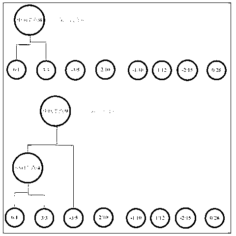
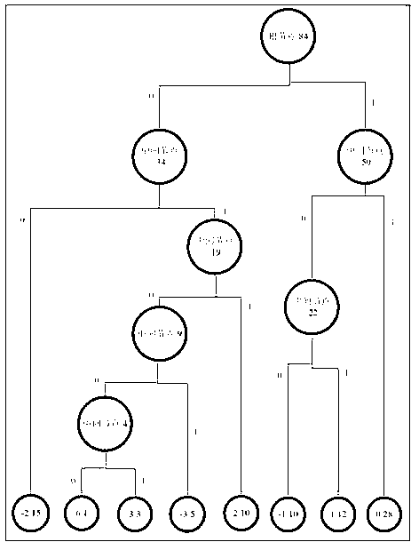
[0029] Step 1, determine the accuracy of the latitude, longitude and height data according to the actual situation, and truncate the data according to the determined accuracy requirements;
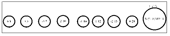
[0030] If the data is a floating-point number and the precision is M digits after the decimal point, then the M+1 digits (including M+1 digits) after the decimal point are all discarded, and the data is enlarged by 10 after truncation M converted to an integer after multiplying. Let the data used in this example be figure 1 Shown, where latitude and longitude and height data are respectively used j k ,w k , h k express. In this embodiment, the accuracy of latitude and longitude is 5 digits after the decimal point, and the accuracy of height is at the meter level, so the data after the 6th digit (including the 6th digit) after the decimal point in the latitude and longitude data can be considered unnecessary or inaccurate. to discard. After truncating, expand the longitude, latitude a...
PUM
 Abstract
Description
Claims
Application Information
 - Generate Ideas
- Intellectual Property
- Life Sciences
- Materials
- Tech Scout
- Unparalleled Data Quality
- Higher Quality Content
- 60% Fewer Hallucinations
Browse by: Latest US Patents, China's latest patents, Technical Efficacy Thesaurus, Application Domain, Technology Topic, Popular Technical Reports.
© 2025 PatSnap. All rights reserved.Legal|Privacy policy|Modern Slavery Act Transparency Statement|Sitemap|About US| Contact US: help@patsnap.com