S Stratification position flattening method-based ancient landform restoration method

A technology of ancient landform restoration and horizon leveling, applied in the direction of seismic signal processing, etc., can solve the problems of difficult operation, difficult coding, complicated logic, etc., and achieve the effect that is conducive to realization.

Active Publication Date: 2013-12-04
CHINA PETROLEUM & CHEM CORP +1
View PDF4 Cites 47 Cited by
  • Summary
  • Abstract
  • Description
  • Claims
  • Application Information

AI Technical Summary

Problems solved by technology

[0010] The present invention provides a paleogeomorphology restoration method based on horizon leveling method, the purpose of which is to solve the problems encountered by the current paleogeomorphology restoration...

Method used


Image

  • S Stratification position flattening method-based ancient landform restoration method
  • S Stratification position flattening method-based ancient landform restoration method
  • S Stratification position flattening method-based ancient landform restoration method

Examples


Embodiment Construction

[0040] Below in conjunction with accompanying drawing, the present invention is described in further detail:

[0041] Such as Figure 5 Shown, the inventive method comprises the following steps:

[0042] (1) Define the geological horizon:

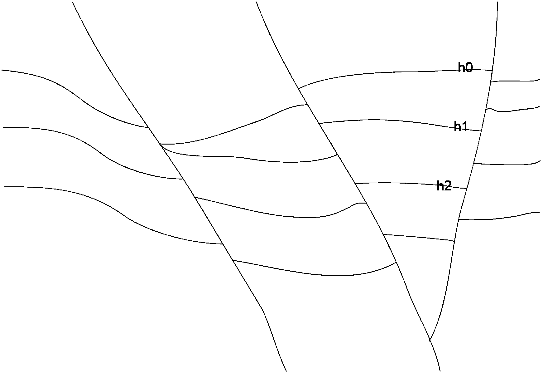
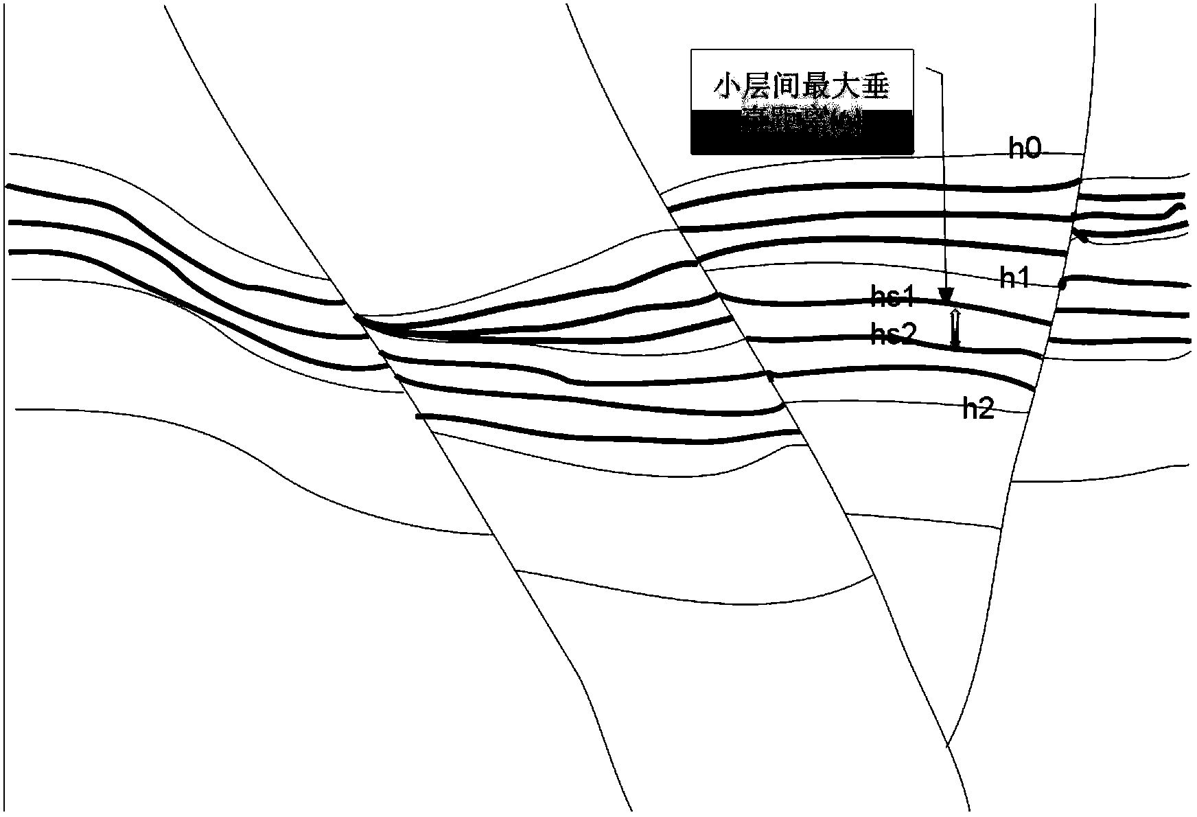
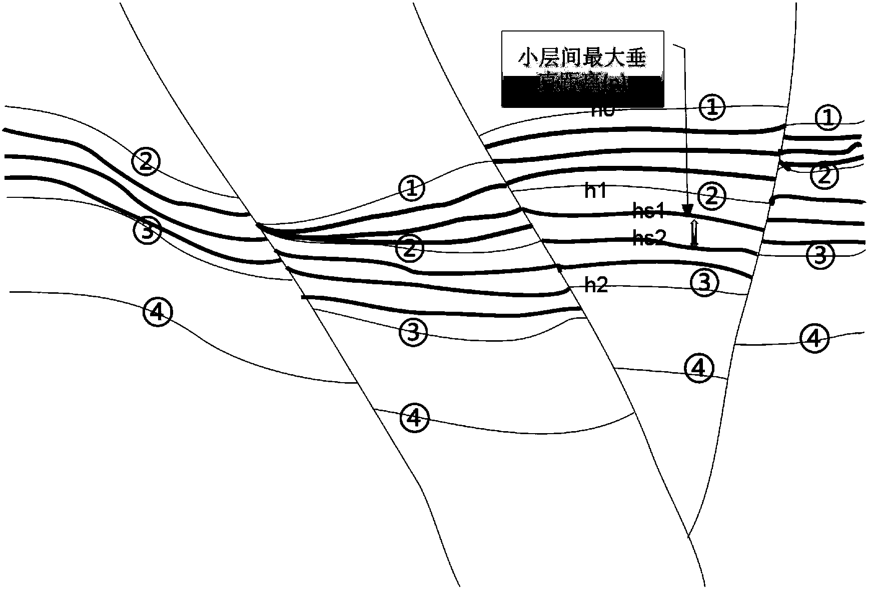
[0043] On a seismic section displayed by standard seismic data (SEGY format), the geological horizons are defined according to the geological structure theory, and the coordinate information of these geological horizons relative to the seismic section is recorded, such as figure 1 as shown, figure 1 Among them, the information of h0, h1, h2 and all curves can be defined according to the standard computer screen coordinate system.

[0044] Specifically, since seismic reflections are generated at the physical interfaces of rocks, these interfaces are mainly composed of layer (or bedding) planes and unconformities with velocity-density differences, so the original seismic reflections are parallel to the layers and unconformities, The high-...


PUM


Abstract

The invention, which belongs to the oil gas and coalbed methane seismic exploration and development field, provides a stratification position flattening method-based ancient landform restoration method. The provided method comprises the following steps that: firstly, geologic stratification position defining is carried out; secondly, a geologic stratification position sequence is defined; thirdly, a small stratification is divided between two adjacent geologic stratification positions; fourthly, a maximum distance between two adjacent small stratifications between two adjacent geologic stratification positions at vertical direction is defined; fifthly, interpolation is carried out on channel data between the two adjacent small stratifications according to the maximum distance at the vertical direction and after the interpolation is completed, the distances at the vertical direction between the two small stratifications are equal, thereby completing stratification position flattening of the two small stratifications; sixthly, the step three and the step five are repeatedly carried out on all the two adjacent stratification positions so as to complete all the stratification position flattening; and seventhly, zero value filling is carried out on the truncation portion. The method can be implemented easily by a computer; and the actual effect required by the ancient landform restoration theory can be ensued.

Description

technical field [0001] The invention belongs to the field of seismic exploration and development of oil and gas and coalbed methane, and in particular relates to a method for restoring paleogeomorphology based on a horizon leveling method. Background technique [0002] Paleogeomorphology restoration is an important part of the study of sedimentary systems. The result of the restoration is a paleogeomorphology map, which refers to a map of the concave-convex state of the interface surface represented by the isobath line on a certain interface in a certain period of basin development. Paleogeomorphology restoration The main methods are: residual thickness method, impression method, sequence stratigraphy method, sedimentology method, horizon leveling method, etc., the details are as follows: [0003] The residual thickness method regards the time when the landform to be restored ends denudation and begins to deposit the overlying strata as the first isochrone surface, selects a...

Claims


Application Information

Patent Timeline
IPC IPC(8): G01V1/28
Inventor 宋志翔苏凌杨强白俊雨杨文广岳承琪魏嘉杨尚琴仇正兰林庆富毕进娜
Owner CHINA PETROLEUM & CHEM CORP
Why Eureka
Try Eureka