Coal field fire area determining method and device

A technology for determining methods and devices, applied in optical device exploration, character and pattern recognition, instruments, etc., can solve the problem of low monitoring accuracy in coalfield fire areas, and achieve the effect of improving monitoring accuracy

Inactive Publication Date: 2014-02-26
CHINA SHENHUA ENERGY CO LTD +1
View PDF4 Cites 11 Cited by
  • Summary
  • Abstract
  • Description
  • Claims
  • Application Information

AI Technical Summary

Problems solved by technology

[0005] The main purpose of the present invention is to provide a method and device for determining a coalfie

Method used


Image

  • Coal field fire area determining method and device
  • Coal field fire area determining method and device
  • Coal field fire area determining method and device

Examples


Embodiment Construction

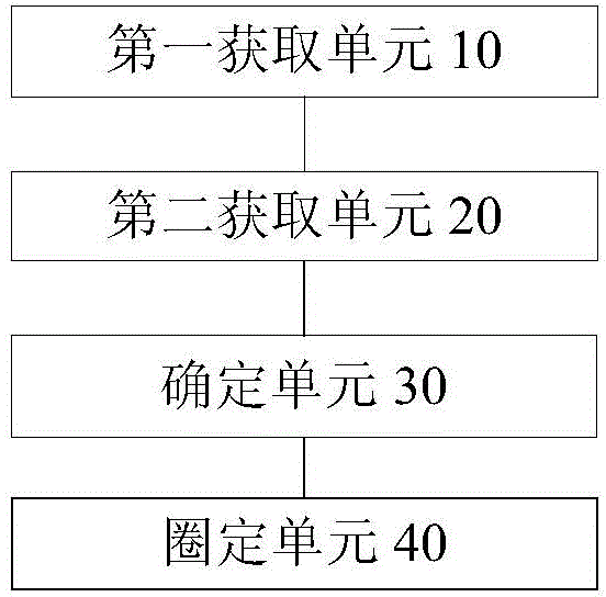
[0024] It should be noted that, in the case of no conflict, the embodiments in the present application and the features in the embodiments can be combined with each other. The present invention will be described in detail below with reference to the accompanying drawings and examples.

[0025] In order to enable those skilled in the art to better understand the solutions of the present invention, the following will clearly and completely describe the technical solutions in the embodiments of the present invention in conjunction with the drawings in the embodiments of the present invention. Obviously, the described embodiments are only It is an embodiment of a part of the present invention, but not all embodiments. Based on the embodiments of the present invention, all other embodiments obtained by persons of ordinary skill in the art without making creative efforts shall fall within the protection scope of the present invention.

[0026] It should be noted that the terms "fir...


PUM


Abstract

The invention discloses a coal field fire area determining method and device. The coal field fire area determining method includes the steps of obtaining thermal infrared image data of a target area, obtaining land surface temperature information of the target area according to the thermal infrared image data of the target area, determining the position of the burning center of coal fire of the target area according to the land surface temperature information of the target area, and determining the burning area of a current coal field fire area in the target area according to the position of the burning center of the coal fire of the target area. By means of the coal field fire area determining method and device, the effect of improving monitoring accuracy of the coal field fire area is achieved.

Description

technical field [0001] The invention relates to the field of coal fire monitoring, in particular to a method and a device for determining coalfield fire areas. Background technique [0002] Coal fire is a fire caused by coal seam combustion. The existing coal fire remote sensing monitoring technology uses a combination of remote sensing, drilling, geophysical prospecting, and field surveys to delineate the coal fire distribution area and determine the coal fire burning center. The remote sensing method uses satellite Or airborne thermal infrared, near-infrared data such as TM (Thematic Mapper, Thematic Mapper) / ETM+ (Enhanced Thematic Mapper, Enhanced Thematic Mapper) data, ASTER (satellite sensor name) data, OMIS (Practical Modular Imaging Spectrometer) Data and high spatial resolution data Quickbird, IKONOS (Ikonos satellite), etc. to extract coal fire information, satellite thermal images simply cannot allow us to identify and extract information about surface coal fires. ...

Claims


Application Information

Patent Timeline
IPC IPC(8): G06K9/62G01V8/10
Inventor 张国荣张鑫田新光韩志芳
Owner CHINA SHENHUA ENERGY CO LTD
Why Eureka
Try Eureka