Walking guide system based on mobile terminal and implementation method of walking guide system

A mobile terminal and real-scene technology, applied in the direction of radio wave measurement system, satellite radio beacon positioning system, measurement device, etc., can solve problems such as poor experience, increased burden of location recognition, and gap in fidelity, so as to increase user experience Speed, save production time, improve navigation efficiency

Active Publication Date: 2014-03-26
维沃软件技术有限公司
View PDF6 Cites 25 Cited by
  • Summary
  • Abstract
  • Description
  • Claims
  • Application Information

AI Technical Summary

Problems solved by technology

[0004] The two-dimensional navigation interface displays map information including information such as roads, parks, rivers, stores, hospitals, etc. on a planar map from an overhead perspective. This planar map is quite different from the real environment where the user is located, and the directionality is poor. The screen is not intuitive enough. When navigating, users must first identify the direction they are facing, and then choose the current route based on the correspondence between the map and the environment. The navigation efficiency is low and the experience is poor.
[0005] The virtual navigation interface can generate a three-dimensional space map by simulating urban buildings, roads and terrain, which can present the information of the user's location more intuitively. However, there is still a certain gap between its fidelity and the real scene
Moreover, the production of three-dimensional space maps takes longer, and compared with flat maps, its update is slow and time-sensitive
The higher and higher urban density also makes the information on the 3D map more complicated, which invisibly increases the burden of user location recognition

Method used


Image

  • Walking guide system based on mobile terminal and implementation method of walking guide system
  • Walking guide system based on mobile terminal and implementation method of walking guide system
  • Walking guide system based on mobile terminal and implementation method of walking guide system

Examples


Embodiment Construction

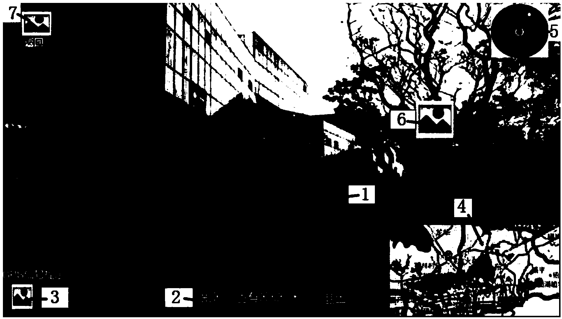
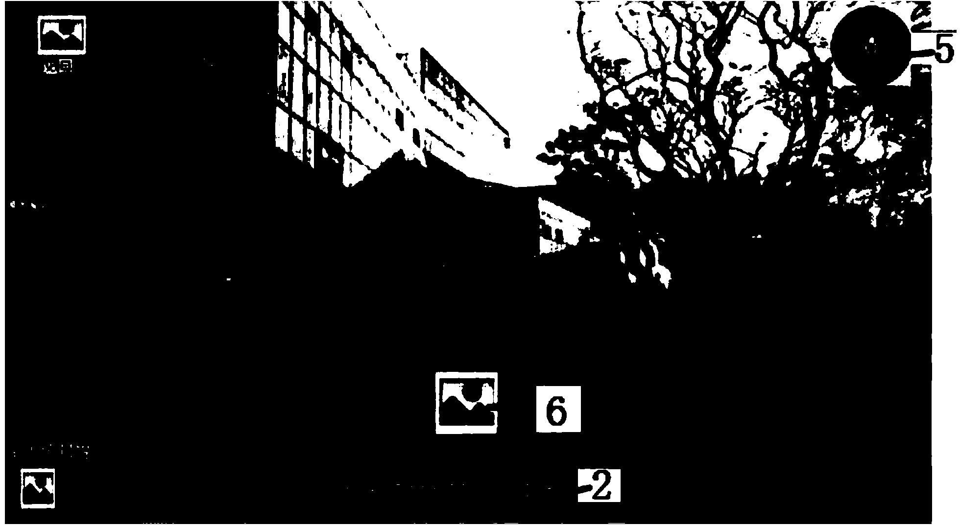
[0054] A walking guidance system based on a mobile terminal, which includes a map information acquisition module and a positioning device, the map information acquisition module obtains map information, and the positioning device obtains the user's actual position and direction in real time, it is characterized in that: it also includes:

[0055] A camera, used to collect the real scene around the current location;

[0056] A display module, including a display screen, the display module generates a real scene navigation interface including the real scene picture on the display screen;

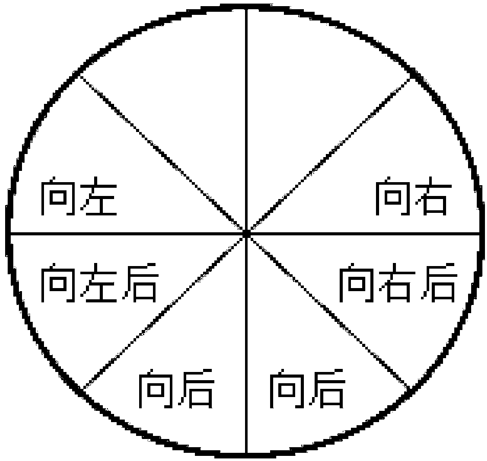
[0057] A route planning module, which matches the map information with the real-scene picture and establishes a mapping relationship, and calculates and obtains the navigation route and distance according to the current user's location information and the destination location information, and displays the direction guide mark on the real-scene navigation interface and / or distance markers.

[...


PUM


Abstract

The invention relates to the technical field of mobile communication, in particular to a walking guide system based on a mobile terminal and an implementation method of the walking guide system. The walking guide system based on the mobile terminal comprises a cartographic information acquisition module, a positioning device, a camera, a display module and a route planning module, wherein the cartographic information acquisition module acquires cartographic information; the positioning device acquires the actual position and direction of a user in real time; the camera is used for collecting a live-action picture of the periphery of the current position; a display module comprises a display screen where a live-action navigation interface including the live-action picture is generated by the display module; and the route planning module matches the cartographic information with the live-action picture for establishing a mapping relation, calculates and obtains a navigation path and distance according to user's current position information and destination position information and displays a direction guide identification and / or a distance identification on the live-action navigation interface. The method is used for implementing the system. The walking guide system is simple to operate and convenient to use, and the navigation efficiency can be improved.

Description

Technical field: [0001] The invention relates to the technical field of mobile communication, in particular to a walking guidance system based on a mobile terminal and an implementation method thereof. Background technique: [0002] With the rapid development of mobile communication networks and the miniaturization of positioning devices, navigation systems have begun to appear on mobile terminals such as mobile phones and tablet computers. Compared with vehicle navigation systems, navigation systems on mobile phones and tablet computers can realize real-time interaction with the communication network, download the latest map information or road data from the server, which is more accurate and humanized, and can meet the higher needs of users. [0003] However, currently, the navigation interface adopted by the existing mobile terminal-based navigation system is a two-dimensional navigation interface or a virtual navigation interface. [0004] The two-dimensional navigation...

Claims


Application Information

Patent Timeline
Patent Type & Authority Applications(China)
IPC IPC(8): G01C21/00
CPCG01C21/00G01S19/42
Inventor 曾昆鹏汤青良黄韬
Owner 维沃软件技术有限公司
Why Eureka
Try Eureka