A Fast Retrieval Method of Location Information Based on Mask Technology and Subdivision Coding
A location information and subdivision encoding technology, which is applied in geographic information databases, structured data retrieval, instruments, etc., can solve the problems of huge conversion costs and achieve the effects of low algorithm complexity, reduced retrieval time, and reduced encoding set elements
- Summary
- Abstract
- Description
- Claims
- Application Information
AI Technical Summary
Problems solved by technology
Method used
Image
Examples
Embodiment 1
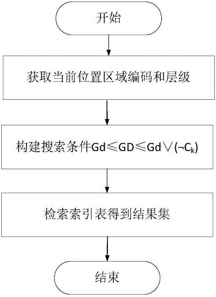
[0035] In order to realize fast retrieval of location information, the technical solution of the method may include the following steps:
[0036] Step 1. In the GeoSOT subdivision and coding scheme, create a layer mask C corresponding to each layer j j , C j It is consistent with the GeoSOT code length of the 32nd level, and the bits corresponding to levels 1~j are all 1, and the remaining bits are 0; 1≤j≤32. For example, the level mask of level 14 expressed in quaternary is 33333333333333000000000000000000.
[0037] Step 2. For the search area, select a subdivision patch set related to the search area in the GeoSOT subdivision and coding scheme, and the GeoSOT code of the subdivision patch p in the subdivision patch set is Gd p ; Obtain the search result for each subdivision patch p in the subdivision patch set: perform logic negation on the hierarchical mask of the subdivision patch p and then combine it with Gd p Perform a logical OR operation to obtain the code G of the...
Embodiment 2
[0046] Embodiment 2, for the above-mentioned first case:
[0047] Then, in the GeoSOT subdivision and coding scheme, the subdivision patch set that is associated with the retrieval area is selected as follows: a subdivision patch A that completely covers the retrieval area is selected. That is, at this time, the subdivision patch set associated with the retrieval area only includes one subdivision patch.
[0048] Then the GeoSOT code of A is Gd. In this embodiment, Gd is selected as a quaternary code. In practical applications, Gd can be converted into any code, and Gd is specifically Gd 1 d 2 d 3 … d k , where d k is 0, 1, 2 or 3, k is an integer and 1≤k≤32, k is the level of the above-mentioned subdivision patch A, the index number in the index table is GD, and the level mask of the kth level is C k .
[0049] At this time, for step 3 in embodiment 1, the following query method can be adopted:
[0050] Query the GeoSOT coded GD that meets the following conditions, an...
Embodiment 3
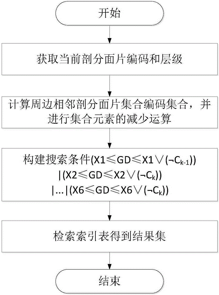
[0053] Embodiment 3, for the above-mentioned second situation:
[0054] In the GeoSOT subdivision and coding scheme, the subdivision patch set that is associated with the retrieval area is selected as: the smallest subdivision patch A covering the retrieval area in the GeoSOT subdivision and coding scheme 0 , A 0 The level is k, find 8 adjacent subdivision patches A with level k around the smallest subdivision patch 1 ~A 8 , by A 0 ~A 8 Composition of subdivision facet set, specifically as figure 2 shown. That is, at this time, the subdivision patch set associated with the retrieval area includes 9 subdivision patches.
[0055] Based on the set A, step 3 in embodiment 1 can adopt the following retrieval process:
[0056] Set up the subdivision patch A 0 ~A 8 The corresponding GeoSOT code is Gd 0 ~Gd 8 , use the following query conditions to obtain the qualified GD, and use the qualified GD to retrieve the areas or objects in the surrounding area of the current lo...
PUM
 Abstract
Description
Claims
Application Information
 - R&D
- Intellectual Property
- Life Sciences
- Materials
- Tech Scout
- Unparalleled Data Quality
- Higher Quality Content
- 60% Fewer Hallucinations
Browse by: Latest US Patents, China's latest patents, Technical Efficacy Thesaurus, Application Domain, Technology Topic, Popular Technical Reports.
© 2025 PatSnap. All rights reserved.Legal|Privacy policy|Modern Slavery Act Transparency Statement|Sitemap|About US| Contact US: help@patsnap.com


