
Method for improving vehicle-mounted speed chart through GPS speed information

A speed information and speed technology, applied in speed/acceleration/shock measurement, linear/angular velocity measurement, measuring devices, etc., can solve the problems of large influence of GPS and increase of GPS positioning error

Active Publication Date: 2015-01-28
TSINGHUA UNIV
View PDF7 Cites 10 Cited by
  • Summary
  • Abstract
  • Description
  • Claims
  • Application Information

AI Technical Summary

Problems solved by technology

GPS has been widely used in vehicle navigation systems. Most of the cars produced now have GPS, which is the main sensor for navigation and positioning. However, GPS is greatly affected by the environment. The main factors affecting GPS positioning are the environment such as buildings and trees. GPS satellite signals lead to an increase in GPS positioning errors. In an open environment, the positioning accuracy of the GPS receiver is relatively high, including coordinates and speed.

Method used


Image

  • Method for improving vehicle-mounted speed chart through GPS speed information
  • Method for improving vehicle-mounted speed chart through GPS speed information
  • Method for improving vehicle-mounted speed chart through GPS speed information

Examples


Embodiment Construction

[0031] The present invention will be further described below in conjunction with embodiment.

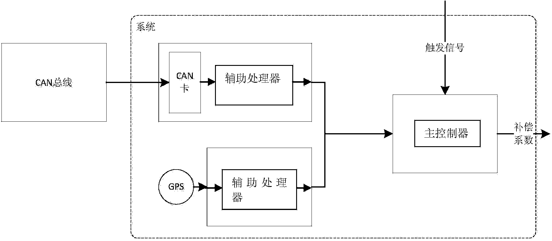
[0032] The method of the present invention is based on a certain form of hardware device; the hardware device includes a GPS acquisition device, a vehicle-mounted speed acquisition device, and a main controller;

[0033] Both the GPS acquisition device and the vehicle speed acquisition device are connected to the main controller for data exchange;

[0034] The on-vehicle speed acquisition device includes a CAN acquisition card. The CAN acquisition card collects the information on the CAN bus of the vehicle according to the established rules and transmits it to the main controller. The main controller monitors the data and extracts the information when the speed information is monitored. Come out, finish the selection work of speed information; Optionally, vehicle-mounted speed acquisition device also comprises first auxiliary processor, and the first auxiliary processor is connected ...


PUM


Abstract

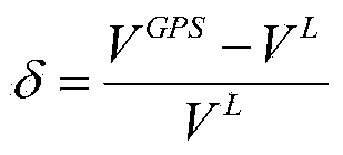
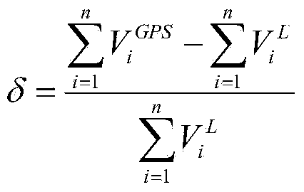
The invention relates to a method for improving a vehicle-mounted speed chart through GPS speed information. The method includes the steps of collecting accurate speed information measured by a GPS under an open environment and the vehicle-mounted speed information of a vehicle-mounted speed collecting device to obtain a complementation coefficient, and correcting the vehicle-mounted speed information of the vehicle-mounted speed collecting device through the complementation coefficient when measurement of the GPS is not accurate. By means of the method, the defect that the vehicle-mounted speed accuracy is influenced by various factors is overcome; for instance, the defect that the vehicle-mounted speed measurement error occurs when the actual perimeter and the calibrated perimeter of a tyre are not consistent is overcome; meanwhile, the GPS measurement accuracy is prevented from being influenced by a complex environment.

Description

technical field [0001] The invention relates to the field of intelligent traffic control, in particular to a method for improving vehicle speed by using GPS speed information. Background technique [0002] With the continuous development of IT technology, all aspects of human production and life are gradually becoming informatized. The field of transportation and travel is no exception. Cars are becoming more and more intelligent. Various sensors have been installed on ordinary cars, which can transmit vehicle status information in real time; and multi-sensor data fusion technology is a hot field of current research. Through Fusion of information from different sensors can improve the accuracy and reliability of the magnitude. [0003] In terms of vehicle safety control, the requirements for the position and speed of vehicles are getting higher and higher. GPS is used more often, but the accuracy of GPS is greatly affected by the environment. In tunnels or "urban canyons" a...

Claims


Application Information

Patent Timeline
IPC IPC(8): G01P3/00
Inventor 姚丹亚蒋凤成
Owner TSINGHUA UNIV
Learn More