Ship Detection Method in Port Area Based on High Resolution SAR Image
A high-resolution, regional technology, applied in the radar field, can solve problems such as poor detection performance, increased data volume, heterogeneous mixing and unevenness, and achieve the goal of reducing computational complexity, data processing volume, and computational complexity Effect
- Summary
- Abstract
- Description
- Claims
- Application Information
AI Technical Summary
Problems solved by technology
Method used
Image

Examples
Embodiment Construction
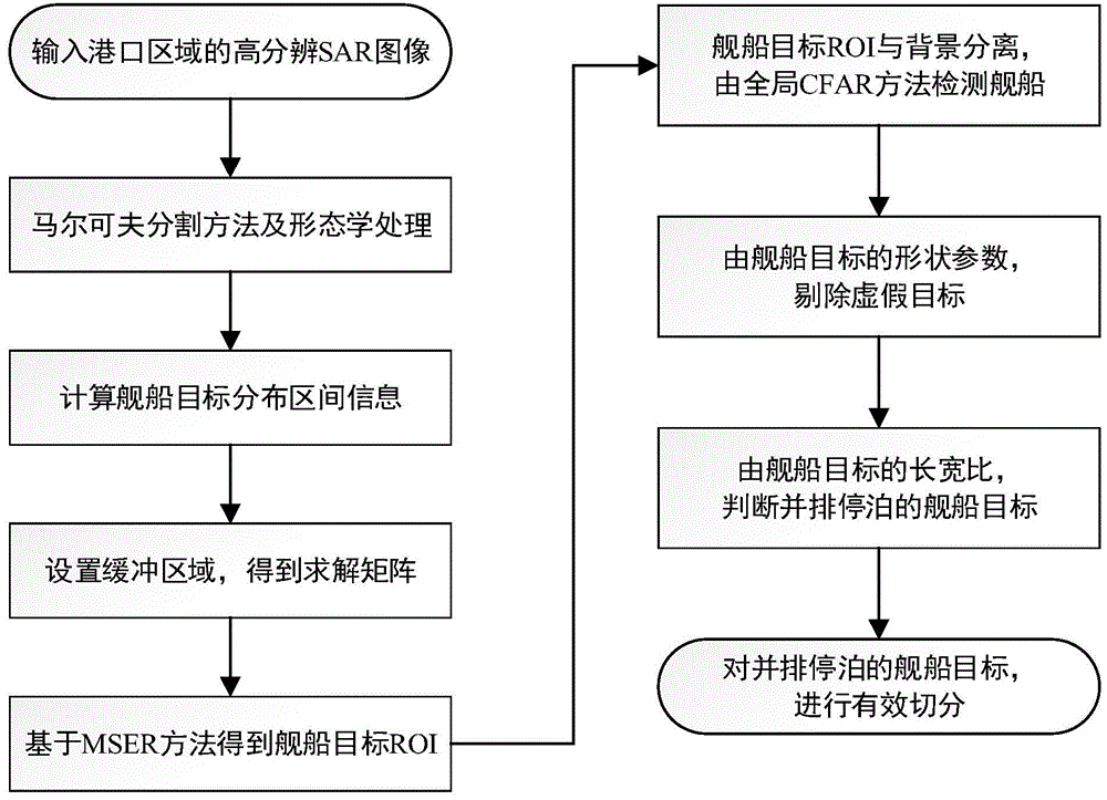
[0025] Embodiments of the present invention will be described in detail below in conjunction with the accompanying drawings.
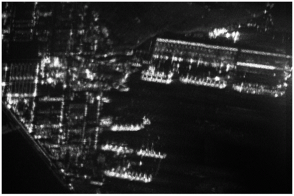
[0026] Step 1: Input the high-resolution SAR image of the port area to obtain an M×N-dimensional image matrix I, the pixel gray value of the i-th row and j-th column of the image matrix I is I(i,j), where i=1, 2,...,M,j=1,2,...,N;
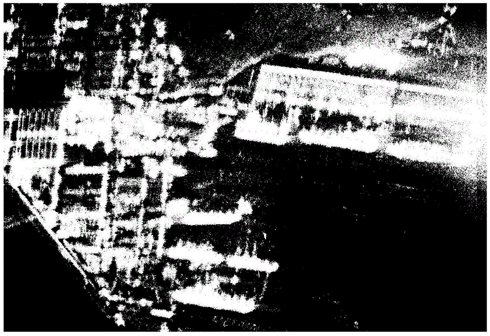
[0027] Step 2: For the image matrix I, use the Markov segmentation method and morphological processing to obtain land areas, ocean areas, and coastlines. The specific steps are as follows:
[0028] 2a) Use the Markov method to binarize the input image matrix I to obtain an M×N-dimensional binary image, which is recorded as the label map BW 1 : The pixel representing the land has a pixel value of 1, and the label value is 1; the pixel representing the ocean has a pixel value of 0, and the label value is 0;
[0029] 2b) Perform morphological processing: firstly, label map BW 1 Perform the closing operation to get the label...
PUM
 Abstract
Description
Claims
Application Information
 - Generate Ideas
- Intellectual Property
- Life Sciences
- Materials
- Tech Scout
- Unparalleled Data Quality
- Higher Quality Content
- 60% Fewer Hallucinations
Browse by: Latest US Patents, China's latest patents, Technical Efficacy Thesaurus, Application Domain, Technology Topic, Popular Technical Reports.
© 2025 PatSnap. All rights reserved.Legal|Privacy policy|Modern Slavery Act Transparency Statement|Sitemap|About US| Contact US: help@patsnap.com