

Ecological environment parameter ground sampling method suitable for wide-range multi-scale satellite remote sensing data inversion
A technology of satellite remote sensing data and ecological environment, which is applied in the direction of electrical digital data processing, special data processing applications, instruments, etc., and can solve problems such as unstable accuracy
- Summary
- Abstract
- Description
- Claims
- Application Information
AI Technical Summary
Problems solved by technology
Method used
Image

Examples
Embodiment Construction
[0024] The ground sampling method for multi-scale soil water content of the present invention will be further described below in conjunction with the accompanying drawings.
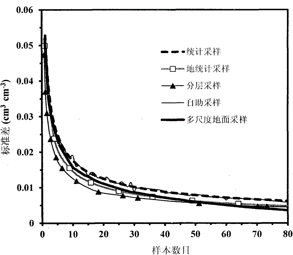
[0025] First, reasonable sample numbers for different sampling methods are estimated for this comparison. For the 55m research scale, the relationship between the number of samples obtained by using different sampling methods and the corresponding standard deviation is shown in figure 1 ,From figure 1 It can be seen that the increase in the number of samples leads to a sharp decrease in the standard deviation. When the standard deviation is equal to 0.0076cm 3 cm -3 (with a relative error of 5% and a confidence level of 95%), the estimated NSS for traditional statistical and geostatistical sampling are 55 and 35, respectively. It shows that under a certain standard deviation, the NSS estimated by geostatistical sampling is smaller than the result of traditional statistics, which is consistent with the...
PUM
 Abstract
Description
Claims
Application Information