

Construction method for geospatial information workflow service function flow templates
A geospatial information and functional process technology, which is applied in the field of construction of geospatial information workflow service functional process templates, can solve problems such as collaborative computing obstacles, inability to revert to heterogeneous platforms, interoperability, and low portability, and achieve fast The effect of extension and encapsulation
- Summary
- Abstract
- Description
- Claims
- Application Information
AI Technical Summary
Problems solved by technology
Method used
Image

Examples
Embodiment Construction
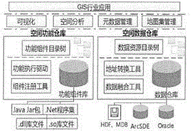
[0017] With the continuous development of data warehouse technology, the combination of GIS software and data warehouse technology has emerged spatial data warehouse technology. The spatial data warehouse can integrate and manage scattered and multi-source spatial databases through the use of spatial data middleware technology. The interoperability between heterogeneous spatial databases can realize the positioning and mapping of heterogeneous spatial resources with a unified data directory view, and at the same time provide a variety of maintenance tools to effectively manage various spatial data sources.
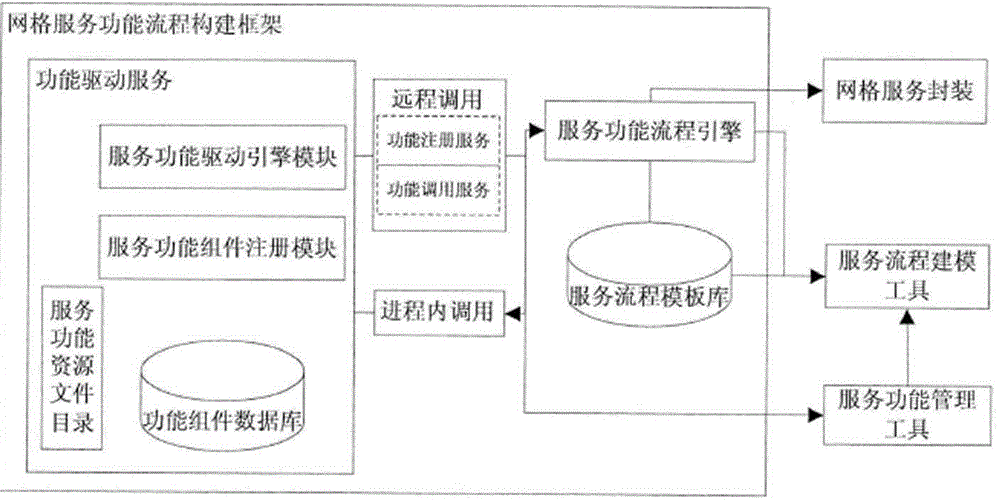
[0018] Split all the spatial functions of the existing GIS software into the form of functional component combinations, and express the spatial data resources in a unified way that shields the heterogeneity of the bottom layer, so as to realize the "separation" state of the spatial processing function and the spatial data at the software layer. The management of spatial fun...
PUM
 Abstract
Description
Claims
Application Information