Denoising Method and System Constrained by Spectrum Characteristics of Remote Sensing Images of Ground Building Groups

A technology of remote sensing images and spectral characteristics, applied in image enhancement, image data processing, instruments, etc., can solve the problems of loss of image details, increase processing difficulty, poor denoising effect, etc., and achieve real-time denoising processing. Good noise effect, good denoising effect

Active Publication Date: 2017-09-29
HUAZHONG UNIV OF SCI & TECH
View PDF4 Cites 0 Cited by
  • Summary
  • Abstract
  • Description
  • Claims
  • Application Information

AI Technical Summary

Problems solved by technology

[0005] In view of the above defects or improvement needs of the prior art, the present invention provides a method and system for denoising the spectrum characteristics of remote sensing images of ground buildings, which are used for the ground buildings obtained during remote sensing, detection, navigation and guidance of high-speed aircraft. The purpose of denoising the real-time image of the group target is to solve the technical problems that the existing denoising method has poor denoising effect on strong noise, and the image is blurred due to the loss of image detail information, which increases the difficulty of subsequent processing.

Method used


Image

  • Denoising Method and System Constrained by Spectrum Characteristics of Remote Sensing Images of Ground Building Groups
  • Denoising Method and System Constrained by Spectrum Characteristics of Remote Sensing Images of Ground Building Groups
  • Denoising Method and System Constrained by Spectrum Characteristics of Remote Sensing Images of Ground Building Groups

Examples


Embodiment Construction

[0050] In order to make the object, technical solution and advantages of the present invention clearer, the present invention will be further described in detail below in conjunction with the accompanying drawings and embodiments. It should be understood that the specific embodiments described here are only used to explain the present invention, not to limit the present invention. In addition, the technical features involved in the various embodiments of the present invention described below can be combined with each other as long as they do not constitute a conflict with each other.

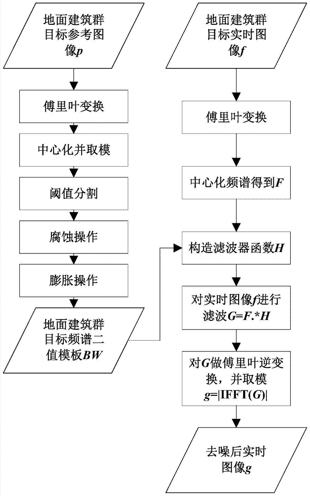
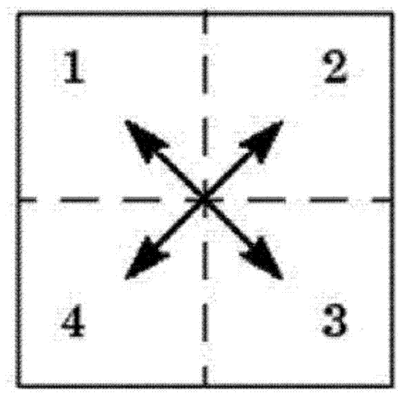
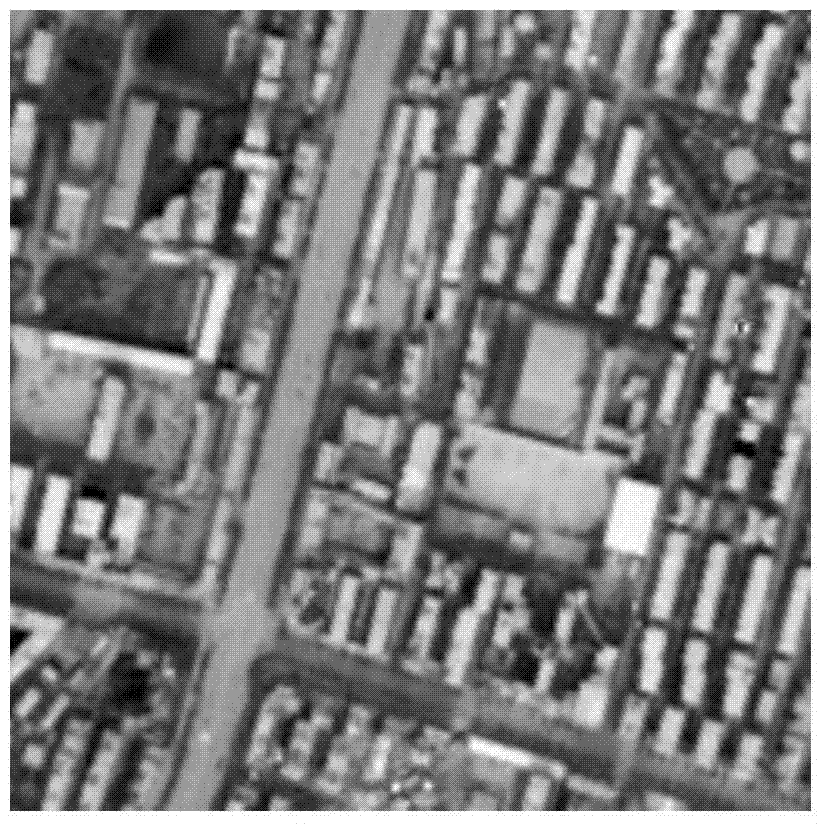
[0051] Ground buildings are an important class of targets for remote sensing, detection, navigation and guidance of high-speed aircraft. The various basic structures and components of ground buildings have unique spatial directionality. When these buildings are grouped into building groups, they are aggregated to show unique directionality in the frequency domain; Gaussian noise undergoes Fourie...


PUM


Abstract

A denoising method for restraining a spectrum characteristic of a remote sensing image of a ground building group comprises: acquiring a reference image of a target of a ground building group from a remote sensing image library of the ground building group, and performing a Fourier transform on the reference image so as to obtain an amplitude spectrum; performing threshold segmentation, erosion and dilation operations on the result of the amplitude spectrum so as to obtain a binary template of the spectrum of the target of the ground building group; acquiring a real-time image of the target of the ground building group by means of the flight of a high-speed air vehicle, performing a Fourier transform on the real-time image so as to obtain the spectrum; performing frequency-domain filtering processing on the spectrum of the real-time image by using the obtained binary template of the spectrum of the target of the ground building group; and performing an inverse Fourier transform to generate the real-time image of the target of the ground building group after filtering.

Description

technical field [0001] The invention belongs to the intersection field of digital image processing technology and aerospace science and technology, and more specifically relates to a denoising method and system for constraining spectral characteristics of remote sensing images of ground buildings, which are used for remote sensing, detection, navigation and guidance of high-speed aircraft Image preprocessing process. Background technique [0002] Remote sensing, detection, navigation and guidance of high-speed aircraft is an important field in the development of the aerospace industry in the 21st century, and it has important scientific significance and application value in the future high-tech and national economic development. However, due to the high frame rate characteristics of the high-speed aircraft imaging system, the imaging integration time is short, resulting in strong sensor noise; the remote sensing, detection, navigation and guidance based on the high-speed air...

Claims


Application Information

Patent Timeline
Patent Type & Authority Patents(China)
IPC IPC(8): G06T5/10
CPCG06T5/10
Inventor 张天序王正何力刘立候旋章川凡速飞陈一梦
Owner HUAZHONG UNIV OF SCI & TECH
Why Eureka
Try Eureka