Multi-reference station-based network RTK (Real Time Kinematic) area atmospheric error modeling method

A technology of atmospheric error and modeling method, applied in special data processing applications, instruments, electrical digital data processing, etc., can solve problems such as correction accuracy reduction, positioning accuracy reduction, and limited accuracy

Active Publication Date: 2015-06-03
SOUTHEAST UNIV
View PDF4 Cites 27 Cited by
  • Summary
  • Abstract
  • Description
  • Claims
  • Application Information

AI Technical Summary

Problems solved by technology

But this triangular network structure also has some deficiencies, mainly in: (1) It adopts a single baseline calculation mode, which does not make full use of the redundant observation information of multiple reference stations, which is not conducive to the initialization of large-scale reference station networks; ( 2) independent The baseline information is less (2 baselines), which limits the

Method used


Image

  • Multi-reference station-based network RTK (Real Time Kinematic) area atmospheric error modeling method
  • Multi-reference station-based network RTK (Real Time Kinematic) area atmospheric error modeling method
  • Multi-reference station-based network RTK (Real Time Kinematic) area atmospheric error modeling method

Examples


Embodiment Construction

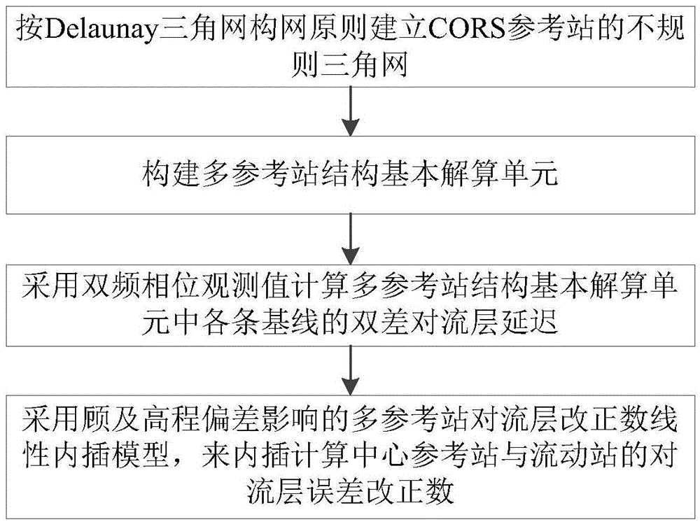
[0031] Combine below Attached picture The present invention is further explained.

[0032] Such as figure 1 As shown, a network RTK regional atmospheric error modeling method based on multiple reference stations includes the following specific steps:

[0033] Step 1), establish the basic calculation unit based on the multi-reference station structure, including the following specific steps:

[0034] a) Build an irregular triangular network for all reference stations of the entire CORS according to the principle of Delaunay triangular network construction;

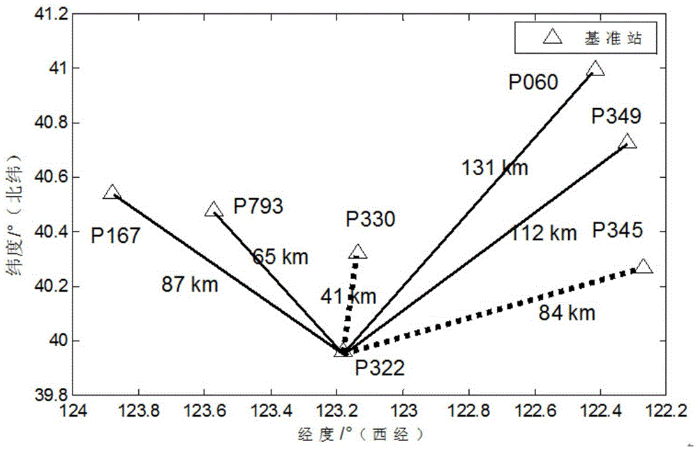
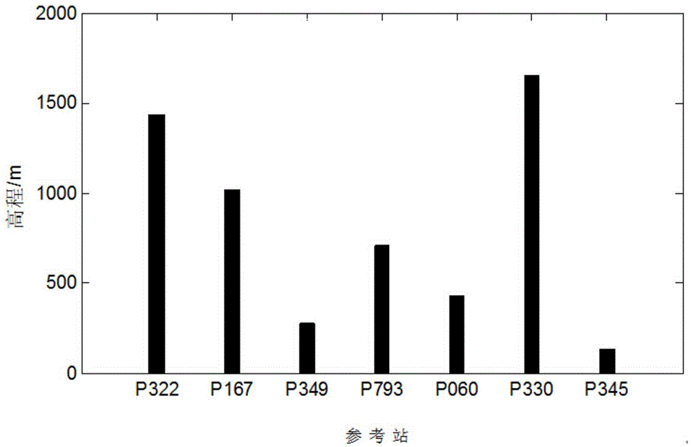
[0035] b) From the CORS reference stations, select the reference station closest to the rover u as the central reference station c, select the Delaunay triangular network covering the rover u, and connect the other two reference stations of this Delaunay triangular network and the The other reference stations of the Delaunay triangular network on any side of the network are used as auxiliary reference stations, and t...


PUM


Abstract

The invention discloses a multi-reference station-based network RTK (Real Time Kinematic) area atmospheric error modeling method. The method comprises the following steps of firstly, using multi-reference redundant observation information to build a multi-reference station structure-based basic resolving unit; secondly, for the multi-reference station structure-based basic resolving unit, studying an algorithm of network RTK area troposphere correction number, providing a network RTK area troposphere error modeling method which considers height difference influence and is suitable for a multi-reference station structure, and obtaining a flow station troposphere error correction value. On the basis of considering height difference, the precision and the reliability of network RTK area troposphere correction number can be obviously improved, particularly, for a low-altitude angle satellite, the precision and the reliability are higher.

Description

technical field [0001] The invention belongs to the field of network RTK positioning, and relates to the calculation of network tropospheric error correction numbers between stations in a continuous operation reference station (CORS) system, in particular to a network RTK regional atmospheric error modeling based on a multi-reference station structure in a GNSS network differential positioning system method. Background technique [0002] With the development of global satellite navigation and positioning systems, GNSS network differential positioning technology is currently a popular technology in the field of satellite positioning. The earth reference coordinate and geodynamic service system composed of global satellite navigation system, computer network and communication technology is the result of the integration of network and GNSS positioning technology and modern geodetic survey and geodynamics. It is a combination of conventional RTK and differential global positioni...

Claims


Application Information

Patent Timeline
IPC IPC(8): G06F19/00
Inventor 潘树国吴波高旺高成发
Owner SOUTHEAST UNIV
Why Eureka
Try Eureka