Hierarchical spatial location description method and device based on Voronoi diagram and landmark
A spatial location and hierarchical technology, applied in the direction of instruments, calculations, electrical digital data processing, etc., can solve the problems of time-consuming, unfavorable to quickly find the spatial location of the target object, and the inability to establish spatial relationships with multiple landmarks, so as to improve efficiency Effect
- Summary
- Abstract
- Description
- Claims
- Application Information
AI Technical Summary
Problems solved by technology
Method used
Image
Examples
Embodiment 1
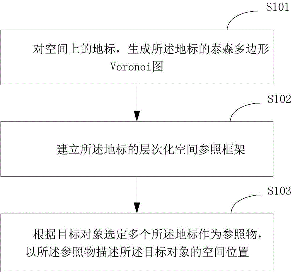
[0024] figure 1 It is an implementation flowchart of the hierarchical spatial position description method based on the Voronoi diagram and landmarks provided by the embodiment of the present invention, and is described in detail as follows:
[0025] In step S101, for a landmark in space, a Voronoi diagram of the landmark is generated;
[0026] In step S102, establishing a hierarchical spatial reference frame of the landmark;
[0027] Based on the Voronoi diagram, a hierarchical spatial reference frame of the landmarks is established.
[0028] Among them, the spatial hierarchical model based on the Voronoi diagram means that when one Voronoi unit is contained inside another Voronoi unit, the boundary of the latter is limited by the boundary of the former, and the low-level regional management center falls into the high-level area Inside.
[0029] In step S103, a plurality of landmarks are selected as reference objects according to the target object, and a hierarchical spatia...
Embodiment 2
[0034] This embodiment describes the implementation process of establishing a hierarchical spatial reference frame, which is described in detail as follows:
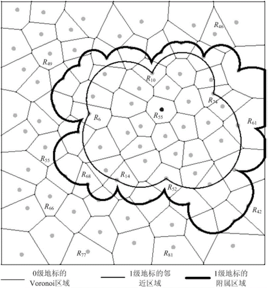
[0035] Generate adjacent regions based on the Voronoi diagram for the landmarks in space, and the subsidiary region S (R, 0) of each landmark R is the adjacent regions;
[0036] Cycle k from 1 to n, k is the granularity;
[0037] For all landmarks in space, using landmarks where L(R)>=k as a set, generate the adjacent area;
[0038] For landmarks R with L(R)>=k, obtain all landmarks of all k-1 levels that fall within the adjacent area of landmark R;
[0039] The subsidiary area S(R, k) of landmark R on layer k is the sum of all the landmarks (including R itself) of level k-1 that fall within the adjacent area of the landmark at level k-1;
[0040] Among them, the subsidiary area of the landmark at the j (j<=i) layer is denoted as S(R, j);
[0041] Among them, L(R) represents the level of landmark R.
[0042] Am...
Embodiment 3
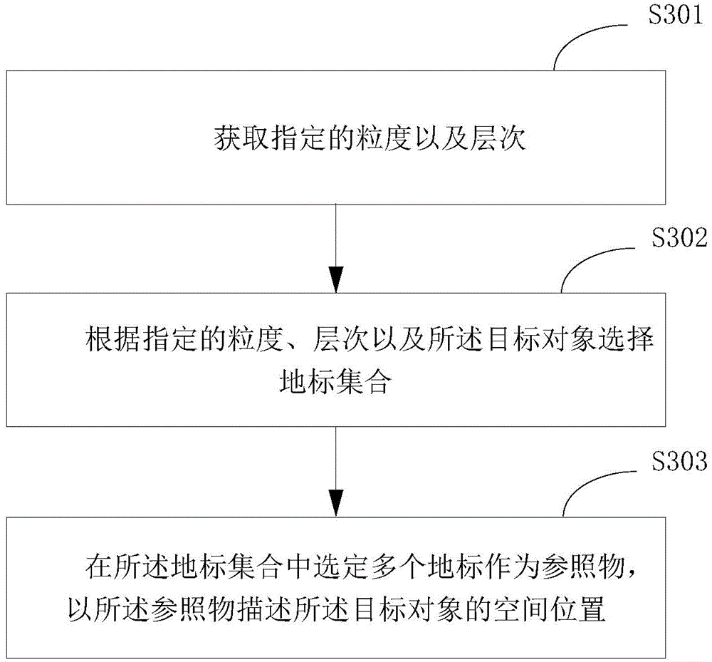
[0046] image 3 It is the implementation flowchart of step S103 of the hierarchical spatial position description method based on the Voronoi diagram and landmarks provided by the embodiment of the present invention, and is described in detail as follows:
[0047] In step S301, the specified granularity and level are obtained;
[0048] In step S302, select a landmark set according to the specified granularity, level and the target object;
[0049] In step S303, a plurality of landmarks are selected in the landmark set as reference objects, and a hierarchical spatial position description of the target object is established with the reference objects.
[0050] refer to Figure 4 , Figure 4 It is a better sample diagram of the positioning target object provided by the embodiment of the present invention.
[0051] In the case where the granularity requirement is 1, T 1 Several first-level landmarks adjacent to it will be used as candidate reference objects, and an appropriate...
PUM
 Abstract
Description
Claims
Application Information
 - R&D
- Intellectual Property
- Life Sciences
- Materials
- Tech Scout
- Unparalleled Data Quality
- Higher Quality Content
- 60% Fewer Hallucinations
Browse by: Latest US Patents, China's latest patents, Technical Efficacy Thesaurus, Application Domain, Technology Topic, Popular Technical Reports.
© 2025 PatSnap. All rights reserved.Legal|Privacy policy|Modern Slavery Act Transparency Statement|Sitemap|About US| Contact US: help@patsnap.com


