A method for estimating the spatial distribution of farmland straw resources
A technology of spatial distribution and straw resources, applied in calculation, instrumentation, electrical digital data processing, etc., can solve problems such as large deviations in calculation results and inability to accurately reflect relative differences in straw productivity, and achieve low-cost effects
- Summary
- Abstract
- Description
- Claims
- Application Information
AI Technical Summary
Problems solved by technology
Method used
Image
Examples
Embodiment Construction
[0057] In order to facilitate those of ordinary skill in the art to understand and implement the present invention, the present invention will be described in further detail below in conjunction with the accompanying drawings and embodiments. It should be understood that the implementation examples described here are only used to illustrate and explain the present invention, and are not intended to limit this invention.
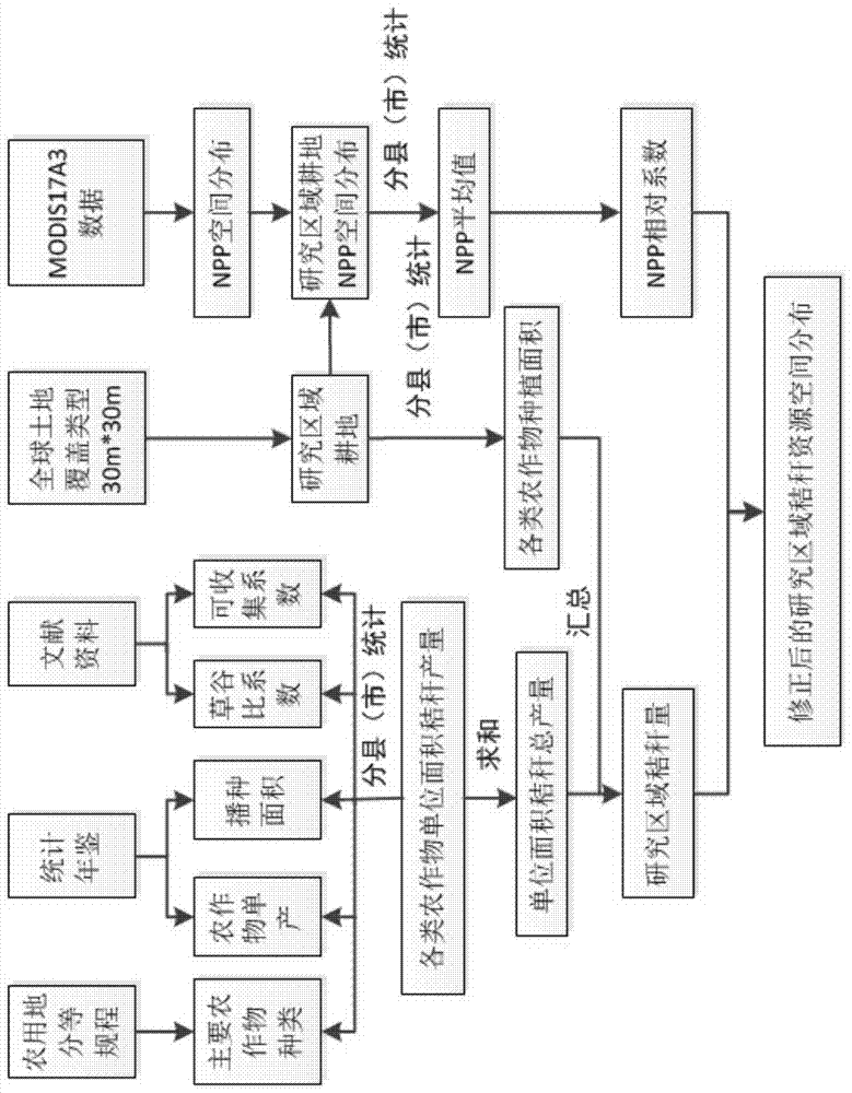
[0058] Crop stalks usually refer to the remaining parts of wheat, rice, corn, potatoes, oilseeds, cotton, sugar cane and other crops (usually coarse grains) after the seeds are harvested. Since the ratio of straw to grain (grass-to-grain ratio coefficient) of each crop in each county (city) is basically fixed, the amount of straw per unit area of the crop can be estimated by multiplying the grass-to-grain ratio coefficient of each county (city) by the unit yield of the crop.
[0059] The global land cover data (GlobalLand30) is the scientific research achie...
PUM
 Abstract
Description
Claims
Application Information
 - R&D
- Intellectual Property
- Life Sciences
- Materials
- Tech Scout
- Unparalleled Data Quality
- Higher Quality Content
- 60% Fewer Hallucinations
Browse by: Latest US Patents, China's latest patents, Technical Efficacy Thesaurus, Application Domain, Technology Topic, Popular Technical Reports.
© 2025 PatSnap. All rights reserved.Legal|Privacy policy|Modern Slavery Act Transparency Statement|Sitemap|About US| Contact US: help@patsnap.com


