A 3D environment modeling method and system for an unmanned aerial vehicle

A modeling method and unmanned aerial vehicle technology, which is applied in the 3D environment modeling method and system field of UAV, can solve the problems such as the inability to model the 3D environment with a single lens, so as to improve the ability of anti-motion blur and improve the accuracy and robustness, the effect of improving the speed of optimization

Active Publication Date: 2018-02-27
深圳市易恬技术有限公司
View PDF7 Cites 0 Cited by
  • Summary
  • Abstract
  • Description
  • Claims
  • Application Information

AI Technical Summary

Problems solved by technology

[0003] In view of this, the purpose of the embodiments of the present invention is to provide a 3D environment modeling method and system for UAVs, aiming to solve the problem in the prior art that it is impossible to use a single lens to perform real-time 3D environment modeling on UAVs

Method used


Image

  • A 3D environment modeling method and system for an unmanned aerial vehicle
  • A 3D environment modeling method and system for an unmanned aerial vehicle
  • A 3D environment modeling method and system for an unmanned aerial vehicle

Examples


Embodiment Construction

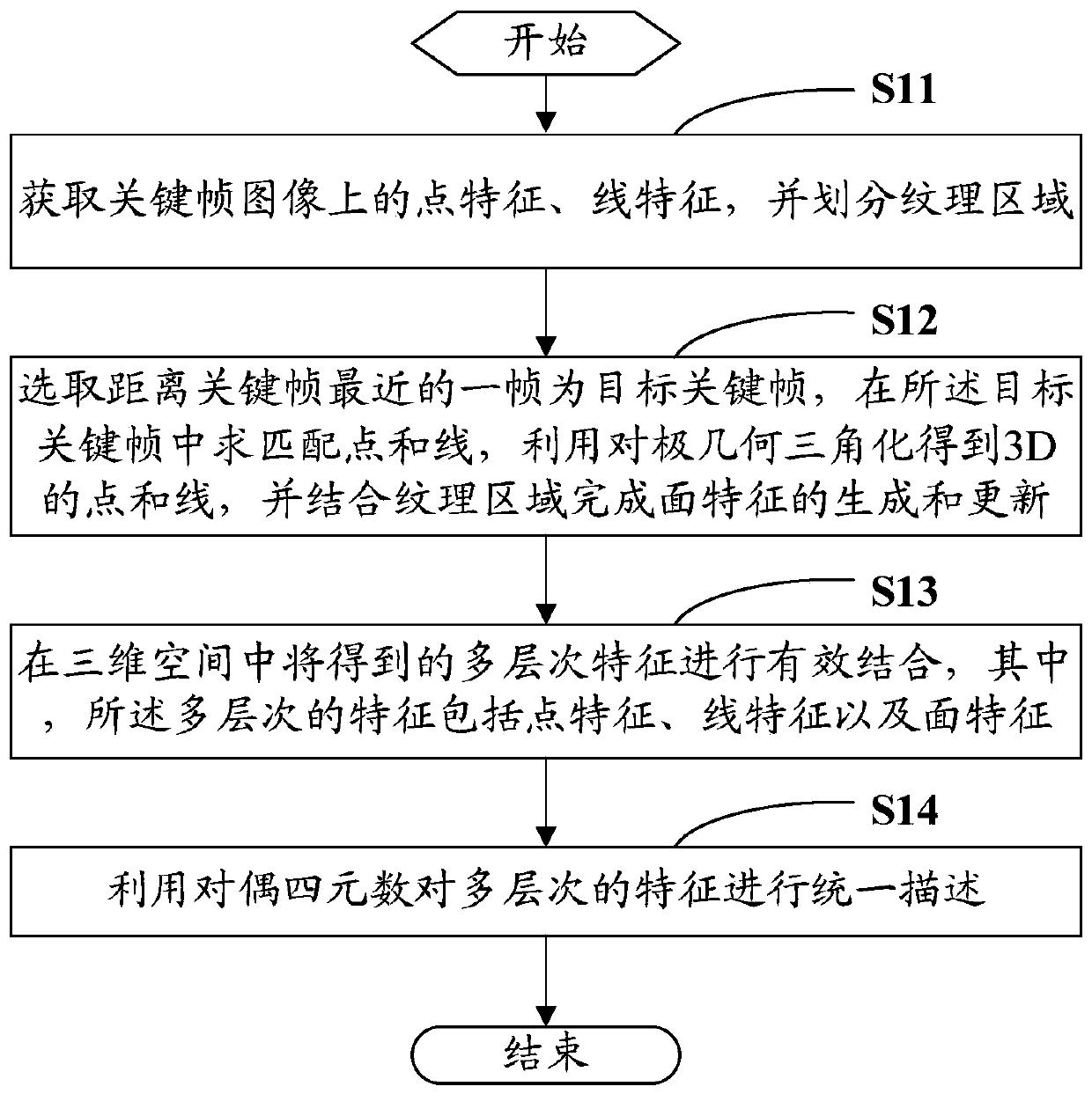
[0063] In order to make the object, technical solution and advantages of the present invention clearer, the present invention will be further described in detail below in conjunction with the accompanying drawings and embodiments. It should be understood that the specific embodiments described here are only used to explain the present invention, not to limit the present invention. A 3D environment modeling method and system for an unmanned aerial vehicle

[0064] The specific embodiment of the present invention provides a three-dimensional environment modeling method of an unmanned aerial vehicle, which mainly includes the following steps:

[0065] S11. Obtain point features and line features on the key frame image, and divide texture regions;

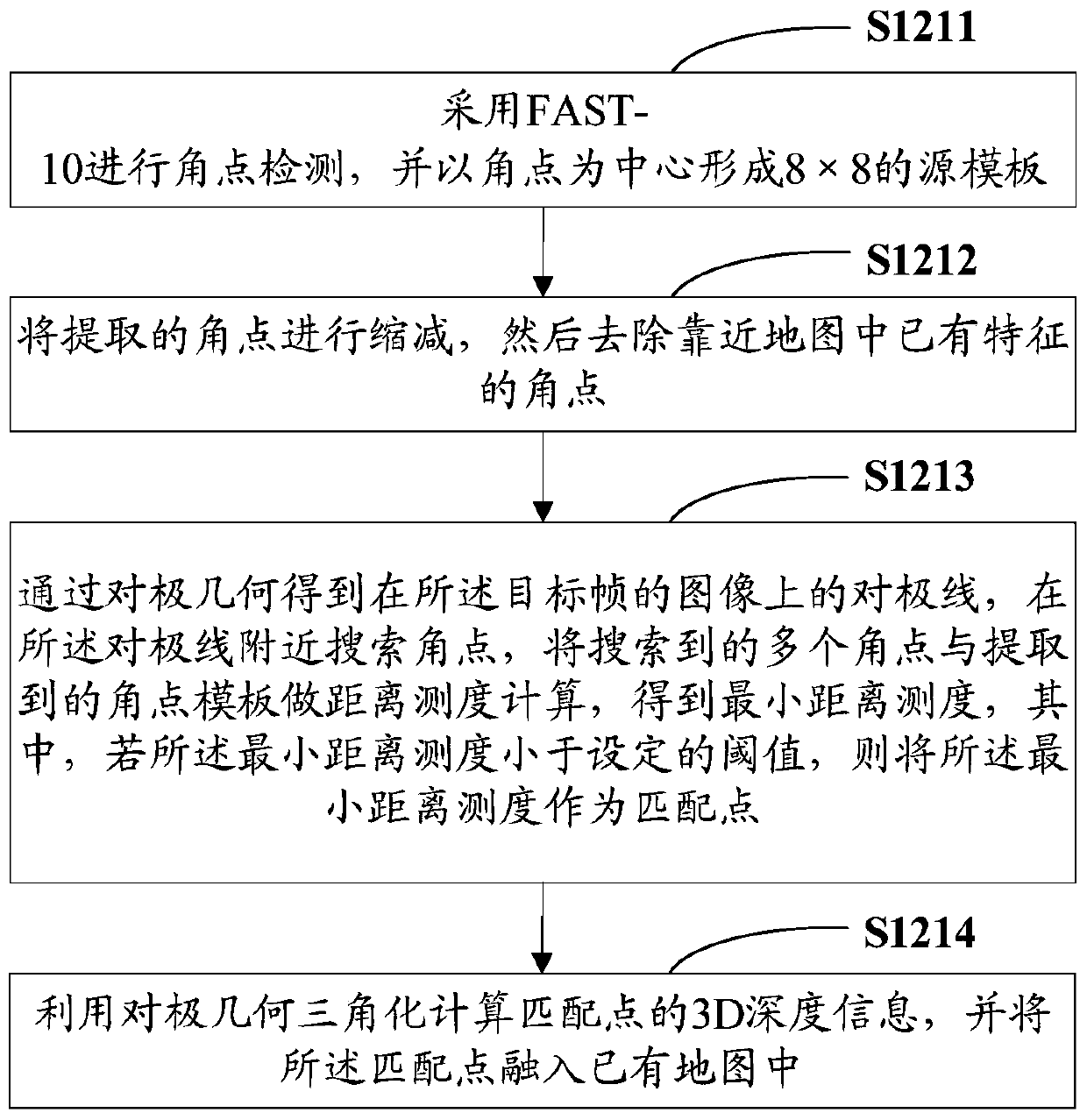
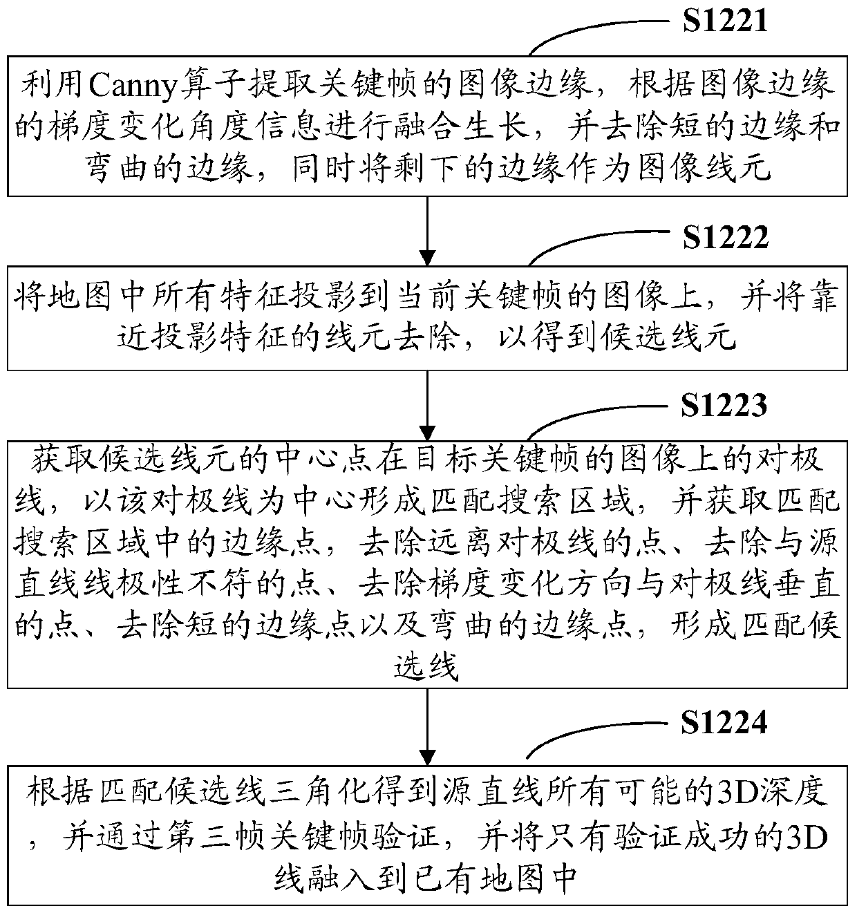
[0066] S12. Select a frame closest to the key frame as the target key frame, find matching points and lines in the target key frame, use epipolar geometric triangulation to obtain 3D points and lines, and complete the surface feature ...


PUM


Abstract

The invention is applicable to the field of unmanned aerial vehicles, and provides a three-dimensional environment modeling method of unmanned aerial vehicles, comprising: acquiring point features and line features on key frame images, and dividing texture areas; One frame is the target key frame, find matching points and lines in the target key frame, use epipolar geometric triangulation to obtain 3D points and lines, and combine the texture area to complete the generation and update of surface features; in the three-dimensional space, the obtained Multi-level features are effectively combined, wherein the multi-level features include point features, line features and surface features; dual quaternions are used to describe the multi-level features uniformly. The invention also provides a three-dimensional environment modeling system for the unmanned aerial vehicle. The invention can provide basic research results for further research and development of new dedicated dual quaternion solving hardware, can improve the optimization speed of the system, and can reduce the error matching rate, thereby improving the accuracy and robustness of the map.

Description

technical field [0001] The invention relates to the field of unmanned aerial vehicles, in particular to a method and system for modeling a three-dimensional environment of an unmanned aerial vehicle. Background technique [0002] How the robot realizes real-time positioning and map construction (SimultaneousLocalizationAnd Mapping, SLAM) in the unknown position of the location environment is the premise of realizing the robot's autonomous navigation, path planning, target recognition and tracking and other tasks. The 3D models reconstructed by different sensors have been applied to many fields such as machine navigation, augmentation realization, and medical image processing. However, how to use a single lens to model the real-time 3D environment on the UAV, and then realize its autonomous control is a difficult point in current research. Contents of the invention [0003] In view of this, the purpose of the embodiments of the present invention is to provide a 3D environm...

Claims


Application Information

Patent Timeline
Patent Type & Authority Patents(China)
IPC IPC(8): G06T17/00G06T17/05
Inventor 蒙山陈桂芳
Owner 深圳市易恬技术有限公司
Why Eureka
Try Eureka