
3D Geological Modeling Method Based on Sparse Borehole Points

A technology of three-dimensional geology and modeling method, which is applied in the field of three-dimensional geological modeling based on sparse drilling points, can solve the problem that the modeling of sparse drilling points cannot meet the needs of mine geological body research, etc., and achieves the effect of improving construction quality.

Active Publication Date: 2018-12-04
CHINA UNIV OF MINING & TECH
View PDF4 Cites 0 Cited by
  • Summary
  • Abstract
  • Description
  • Claims
  • Application Information

AI Technical Summary

Problems solved by technology

[0003] The purpose of the present invention is to provide a three-dimensional geological modeling method based on sparse drilling points to solve the problem that the existing sparse drilling point modeling cannot meet the needs of mine geological body research

Method used


Image

  • 3D Geological Modeling Method Based on Sparse Borehole Points
  • 3D Geological Modeling Method Based on Sparse Borehole Points
  • 3D Geological Modeling Method Based on Sparse Borehole Points

Examples


Embodiment 1

[0018] Embodiment 1: The three-dimensional geological modeling method:

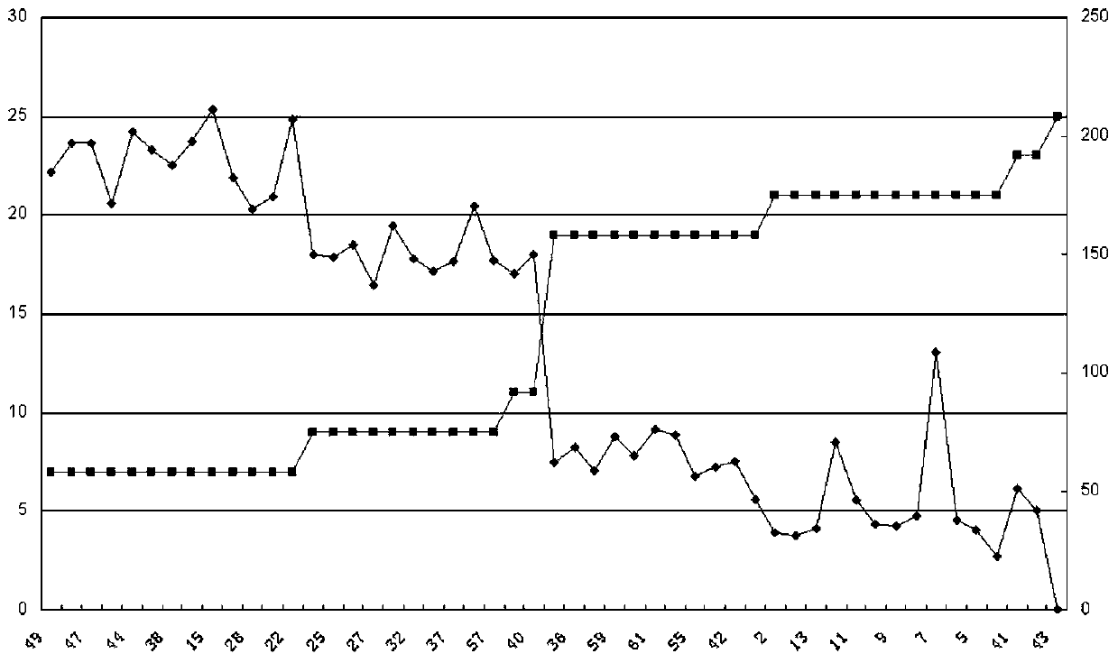
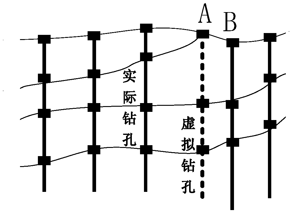
[0019] 1. Construct the drilling database, extract the corresponding underlying information, generate a comparison chart of the complete drilling layer and the incomplete drilling layer, and plan the vertical virtual extension under the missing drilling hole, specifically using the interpolation algorithm of the set point;

[0020] 2. Based on the profile of the exploration line, the profile of the geological exploration line is a microcosm of the spatial elements of the profile of the geological exploration line at a certain scale. It is one of the most common mining area exploration data. Determine the marking point of the horizontal virtual drilling, and use this coordinate as the input parameter of interpolation to form the entire drilling;

[0021] 3. According to the measured and virtual boreholes, use the geological knowledge of geological engineers to divide the strata, and then correlate the dril...


PUM


Abstract

The invention provides a three-directional geology modeling method based on sparse borehole points, and belongs to a three-dimensional geology modeling method for coal mine geology. The modeling method comprises steps of 1: constructing borehole database, extracting responding base information, generating comparison diagram of a complete drilling layer and an incomplete layer and using the interpolation algorithm of fixed points; 2: setting mark points of transverse virtual drilling holes and forming the whole drilling hole by using the coordinates as input parameters of interpolation based on a prospecting line profile map according to exploration data of stratum trend; 3: using crosscheck as a statistical means to test precision of models according constructed models; and 4: referring to the contour map of one stratum, comparing corresponding stratum data of models and summarizing similarity until the models are modified to a proper confidence level. In the general background of sparse borehole points of a model construction process, other non-borehole data are added, missed borehole data are virtualized, and according to possible errors of constructed models, judging abruptly changed construction methods, thereby improving construction quality of the models.

Description

technical field [0001] The invention relates to a three-dimensional geological modeling method of coal mine geology, in particular to a three-dimensional geological modeling method based on sparse drilling points. Background technique [0002] True 3D modeling of geological bodies has become a hot field in geological research, especially mine geological bodies. The 3D geological modeling technology based on borehole data is the most common, and the 3D geological modeling can reflect the geological formation information directly, effectively and completely. However, due to historical reasons, traditional borehole data are relatively scarce and the purpose of exploration is very different, the data quality of 3D geological modeling is insufficient, and redesigning exploration boreholes is time-consuming and expensive, so the construction of existing sparse borehole points The model cannot meet the needs of mine geological research. Contents of the invention [0003] The pu...

Claims


Application Information

Patent Timeline
Patent Type & Authority Patents(China)
IPC IPC(8): G06T17/05
Inventor 陈伟王惠蔡斌王珂
Owner CHINA UNIV OF MINING & TECH
Learn More