A geocoding method and system based on smart city
A geocoding and city technology, applied in geographic information databases, structured data retrieval, etc., can solve the problems of poor interactivity of map components, difficult interface design, and difficult user use, etc., to achieve friendly interface, strong scalability, powerful effects
- Summary
- Abstract
- Description
- Claims
- Application Information
AI Technical Summary
Problems solved by technology
Method used
Image
Examples
Embodiment Construction
[0048] The present invention is described in detail below in conjunction with accompanying drawing:
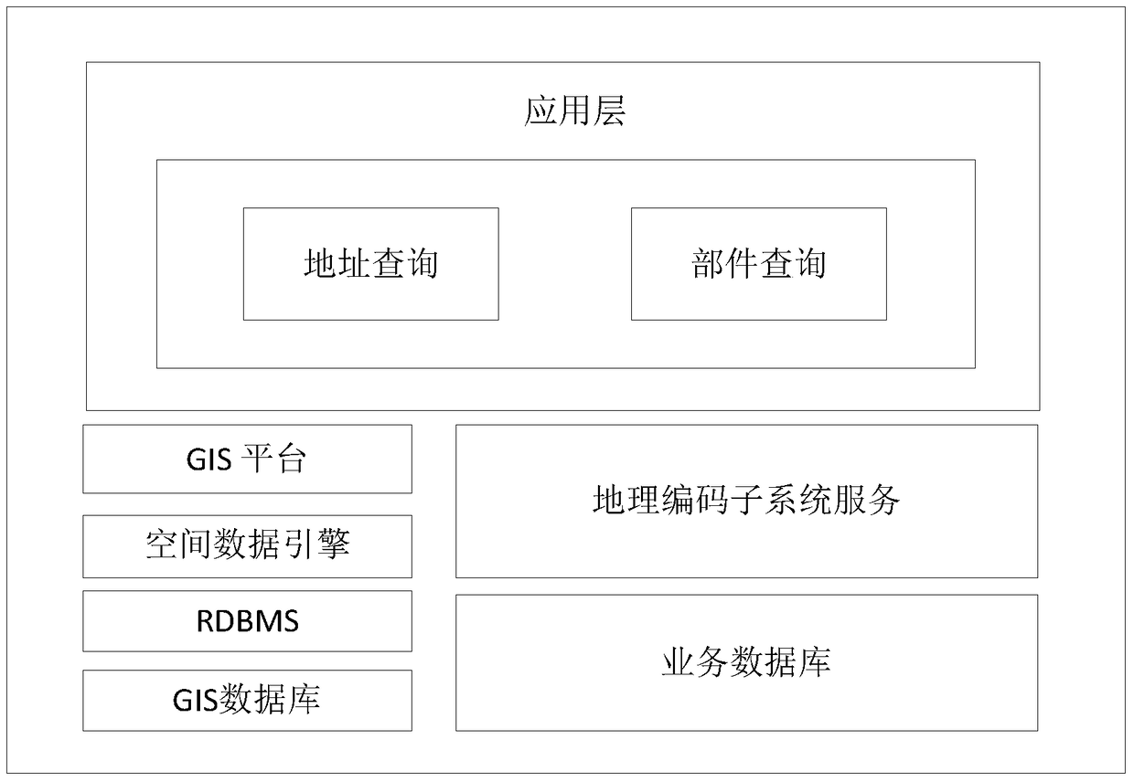
[0049] Such as figure 1 As shown, the embodiment of the composition framework of the smart urban management geocoding system of the present invention is illustrated, specifically including:
[0050] The application layer includes, but is not limited to, the functions of address query and component query; the functions of address query and component query are realized by invoking the related services of the GIS platform and the geocoding subsystem.
[0051] Geocoding subsystem service, providing area of responsibility information, component type information, etc.
[0052] The business database stores responsibility area information, zoning information, component type information, etc.
[0053] The geographic information system (Geographical Information System, GIS) platform provides a wealth of GIS functions, such as maps, locators, and software objects used in central serv...
PUM
 Abstract
Description
Claims
Application Information
 - R&D
- Intellectual Property
- Life Sciences
- Materials
- Tech Scout
- Unparalleled Data Quality
- Higher Quality Content
- 60% Fewer Hallucinations
Browse by: Latest US Patents, China's latest patents, Technical Efficacy Thesaurus, Application Domain, Technology Topic, Popular Technical Reports.
© 2025 PatSnap. All rights reserved.Legal|Privacy policy|Modern Slavery Act Transparency Statement|Sitemap|About US| Contact US: help@patsnap.com


